On June 13, the US National Hurricane Center (NHC) upgraded Invest 93E to a tropical depression with the potential to strengthen into a storm - temporarily named Potential Tropical Cyclone 4-E (PTC 4-E).
The latest storm forecast shows that this system could become tropical storm Dalila today (6, 14), becoming the second storm of the 2025 typhoon season in the East Pacific.
According to the NHC, the low pressure area located in southern Mexico has sustained winds of about 56 km/h and will continue to strengthen as it moves over high-pressure waters. Heavy rain of 50-75mm, some places up to 150mm is forecast in the states of Guerrero, Michoacan and Colima from now until the end of the weekend.
A tropical storm warning has been issued for the southwestern coastal areas of Mexico, from Manzanillo to western Acapulco.
FOX Weather Forecast Center said that Dalila may follow a similar trajectory to Typhoon No. 1 Barbara - the first storm of the season, which reached Category 1 status on June 9 but quickly weakened as it entered the cold water on June 10. Therefore, the possibility of affecting the mainland is assessed as not large, but it is still necessary to closely monitor due to unpredictable weather developments.
In addition to PTC 4-E, the NHC is monitoring a second disturbance area east of the current depression, off the southern coast of Mexico and Central America.
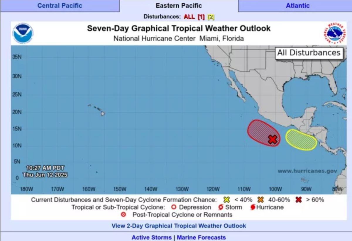
The area has an ocean floor temperature of over 27 degrees Celsius - an ideal condition for storm formation. The system is also expected to develop into a tropical depression or storm in the next few days.
In less than 2 weeks, the East Pacific storm has seen 2 strong depressions and 1 storm form, suggesting that this year's storm season could come early and develop complicatedly. Meteorological agencies recommend that people living along the coast of Mexico and Central America need to be vigilant and update information regularly to proactively prevent when necessary.