The latest storm information from the Philippine Atmospheric, Geophysical and Astronomical Services Administration (PAGASA) said that at 8:00 a.m. on June 11, the tropical depression strengthened into storm WUTIP (storm No. 1 in the East Sea). The storm is being monitored outside the Philippine Forecast Area (PAR).
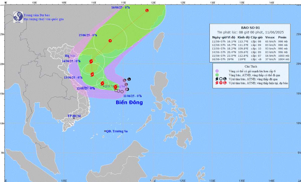
The Vietnam Center for Hydro-Meteorological Forecasting also said that on the morning of June 11, the tropical depression in the eastern area of Hoang Sa archipelago strengthened into a storm, the number 1 storm in 2025, with the international name WUTIP.
The center of the storm is located at 16.1 degrees North latitude; 113.7 degrees East longitude, in the sea east of Hoang Sa archipelago.
Storm intensity level 8 (62-74km/h), gust level 10. The storm moved slowly in the West Northwest direction, at a speed of 5-10 km/h.
It is forecasted that in the next 72 to 120 hours, storm No. 1 will move in the North Northeast direction, then change direction to the Northeast, at a speed of 20 km/h.
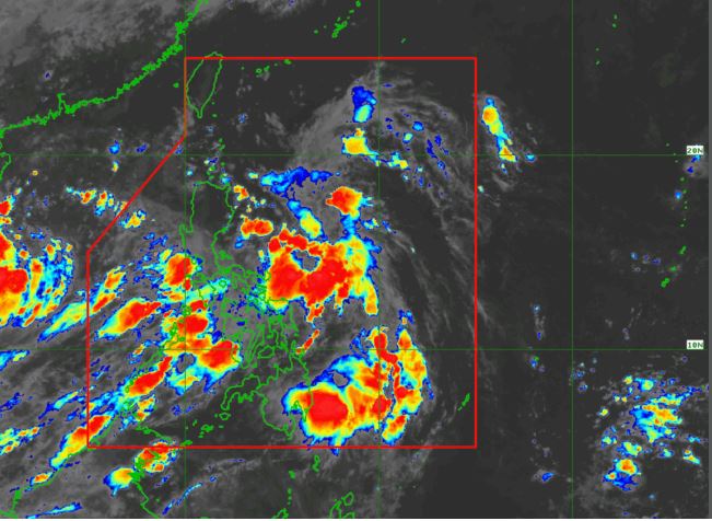
Also on the morning of June 11, PAGASA issued a warning to monitor a new low pressure area (LPA 06b) that has just appeared inside the Philippine PAR forecast area.
This low pressure area is assessed to have a low chance of developing into a tropical depression in the next 24 hours, but cannot be completely ruled out.
Mr. Benison Estareja, weather forecaster of PAGASA, said in the storm forecast bulletin on the morning of September 11: "We are still monitoring the low pressure in the east of the country, over the Philippine Sea. Although there is no chance of developing into a storm, the risk of tropical depression formation in the next 48 hours still exists.
As of June 11, the Philippines has not recorded any official storms in 2025. However, PAGASA forecasts that 1-2 storms will form or enter the PAR region in June. The peak period from June to November is expected to have from 11 to 19 storms.
This year's rainy season was officially announced by PAGASA to start from June 2, while the southwest monsoon has started operating since the end of May. With the changing atmospheric situation, closely monitoring convective cloud areas and low pressure Forms is a key factor in minimizing natural disaster damage.