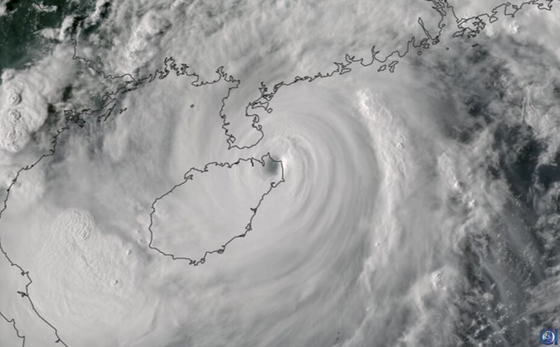
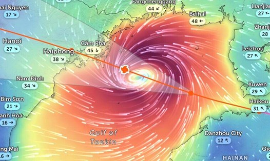
According to the quick news about storm No. 3 released at 7:00 a.m. on September 7 by the Vietnam National Center for Hydro-Meteorological Forecasting, storm Yagi is at about 20.4 degrees North latitude; 108.2 degrees East longitude, about 153km from the coast of Quang Ninh - Hai Phong. The strongest wind in storm No. 3 Yagi is at level 14 (150-166km/h), gusting to level 17. It is forecasted that in the next 3 hours, storm No. 3 Yagi will move in a west-northwest direction, at a speed of about 15-20km/h.
Yagi is the Japanese word for goat and the constellation Capricorn. Tropical cyclones in the western Pacific are named by the Japan Meteorological Agency (JMA) and the Regional Specialized Meteorological Center (RSMC) Tokyo.
The list of storm names is selected from lists contributed by countries in the region, such as Japan, China, the Philippines... Each list is reused after a 4-year cycle.
According to the latest forecast of Independent, as storm number 3 Yagi moves inland, northern Vietnam will experience heavy rain and strong winds, with the risk of flooding and landslides in mountainous areas.
Northern Laos and Thailand are also expected to face similar weather conditions, with heavy rainfall likely to cause flash floods and landslides, although Typhoon Yagi will weaken as it reaches these areas.
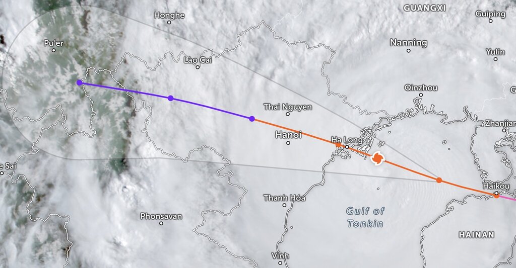
Typhoon Yagi is expected to bring 400 to 760 mm of rain to areas including northern Vietnam, northern Laos and northern Thailand from September 6 to September 8, according to AccuWeather forecasters. Such heavy rainfall could lead to severe flooding, landslides and significant travel disruptions.
The Thai Meteorological Department has warned of heavy rain and thunderstorms this weekend as Typhoon Yagi makes landfall. Acting Director-General of the Thai Meteorological Department Thanasit Iam-ananchai said northern and northeastern Thailand will see heavy rain and strong winds on September 7 and 8 due to Typhoon Yagi's circulation.
Hurricanes have become more intense in recent years. This is closely linked to the impacts of the climate crisis. Warmer ocean temperatures are providing fuel for stronger storms, increasing their wind speeds and the amount of rain they produce.
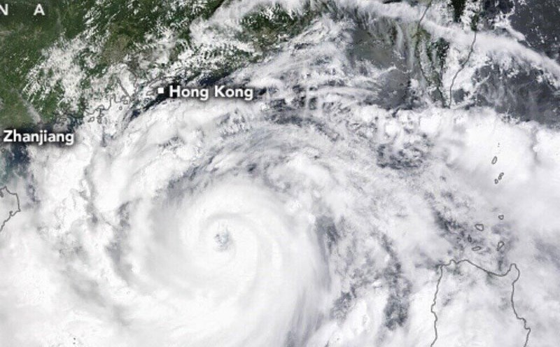
Scientists warn that as the Earth continues to warm, hurricanes and typhoons will become more frequent and destructive. In 2024 alone, several powerful storms, including Super Typhoon Yagi , which devastated the Philippines and China and is headed for Vietnam, and Super Typhoon Beryl, which has already battered the Caribbean, Mexico, and the United States.
Yagi 's winds exceeded 200 km/h, making it one of the strongest typhoons ever recorded. Similarly, Typhoon Shanshan, which hit Japan last month, was the strongest typhoon to hit Japan in decades.