A strong earthquake occurred near the Manay area, Davao Oriental province (Philippines) on the morning of January 7 (local time), according to the US Geological Survey (USGS).
USGS said that the earthquake with a magnitude of 6.7 Richter scale occurred at 11:02 AM, with the epicenter located near Manay, Davao Oriental, at a depth of about 10km.
Due to its shallow depth, vibrations are felt more clearly on the ground. Parameters of magnitude, epicenter position and depth may be adjusted in the coming hours as data continues to be reviewed.
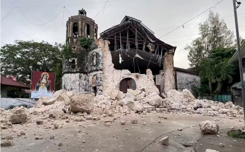
Based on initial data, tremors are believed to have affected most of the area around the epicenter and may have caused moderate to mild damage. Shatters at the level just recorded at Baganga (74km from the epicenter) and Manay (76km from the epicenter).
In further localities such as Mati, Monkayo, Lupon, Maco and Magugpo Poblacion, tremors were felt at a mild level.
Meanwhile, the Philippine Geological Survey (Phivolcs) recorded an earthquake at magnitude 6.4 on the Richter scale, with a depth of 23km, and warned of the risk of damage and subsequent aftershocks.
Police and disaster prevention forces near the epicenter said that no damage or casualties have been recorded. “The tremors were not too strong, but people ran out,” said Hinatuan town police chief Joey Monato.
According to Phivolcs Director Teresito Bacolcolcol, the epicenter of this earthquake is less than 10km away from the area that suffered two strong earthquakes in October, killing 7 people.
Mr. Bacolcol said that the possibility of a tsunami warning is very low, and emphasized: "This earthquake will not create a devastating tsunami because it occurs at a large depth.
The Philippines is located on the "Fire Belt" of the Pacific Ocean, an area where earthquakes and volcanic activity occur frequently.