At the end of December 2025, Ocean Infinity - a maritime robot company that conducted the MH370 search operation in 2018 but failed - officially returned to the scene under the "no search, no toll" agreement with the Malaysian Government.
Narrow search range
The biggest difference of this search operation lies in the level of concentration. Previous operations were based on a very wide probability corridor, formed from Inmarsat satellite data, then scanned by sonar through complex seabed terrain.
This time, Malaysia identified a priority area of about 15,000 km2 in the southern Indian Ocean - which is assessed as the region with the highest probability of success.
This decision is the result of many years of data reanalysis, including combining satellite time and frequency information, flight performance models, drift studies based on confirmed debris, and reviewing "blind spots" in previous sonar campaigns.
The multinational search led by Australia swept more than 120,000 km2 of seabed before ending in January 2017; Ocean Infinity's 2018 separate campaign lasted 3 months but also did not yield results.
Radar and fateful flight path
The new search continues from the series of events on March 8, 2014. The last contact from the MH370 cockpit took place when the plane was about to hand over control to Vietnamese airspace, before the aircraft's landing gear was turned off and the plane disappeared from the civilian air traffic control system.
Military radar data then showed that the plane spun sharply, flying backwards over northern Malaysia and the Penang region, heading towards the Andaman Sea before turning south.
These radar tracks, combined with Inmarsat satellite signals lasting for many hours, have laid the foundation for previous search operations.
The current difference is how these data are layered and re-verified, aiming to focus on seabed areas where many models intersect and are likely to have been omitted.
New generation diving and sensor robots
Ocean Infinity is currently deploying Armada 86-class automatic survey ships and the Kongsberg self-propelled submarine (AUV) fleet that can operate at depths of up to 6,000m.
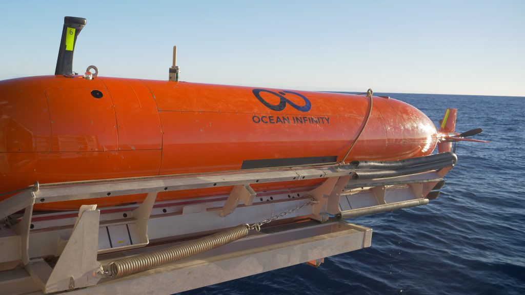
These AUVs are equipped with side scanning sonar, synthetic aperture sonar, metal detection magnetic field meters, laser scanning devices and high-resolution seabed geological measurement systems, helping to better distinguish between natural geological structures and artificial debris.
New signal, old debate
The most controversial "new evidence" in the current MH370 search is not radar, but radio waves.
Some debates revolve around the use of WSPR data - weak radio signals from amateur radio stations - to infer the flight path of MH370. Researcher Richard Godfrey believes that these signal interferences may reflect the movement of the aircraft.
However, Australian officials once noted that WSPR is not designed for aircraft tracking purposes and inferring flight paths from weak signals poses many risks of noise and deviation.
Therefore, the pillar of the MH370 search operation in the period 2025-2026 is still military radar data, Inmarsat signals and drift studies, instead of betting on a single piece of evidence.


