Theo bản tin dự báo thời tiết của AccuWeather, bão Malou xuất hiện vào đầu tuần này ở phía tây quần đảo Mariana và di chuyển về phía Bắc-Đông Bắc, đạt cường độ bão cấp 1 trên Thang gió bão Saffir-Simpson hôm 26.10. Bão Malou sẽ đi qua phía Tây và phía Bắc của Quần đảo Mariana nhưng dự kiến sẽ đi qua gần hoặc đi qua Quần đảo Volcano vào khoảng ngày 28.10 khi nó chuyển hướng về phía Đông Bắc.
Trong khi đó, Cục Khí tượng Thái Lan ngày 27.10 cho hay, bão Malou sẽ không đến gần Thái Lan vào cuối tháng này như đã thông báo rộng rãi trên các phương tiện truyền thông, mặc dù vùng thượng Thái Lan sẽ trải qua thời tiết bất ổn cũng như mưa to, gió lớn và sét.
Cục Khí tượng khẳng định, bão Malou sẽ không tiếp cận Thái Lan và thay vào đó, nó sẽ hướng tới Nhật Bản. Tuy nhiên, Cục Khí tượng cảnh báo rằng, áp thấp nhiệt đới trên Biển Đông có thể làm tăng lượng mưa ở các khu vực miền Đông, miền Nam và miền Trung của Thái Lan cũng như ở phần dưới khu vực Đông Bắc của Thái Lan.
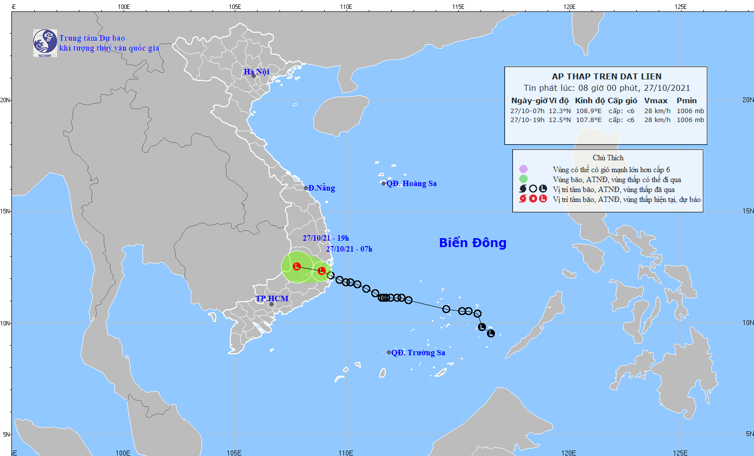
Theo Trung tâm Dự báo Khí tượng Thủy văn Quốc gia Việt Nam, sáng 27.10, áp thấp nhiệt đới đã suy yếu thành một vùng áp thấp và đi vào đất liền tỉnh Khánh Hòa, Việt Nam. Hồi 7h ngày 27.10, vị trí trung tâm vùng áp thấp ở ngay trên đất liền tỉnh Khánh Hòa. Sức gió mạnh nhất ở trung tâm vùng áp thấp giảm xuống dưới cấp 6 (dưới 40km/h).
Ở các tỉnh Nam Trung Bộ và Tây Nguyên của Việt Nam đã có mưa to đến rất to với tổng lượng mưa tính từ 7h ngày 26.10 đến 7h ngày 27.10) phổ biến từ 100-200mm, có nơi trên 300mm; ở vùng ven biển Bình Định-Phú Yên đã có gió giật cấp 6-7.
Dự báo trong 12 giờ tới, vùng áp thấp di chuyển theo hướng Tây Tây Bắc, mỗi giờ đi được 10-15km, đi sâu vào đất liền và suy yếu thêm.
Theo Cục Khí tượng Thái Lan, từ ngày 28.10 đến ngày 3.11, một khối không khí lạnh từ Trung Quốc sẽ ảnh hưởng đến vùng thượng Thái Lan và Biển Đông. Không khí lạnh có thể dẫn đến thời tiết bất ổn, mưa lớn, gió mạnh và sét.


