Not subjective
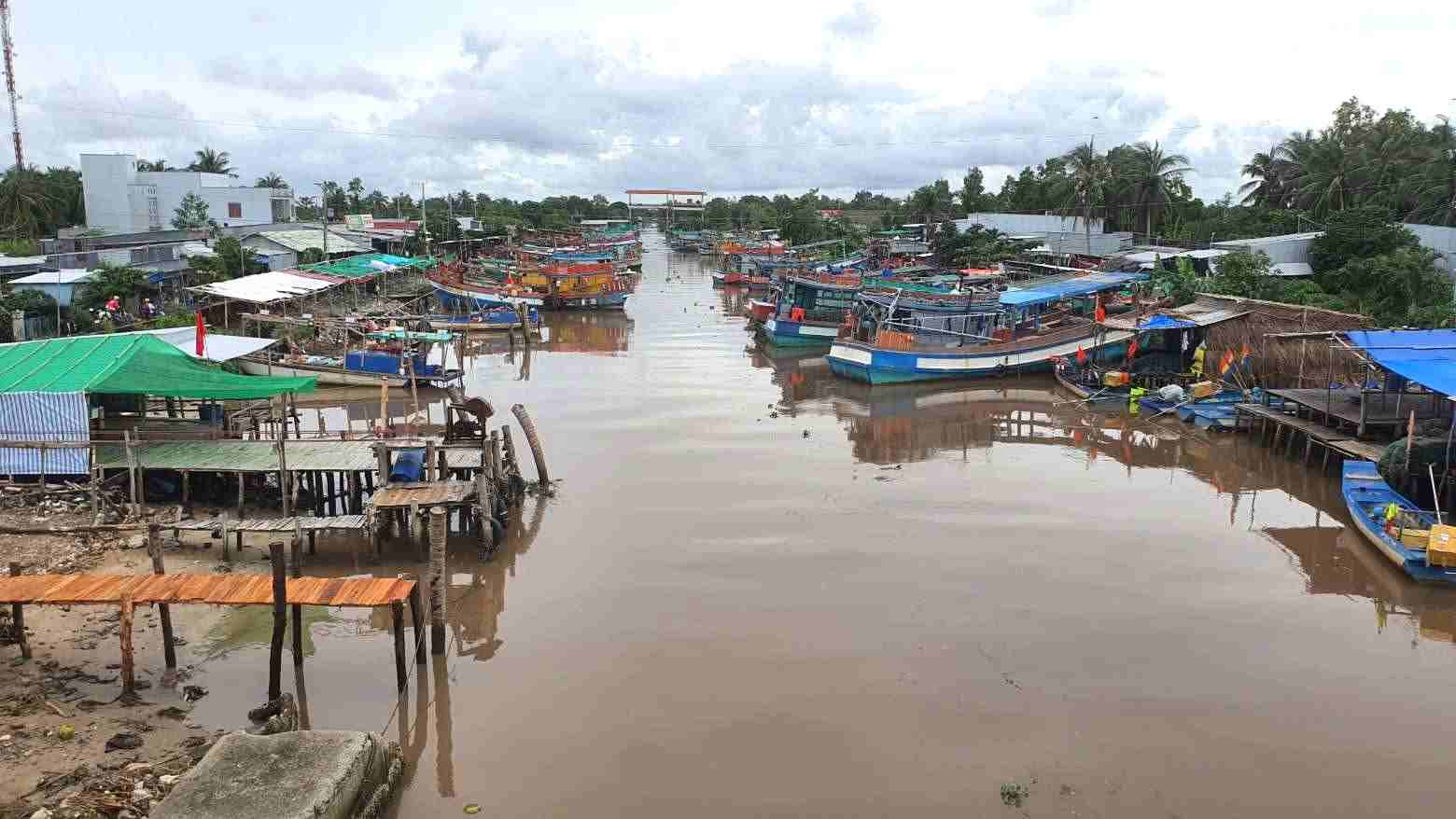
Ca Mau is a locality with three sides bordering the sea, with a coastline of about 310km and a dense river system with more than 100 river mouths leading to the sea. This unique natural condition causes the locality to regularly be strongly affected by climate change, especially heavy rain, high tides and sea level rise.
According to the disaster response plan for 2026 announced on May 5, the rainy season in this province usually starts from the beginning of May and lasts until mid-November. Due to the impact of climate change, especially in years with La Nina phenomena, the largest daily rainfall has been recorded at measurement stations such as Vien An Dong 369.8mm; Bac Lieu Agricultural Meteorological Station 225.5mm; Vien An 178.2mm; Bien Bach 160mm; Dat Mui 153.8mm...
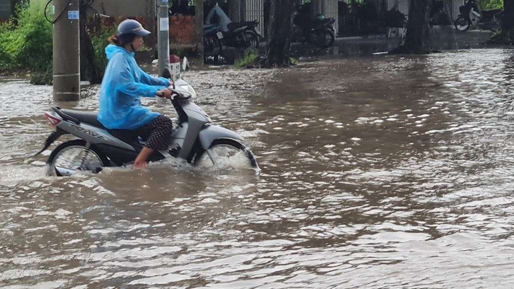
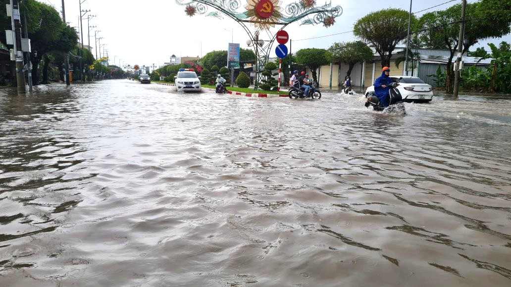
Heavy rain combined with high tide is the main cause of widespread flooding, especially in low-lying areas, along rivers such as Tan Thanh, An Xuyen, Bac Lieu wards, Dam Doi, Nam Can communes... Monitoring data shows that many hydrological stations have exceeded alarm level III, such as Song Doc station recording a water level of 1.41m, Rach Goc station up to 2.35m.
Notably, flooding is assessed as the type of natural disaster with the highest risk in the area, possibly reaching level 3. Meanwhile, sea level rise in the West Sea area - where a tens of kilometers long sea dyke passes through Song Doc and Khanh Lam communes - is also warned at a high risk level, and water has been recorded overflowing the dyke in recent years.
In addition, tornadoes and lightning phenomena often appear locally in the rainy season, causing damage to houses and possibly affecting people's lives. In 2025, the province recorded cases of human damage caused by lightning strikes.
In that context, the drainage infrastructure system in many areas, especially rural areas, is still limited, causing flooding to occur more frequently. A part of people in remote and coastal areas are still subjective or lack response skills, increasing the level of vulnerability when natural disasters occur.
Early response to minimize damage
Faced with the increasingly complex risk of natural disasters, Ca Mau province has developed 3 specific response scenarios. Among them, the scenario of heavy rain accompanied by tornadoes and lightning is activated when rainfall reaches 50 - 100mm in 12 hours or 100 - 200mm in 24 hours in a narrow range. The flood scenario is determined according to alarm levels in large river basins such as Ganh Hao, Cua Lon, Ong Doc, Rach Goc.
For the tidal surge scenario, the plan takes into account the situation that the sea level may rise from 1 - 2m, even above 2m in the West coastal area, combined with high tides causing great pressure on the sea dike system.
A noteworthy point is that the province requires deploying response measures early, when there is forecast information. Functional agencies such as the Hydrometeorological Station, the agricultural sector and local authorities must regularly update and transmit information to people in a timely and easy-to-understand manner.
The "4 on-the-spot" motto continues to be identified as a key solution. Police, military, border guard, and medical forces, along with grassroots shock teams, are mobilized to be ready to participate in supporting people in reinforcing houses, evacuating from dangerous areas, rescuing and overcoming consequences.
Ca Mau has a system of more than 260 irrigation culverts, 93 pumping stations and nearly 110km of sea dykes and dozens of km of East Sea and West Sea dikes. These are important works in tide control, drainage and protection of residential areas, but still need to be closely monitored in extreme weather conditions.
For people, the government recommends to closely monitor forecast bulletins, proactively reinforce houses, prepare food, drinking water, medicine and essential necessities. Households in riverside, coastal, and low-lying areas need to be ready with evacuation plans when required to ensure safety.


