Tropical Depression Emergency News
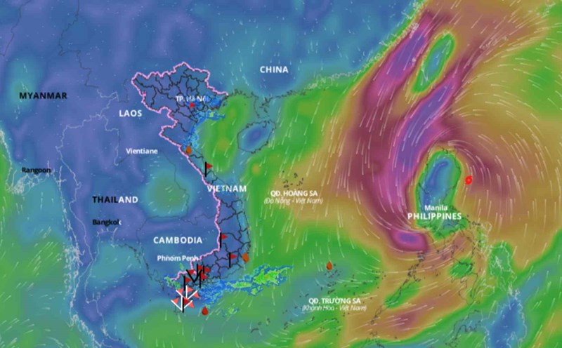
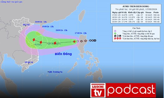
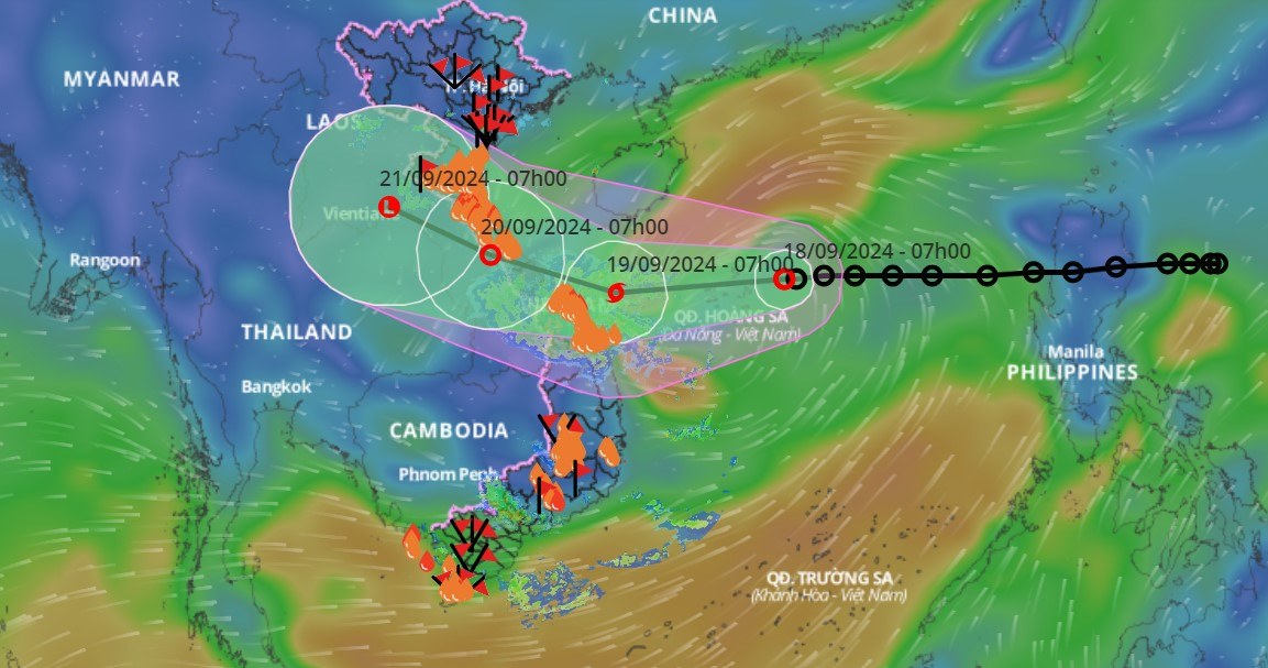
The Department of Dyke Management and Natural Disaster Prevention and Control said that at 7:00 a.m. on September 18, the center of the tropical depression was at about 16.7 degrees North latitude; 113.5 degrees East longitude, about 220 km east of Hoang Sa archipelago. The strongest wind near the center of the tropical depression was level 7 (50-61 km/h), gusting to level 9; moving mainly in a westerly direction at a speed of about 15 km/h, strengthening into a storm.
Forecast of the storm's progress (in the next 24 to 48 hours): At 7:00 a.m. on September 19, the center of the storm is located at 16.4 degrees North latitude, 109.2 degrees East longitude; about 210km East Southeast of Quang Tri, about 120km East of Da Nang, moving West Southwest at about 20km/h, strengthening into a storm, wind force level 8, gust level 10.
Dangerous area: latitude 15.0N - 19.0N; longitude 109.0E - 115.0; RRTT: level 3: Western sea area of the North East Sea (including Hoang Sa archipelago); sea area from Quang Tri to Quang Ngai (including Ly Son island, Cu Lao Cham, Con Co).
At 7:00 a.m. on September 20: The center of the storm is located at 17.3 degrees North latitude, 106.0 degrees East longitude; on the Vietnam - Laos border area; moving in the West Northwest direction at about 15km/h, entering the mainland and gradually weakening; wind force level 6, gusting to level 8.
Dangerous area from 15.0N-19.0N; West of longitude 110.0E; RRTT: level 3: Sea area west of the North East Sea (including Hoang Sa archipelago); sea area from Nghe An to Quang Ngai (including Ly Son island, Cu Lao Cham, Con Co, Hon Ngu).
Heavy rain in the North and Central Central regions; Central Highlands, South
From noon on September 18 to the night of September 19, the area from Ha Tinh to Quang Ngai will have heavy rain and scattered thunderstorms, some places will have very heavy rain with common rainfall of 100-250mm, locally over 400mm.
From the night of September 18 to the night of September 19, Thanh Hoa and Nghe An will have moderate to heavy rain and scattered thunderstorms, with some places experiencing very heavy rain with common rainfall of 50-100mm, locally over 180mm.
From September 18 to the night of September 19, the Central Highlands and the South will have moderate rain, heavy rain and thunderstorms, locally very heavy rain with common rainfall of 30-70mm, locally over 120mm.
Warning: From the day and night of September 20, the North Central region will continue to have moderate to heavy rain, with some places having very heavy rain with common rainfall of 50-100mm, and some places over 200mm. Heavy rain in the North and North Central regions is likely to last until around September 21.
Warning level of natural disaster risk due to heavy rain, tornado, lightning: level 1.
Strong winds, high waves and thunderstorms forecast at sea
According to the Department of Dyke Management and Natural Disaster Prevention and Control, on the day and night of September 18, the North East Sea area (including the sea area of Hoang Sa archipelago) will have strong winds of level 6-7, near the storm's eye level 8, gusting to level 10. Rough seas; rough seas; waves 2.0-4.0m high, near the storm's eye 3.0-5.0m.
The sea area from Ninh Thuan to Ca Mau; the south of the central East Sea area, the southern East Sea area (including the sea area of Truong Sa archipelago) has southwest wind level 6, sometimes level 7, gusting to level 8-9; very rough seas; waves 3.0-5.0m high, especially the sea area from Ninh Thuan to Ca Mau has waves 2.0-4.0m high.
In the Gulf of Tonkin and from Quang Tri to Quang Ngai, there will be strong northeast winds at level 5, gradually increasing to level 6 in the evening and at night, gusting to level 7-8; rough seas; waves 2.0-3.0m high.
The sea area from Ca Mau to Kien Giang, the Gulf of Thailand and the northern sea area of the Central East Sea has strong southwest winds of level 5-6, gusting to level 7-8; rough seas; waves 2.0-3.0m high.
Risk level of natural disasters due to strong winds at sea: Level 2, especially in the North East Sea area, level 3.