News of tropical depression near the East Sea
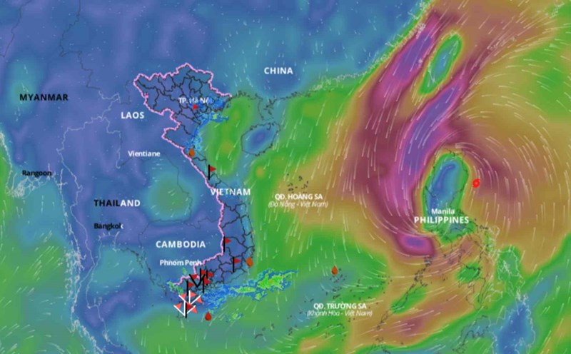
In a bulletin issued on the morning of September 17, the Department of Dyke Management and Natural Disaster Prevention and Control said that at 1:00 a.m. on September 17, the center of the tropical depression was at about 17.0 degrees North latitude; 122.0 degrees East longitude, in the sea east of Luzon Island (Philippines). The strongest wind near the center of the tropical depression was at level 7, gusting to level 9; moving mainly in a westerly direction at about 15km/h and likely to strengthen into a storm.
At 7:00 a.m. on September 17, the center of the tropical depression was at about 16.9 degrees north latitude; 120.9 degrees east longitude, on the mainland of Luzon Island (Philippines). The strongest wind near the center of the tropical depression was level 7 (50 - 61 km/h), gusting to level 9; moving mainly west at about 15-20 km/h (information from the National Center for Hydro-Meteorological Forecasting).
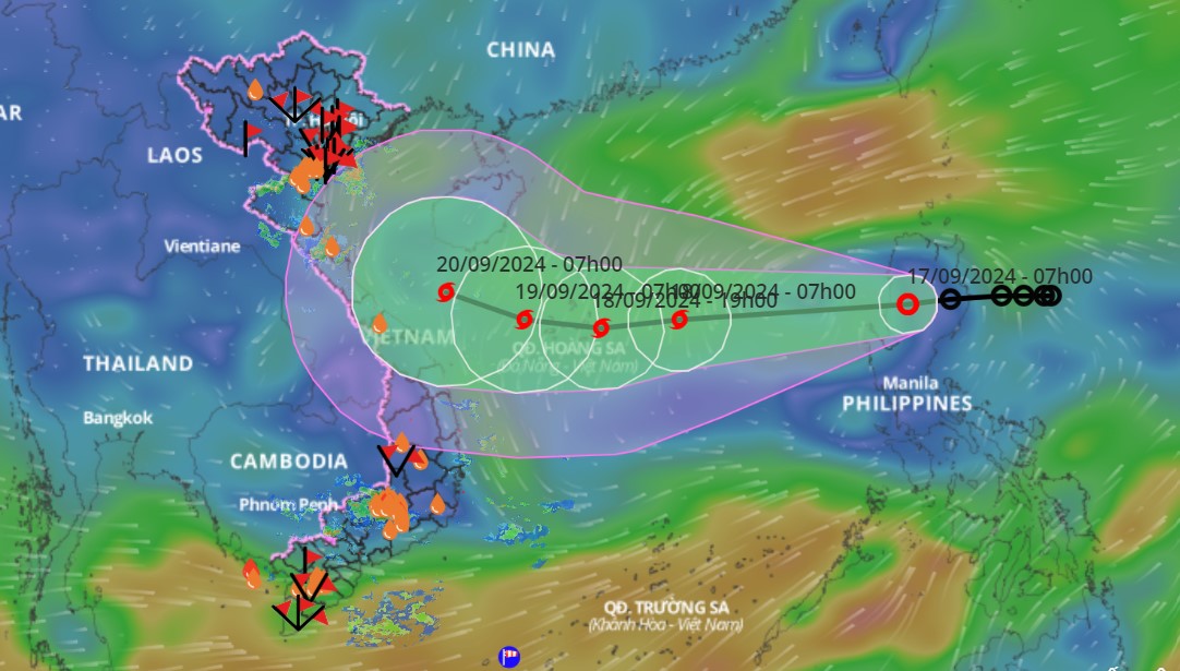
Forecast of storm developments (in the next 24 to 48 hours): At 1:00 a.m. on September 18: Storm center is located at 16.6 degrees North latitude; 116.4 degrees East longitude; in the North East Sea; moving in the West Southwest direction at about 25km/h, wind force level 8, gust level 10; dangerous area from latitude 15.0N-19.0N; East of longitude 115.0E; RRTT level 3: Eastern area of the North East Sea.
- At 1:00 a.m. on September 19: The center of the storm is located at 16.3 degrees North latitude; 112.2 degrees East longitude, in the Hoang Sa archipelago; moving in the West Southwest direction at about 15-20 km/h, wind force level 9, gust level 10.
Warning in the next 48 to 72 hours, the storm is likely to change direction, moving in the West Northwest direction, traveling 10-15km/h per hour.
Strong winds, high waves and thunderstorms forecast at sea
During the day and night of September 17, the sea area from Ninh Thuan to Ca Mau; the South of the Central East Sea area, the South East Sea area (including the sea area of Truong Sa archipelago) will have strong southwest winds of level 6, level 7, gusting to level 8-9, rough seas; the sea area from Ca Mau to Kien Giang and the Gulf of Thailand will have southwest winds of level 5, level 6, gusting to level 7-8, rough seas; the sea area to the East of the North East Sea area will have winds of level 6, level 7.
In addition, during the day and night of September 17, in the Gulf of Tonkin, the sea area from Quang Tri to Ca Mau, Ca Mau to Kien Giang, the Gulf of Thailand, the North, Central and South East Sea (including the sea area of Hoang Sa and Truong Sa archipelagos) there will be showers and thunderstorms. During the thunderstorms, there is a possibility of tornadoes and strong gusts of wind of level 7 and level 8.
Disaster risk level due to strong winds at sea: level 2.
Warning of localized heavy rain, tornadoes, lightning in the North and Central regions
According to the Department of Dyke Management and Natural Disaster Prevention and Control, from September 17 to September 18, the Central Highlands and the South will have moderate rain, heavy rain and thunderstorms, locally heavy rain with common rainfall of 40-80mm, locally over 150mm (rain concentrated in the afternoon and night).
During the day and night of September 17, in the Northern region, there will be scattered showers and thunderstorms, locally heavy rain with rainfall from 10-30mm, locally over 50mm (rain concentrated in the afternoon and night). In the Central region, there will be scattered showers and thunderstorms, locally heavy rain with rainfall from 15-30mm, locally over 80mm.
Warning level of natural disaster risk due to heavy rain, tornado, lightning: level 1.