According to a quick report from Da Nang on the morning of September 29, prolonged heavy rain after storm No. 10 has caused soil moisture in some areas to reach over 95%, increasing the risk of flash floods, landslides, subsidence on steep slopes, road slopes and residential areas adjacent to mountains. The city has issued warnings to 16 localities, organized control of people and vehicles, and monitored signs of cracks and slides to activate evacuation plans.
In the next 3-6 hours, the risk of landslides/sweeping will be concentrated at 23 locations in 16 communes/wards: Ba Na, Ben Hien, Ngu Hanh Son, Song Kon, Hoa Vang, Son Tra, Song Vang, Hoa Tien, A Vuong, Phu Thuan, Hung Son, Hai Van, Thuong Duc, Tay Giang, Lien Chieu, Dien Ban Tay. The main risks include landslides on traffic slopes, residential slopes, and possible large-scale slides at long-term water storage points.
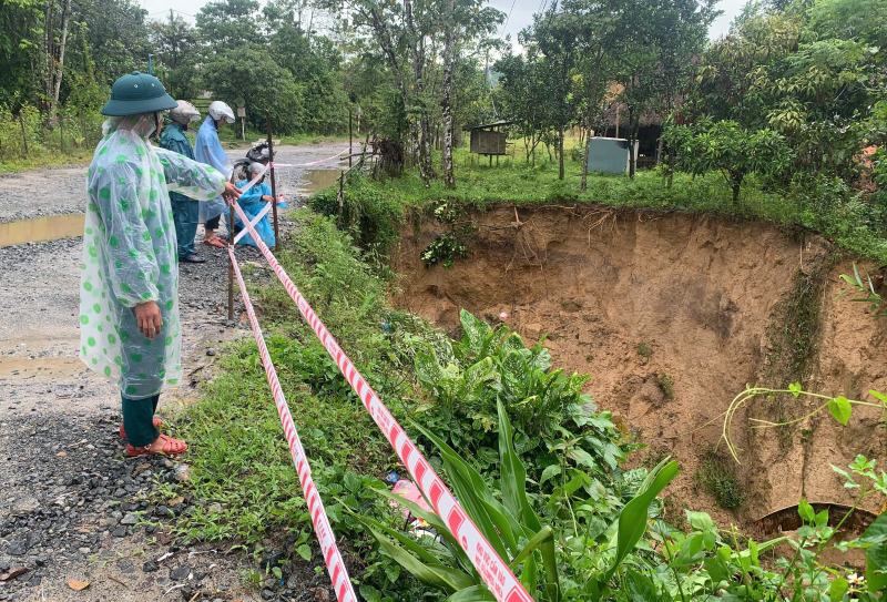
Mr. Zoram Buon - Chairman of the People's Committee of Hung Son mountainous commune - said: "There are 4 high-risk villages in the area. After storms No. 9 and No. 10, many mountain cracks and subsidence of the house foundation appeared. The authorities have urgently evacuated some households from the danger zone and closely monitored to expand the evacuation area if the heavy rain continues."

As of the morning of September 29, in Da Nang, there was 1 person missing ( swept away by water in Lao Du village, Kham Duc commune); the authorities are urgently searching.
Agriculture: about 10 hectares of rice, 27 hectares of crops, 1 hectare of seafood affected, landslides of 5m of Trang Keo Lake embankment.
Urban infrastructure: 36 fallen trees/over-shaped; 1,200m of public lighting system damaged; 5 transformer stations have problems.
Many traffic routes were flooded/claimed in large volumes, of which the mountainous commune of Tay Giang was up to 15,000m3.
QL14G (through Ba and Dong Giang communes): soil and rocks overflow, filling ditches along 3 locations, about 40m3; QL40B, QL14D, DT619 subsided, cracked roadbeds; landslides on negative - positive slopes at many points, rocks and soil overflowing the road surface.
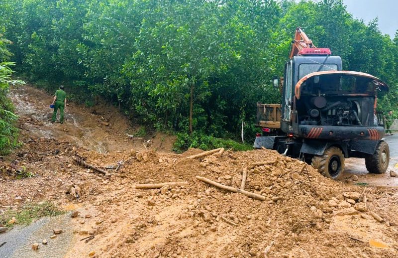
Currently, the authorities have blocked, placed warning signs, and temporarily blocked damaged points on National Highway 14G, National Highway 40B, DT619 and mountain passes/forest roads to ensure safety and promptly repair them.
The Steering Committee for Disaster Prevention and Control and Civil Defense of Da Nang recommends that people do not be subjective because the phenomenon of late landslides may occur in the next few days when the soil and rocks have saturated the water.
The city is reviewing evacuation scenarios in the areas of Ba Na, Hai Van, Lien Chieu, Son Tra, Ngu Hanh Son, Hoa Vang - Hoa Tien and border areas; preparing vehicles and temporary accommodation, ensuring the safety of people's lives is the number one priority.