Due to the impact of storm No. 10 (storm BUALOI), from the evening of September 26 to the morning of September 28, there was light rain and moderate rain in the border commune of Avang (the updated rainfall at 10:00 on September 28 was 80 mm), currently there is continuing to be heavy rain, the water level of rivers and streams such as M'ettel, Talang, Avang, Ta'e... is rising from 1 - 1.5 m compared to the average water level.
From the afternoon of September 26, the leaders of the People's Committee of Avuong commune directly directed the Commune Civil Defense Command to proactively issue disaster response plans according to each level of natural disaster risk that may arise, focusing on traffic assurance, on-site food reserve plans, evacuation plans for people from areas at risk of landslides, flooding... regularly directing and updating the situation in localities in the general zalo group of the commune.
The leaders of the People's Committees of communes directly go to villages and residential areas to inspect the people's storm prevention work, especially inspect and review high-risk and vulnerable points to update and supplement effective response plans, not to be surprised or passive.
With the complicated developments of storm No. 10, the commune leaders allowed 5 schools in the commune to have students off school on September 29 and monitor the storm situation to organize appropriate teaching.
Currently, in the commune, there are about 15 hectares of newly ripe summer-autumn rice that have not yet been harvested (this rice area is located at the foot of high fields). No other damage has been recorded.
The commune has proactively implemented a prevention plan according to the "4 on-site" motto, such as ensuring food reserves for people to harvest new rice in the fields combined with a portion of water rice, so it is stable.
The work of tying up houses, clearing sewers, drainage ditches, pruning trees, etc. was seriously implemented by the villages, with the support of local shock forces and commune armed forces. Continue to review and inspect low-lying areas and areas at risk of landslides to have appropriate response plans (especially evacuation plans).
The locality has also identified 2 main threat groups, which are areas at risk of flash floods and inundation due to residents in riverside areas, streams, and low-lying areas, including the villages: Ta Lang, R'cung, Azat, Arec, A'ur, T'ghey, Cr'toonh, Xa'oi. There is a risk of landslides, including: The villages of Liep, Bhlooc, Ga' Lau, T'ghey, Xa'oi, L' gom.
The commune has assigned forces and members of the Command Committee in charge of the areas of villages, residential areas, and areas identified as vulnerable to village meetings with specific plans when bad situations occur (plans for evacuating people, prioritizing interspersed evacuation).
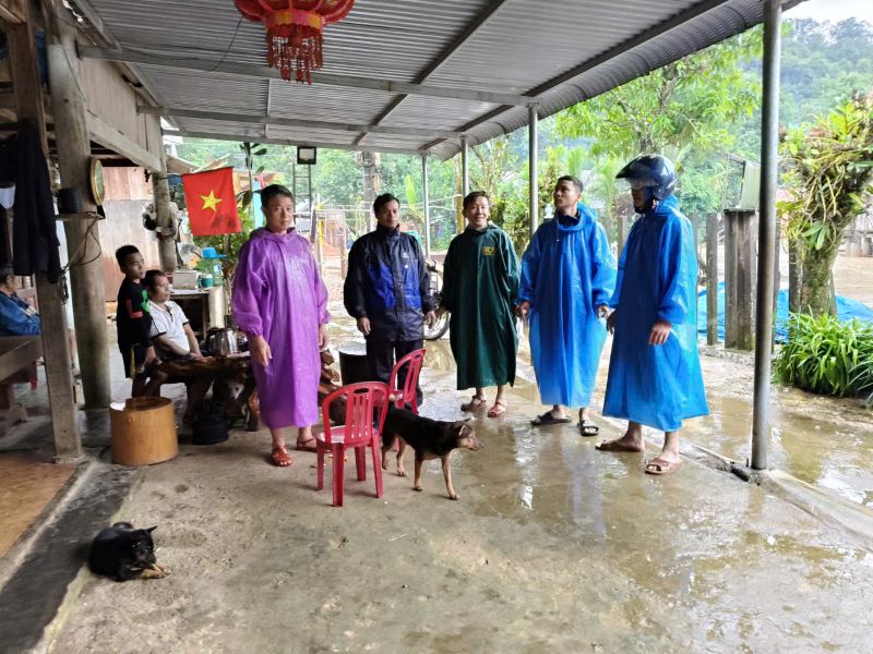
On September 28, Chairman of the People's Committee of Avuong Briu Quan Commune promptly inspected, visited and encouraged 12 people in A'ur village who stayed in the commune center not to return to the village due to rising water, long roads, and fallen trees along the road, affecting their lives.