Weather forecast for the next 24-48 hours, the trough passing through the South will gradually weaken, connecting with the high-altitude wind convergence in the southern offshore waters moving to the West, not operating strongly.
Weather forecast for the next 3-10 days, the newly formed low pressure trough will have an axis passing through the Central region and gradually strengthen into a tropical convergence zone connecting with the disturbance area offshore between the East Sea and the low pressure area in the East of the Philippines gradually becoming stronger and likely to enter the East Sea (September 16-17). The southwest monsoon will operate at medium to strong intensity.
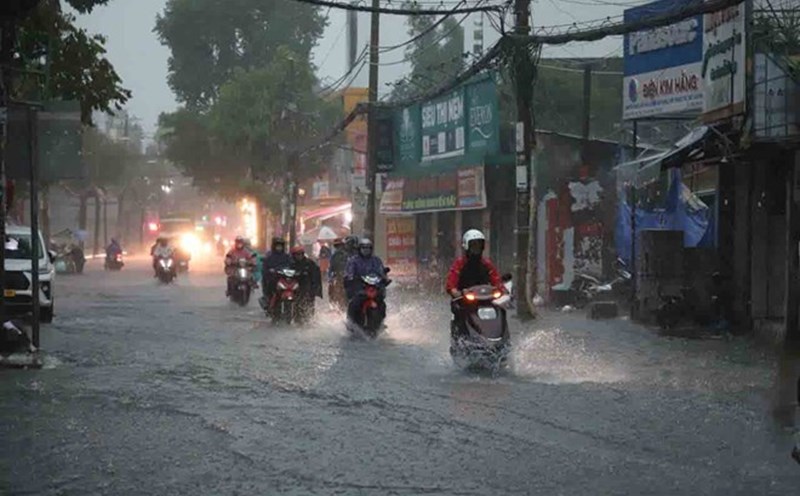
Therefore, the weather in the South will be cloudy to cloudy, with intermittent sunshine. In the afternoon and evening, there will be showers in many places, scattered thunderstorms, some places will have moderate rain, heavy rain with rainfall of 10-30 mm, locally over 80 mm. Around September 15-16, the rain will decrease slightly.
Regarding high tides, the water level at most stations and downstream areas of the Saigon River will decrease rapidly in the coming days, the highest peak tide of the day will be at or above alert level I until the end of September 13.