Weather forecast for the next 24-48 hours, the continental high pressure in the North is likely to strengthen weakly in the mountainous areas of the North, the tropical association with an axis through the North will weaken and fade.
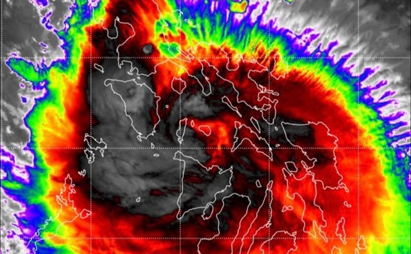
Forming back a tropical convergence zone with an axis across the South Central and Central East Sea connecting with Typhoon Bualoi in the eastern waters of the Philippines around the night of September 26, it will move into the East Sea and become Typhoon No. 10.
The southwest monsoon will gradually decrease and operate at medium intensity. Above, the subtropical high pressure is active and encroaches on the West, axis through South China.
From September 27-30, the tropical convergence zone with an axis through the Central Central region will connect with storm No. 10 to gradually lift the axis to the North. Storm No. 10 moves in the West Northwest direction towards the mainland of the North Central provinces, then gradually weakens.
Above, from around September 28-29, the subtropical high pressure in the southern branch will encroach on the West and lift its axis to the North until around September 30, with an axis through the South - South Central region, then continue to gradually lift its axis to the North.
The southwest monsoon will operate at medium to strong intensity, from around September 29, the wind intensity will gradually decrease.
Therefore, in the coming days, the weather in the South will be cloudy, with scattered showers and thunderstorms, with some places having heavy rain (rain concentrated in the afternoon and evening).
Beware of thunderstorms accompanied by dangerous weather phenomena such as tornadoes and strong gusts of wind affecting agricultural production, breaking trees, damaging houses, traffic works, and infrastructure.
Heavy rain causes flooding in urban areas with poor drainage capacity, affecting traffic, flooding in low-lying areas affecting crops.