
According to the National Center for Hydro-Meteorological Forecasting, from 10:30 PM on July 19 to 3:30 AM on July 20, rainfall in Lai Chau, Lao Cai and Tuyen Quang was commonly from 10-20mm, with many places exceeding 60mm. In Cao Bang, rainfall was commonly below 5mm, locally over 10mm.
Particularly in Lao Cai, many localities recorded heavy rain such as Che Tao 56.4mm, Nam Khat 53mm, Mu Cang Chai 20.6mm and Minh Luong 27.8mm.
Due to prolonged rain for many hours, soil moisture in many areas has reached a state of near saturation or saturation, over 85%, increasing the risk of flash floods on small rivers and streams, landslides on slopes and land subsidence in areas with sensitive terrain.
The level of natural disaster risk due to flash floods and landslides is currently warned at level 1.
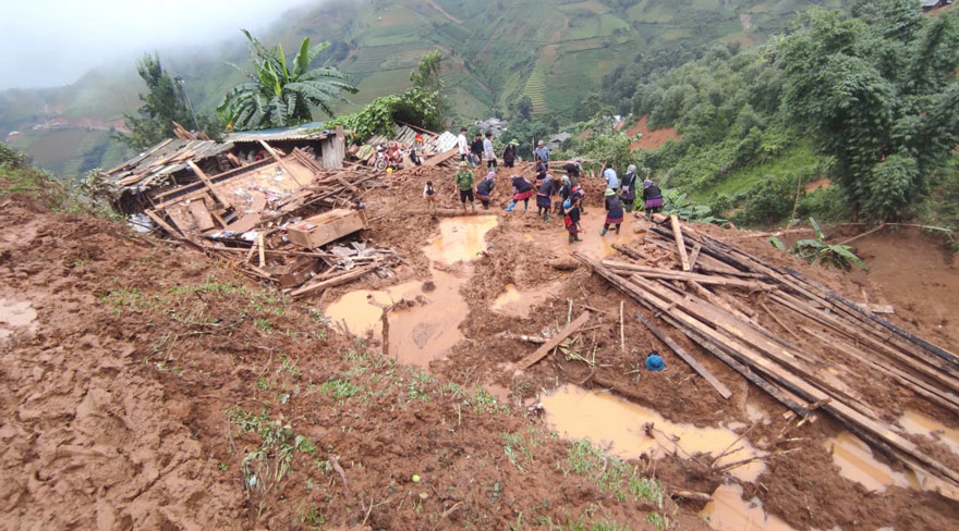
The meteorological agency recommends that people in high-risk areas, especially riverside areas, streams, low-lying areas and sloping roads in Lao Cai, closely monitor weather developments to proactively prevent and avoid.
In addition, some highland areas of Lai Chau, Tuyen Quang and Cao Bang are also warned of the risk of flash floods and landslides in the coming hours.
Previously, on July 18-19, many localities in the northern mountainous region recorded very heavy rainfall such as Thuong Son (Tuyen Quang) 141mm, Muong Lai (Lao Cai) 92.2mm, Vinh Quang (Cao Bang) 92.6mm and Nam Xe (Lai Chau) 73mm.
According to forecasting agencies, flash floods and landslides may occur unexpectedly, causing damage to people and property, disrupting traffic and affecting infrastructure projects.

Localities are required to urgently review key areas, points at risk of flow congestion, and proactively plan to evacuate people when necessary.
People should not go through spillways, streams, areas at risk of landslides when it rains heavily and need to regularly update weather forecasts and warnings to respond promptly.


