According to functional agencies, floods have appeared on the Tien Yen River, and the water level continues to tend to rise.
At 8:00 AM on May 18, at Binh Lieu station on the Tien Yen River, the water level was at 80.40m, about 0.1m below alarm level 2.
It is forecasted that from morning to afternoon on May 18, a flood with an amplitude of 2-3m will appear on the Tien Yen River.
The water level at Binh Lieu station is likely to peak above alarm level 1 to alarm level 2, then slowly decrease.
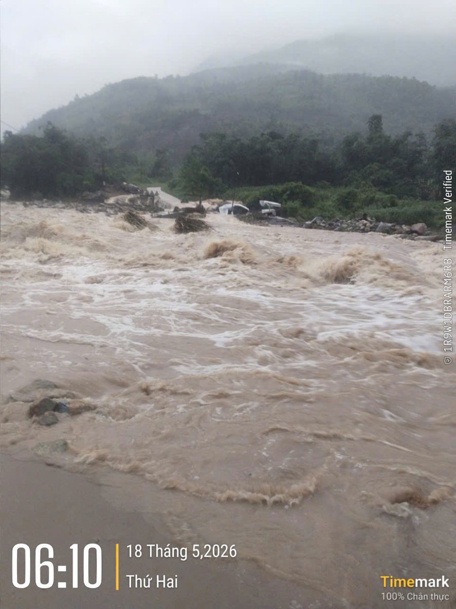
Risk of localized flooding in low-lying areas along rivers, streams, downstream areas, and river mouths such as Hoanh Mo, Luc Hon, Binh Lieu, Dien Xa, Tien Yen, Dong Ngu, Hai Lang...
Functional agencies also warn of a high risk of flash floods and landslides in mountainous areas; flooding in low-lying areas along rivers, coasts and urban areas, affecting agricultural production, waterway traffic, aquaculture and people's lives.
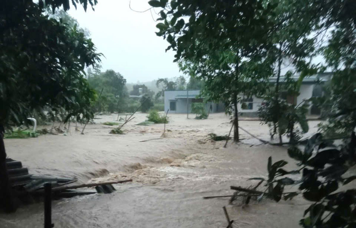
In Duong Hoa commune, on the morning of May 18, river water rose, causing flooding in some villages in the Quang Son area. Meanwhile, upstream water poured in strongly, causing the water level of rivers in Quang Ha commune to rise, causing flooding in some roads, flower gardens and people's houses.
Local authorities recommend that people closely monitor weather developments, proactively move people and property to safe places, cut off electricity when water rises, prepare essential necessities; absolutely do not go through deep flooded areas, overflowing bridges or go to rivers and streams to collect firewood and catch fish when floods occur.
Localities have organized inspections of key areas, reviewed points at risk of landslides, deployed forces to guard underground, spillways, and deeply flooded areas; and at the same time requested ships and boats to proactively anchor safely and limit operations in dangerous areas.
According to statistics from the Quang Ninh Department of Agriculture and Environment, as of the morning of May 18, the prolonged heavy rain from May 16 has not recorded any casualties. However, many areas in Ha Long, Viet Hung, Hon Gai, Mao Khe, Quang Tan, Hoanh Bo wards experienced localized flooding.
Heavy rain also caused local landslides at 2 points on National Highway 18C, in the former Binh Lieu district area, with about 400m3 of soil and rock. Functional forces have urgently cleared it.
On provincial road 326, about 30m of asphalt road surface was washed away, and has been temporarily repaired for vehicle traffic.
In addition, about 127.5ha of rice and 8ha of vegetables were flooded and fallen. Some reservoirs have discharged floodwater, of which Chuc Bai Son reservoir discharged 13.68m3/s, Trang Vinh reservoir discharged 307.23m3/s.
Faced with the risk of landslides, Ha Tu ward has relocated a household in Ha Phong 6A area to a safe place.
Functional agencies recommend that localities continue to closely monitor weather developments, proactively deploy plans to respond to heavy rains, and especially pay attention to the risk of landslides at night and in the coming days.


