According to Dien Bien Provincial Hydrometeorological Station, on June 26, due to the influence of the southern edge of a low pressure trough with axis of about 23-26 degrees North latitude combined with a wind convergence zone at an altitude of up to 5,000m gradually strengthening, the weather in the province on June 26 will have showers and scattered thunderstorms.
Common rainfall is from 20-40mm, in some places over 50mm. The meteorological agency warns of disaster risk level due to tornadoes, lightning, hail and strong gusts at level 1.
Previously, in the past 24 hours (from 1:00 AM on June 25), the Dien Bien area only recorded scattered light rain, with common rainfall below 5mm. However, atmospheric conditions are tending to be unstable, causing thunderstorms to increase in the coming hours.
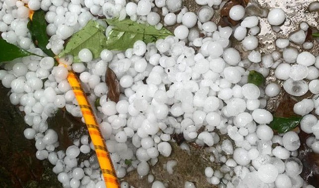
Dien Bien Provincial Hydrometeorological Station assessed that the rain wave is likely to last until June 28. Rainstorms accompanied by tornadoes, lightning, hail and strong gusts of wind can cause roofs to be blown off, trees to be broken, affecting agricultural production and infrastructure projects.
In addition, heavy rain reduces visibility, road surface is slippery, posing a risk of traffic unsafety. In low-lying and urban areas, heavy rain in a short time can cause localized flooding.
Areas along rivers, streams, hillsides and construction sites need to be wary of the risk of flash floods and landslides.
The meteorological agency recommends that people and local authorities proactively monitor weather developments and implement disaster prevention and control measures to limit damage to people and property.


