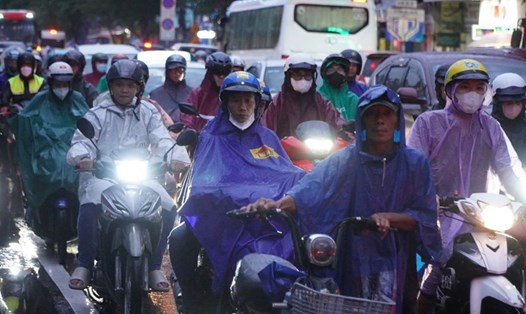
HCMC has rain in the central area since 13:50, then convective clouds develop very strongly causing heavy thunderstorms in the central area. Especially, while the rain occurs, it is accompanied by continuous thunder and lightning.
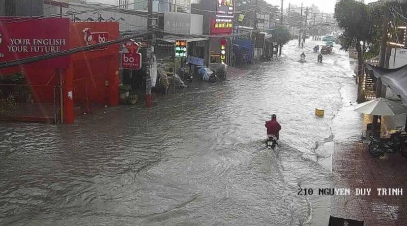
According to records, some roads in Thu Duc City such as Nguyen Duy Trinh, Do Xuan Hop, Quoc Huong, Hiep Binh... were deeply flooded.
Speaking with Lao Dong, Mr. Le Dinh Quyet - Head of Forecast Department of Southern Hydrometeorological Station - said that currently, the equatorial low pressure trough with an axis crossing 6-10 degrees North latitude exists from low to high levels.
The low trough is where moisture converges, forming clouds, while above, the subtropical high pressure across the North makes the ground air temperature high.
"In Ho Chi Minh City, the air temperature and humidity are high, and the energy prevents convection. All indicators are favorable for convective clouds to develop strongly, causing thunderstorms and lightning in the city center," said Mr. Quyet.
Meteorological experts also advise people not to park their cars or take shelter from the rain under trees to prevent the trees from breaking, falling, or crushing them. At the same time, stay away from metal objects that conduct electricity well (to prevent lightning strikes), limit the use of mobile phones (to listen and call), and when at home, unplug electrical devices to prevent direct lightning strikes and lightning strikes from spreading.
In the coming days, Ho Chi Minh City and the southern provinces will be cloudy with rain, showers in many places and scattered thunderstorms, some places will have moderate rain, heavy rain, and locally very heavy rain. From about October 14 onwards, rain will tend to decrease and occur sporadically in the afternoon and evening, sunny during the day.