The Standing Office of the Command Committee for Civil Defense, Natural Disaster Prevention and Control and Search and Rescue (PTDS-PCTT&TKCN) of Can Tho City informed that in May 2025 alone (as of May 20), the area recorded 3 types of natural disasters including: 3 riverbank landslides, 5 heavy rains accompanied by thunderstorms, 1 high tide.
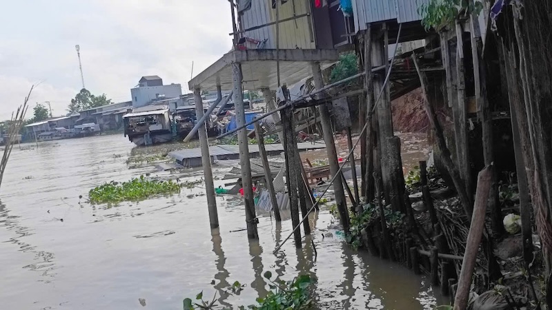
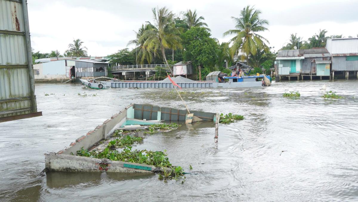
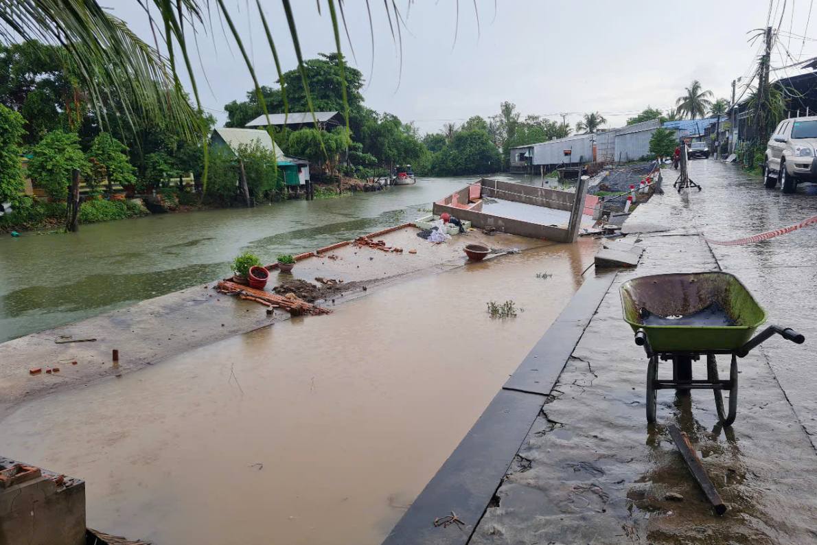
Regarding riverbank landslides, Can Tho has had 3 times in the districts of O Mon, Thot Not and Thoi Lai with a total landslide length of 106m. The landslides did not cause any human casualties, but completely collapsed 5 houses (4 households and 1 rice paper kiln), affecting 2 traffic routes. The total damage is estimated at over 150 million VND.
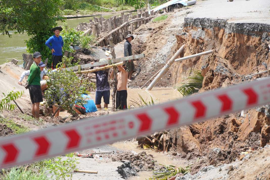
In An Giang, the riverbank landslide on May 18 in Cho Moi district caused 10 houses along the banks of the Ong Chuong River to be swept into the water. The landslide section is about 70m long, with initial damage estimated at about 2 billion VND. The 200m long section of the riverbank at risk of landslides.
Also in May, in Hau Giang province, there were many landslides on the banks of Mai Dam canal, Bao Bung canal... in Chau Thanh district, affecting rural traffic routes. The total damage is estimated at more than 470 million VND.
Explaining the cause of landslides on riverbanks and coasts in the Mekong Delta, Mr. Nguyen Huu Thien - an independent researcher in the Mekong Delta - said that the main cause is the lack of alluvium and sand. This is due to hydropower dams blocking alluvium and sand from upstream not being able to flow downstream and due to sand mining activities along the Mekong River, most of which are in Cambodia and Vietnam.
The lack of alluvium has made the water flow "starved water" due to excess energy, so the water flows into the riverbank and riverbed. The lack of sand makes the riverbed deeper, which means the river banks become higher, heavier and collapse.
"We imagine it like this, corresponding to a type of riverbank material, the riverbank must have a certain elevation, called a stable slope, so as not to collapse. If the riverbank soil is mixed with more sand, it must be more soil and gentle before landslides occur. If the riverbank is full of clay, the slope needed to stabilize it is smaller than the riverbank with a lot of sand. When the riverbed is lowered due to sand mining and lack of sand for compensation, it requires the slope to expand, causing landslides, said Mr. Thien.
According to Mr. Nguyen Huu Thien, river bank erosion in the Mekong Delta usually occurs at the end of the dry season, at the beginning of the season because at the end of the dry season is the lowest lowest, the highest and the heaviest river level of the year. At the same time, the upstream water began to return and flowed strongly at the foot of the river, silently cut the hollow legs below that many people living on the top did not know, until this vacuum land slid into the river carrying houses and property on it.
"One thing to note is that not to exploit sand where there is only landslides there. Once the big river bottoms like the Tien and Hau rivers are deep down and in fact, it has been lowered more than 4-5m deeper than before, it will withdraw the bottom of the branch river.