Han River story
I was stunned, standing for a long time at the photo exhibition about Da Nang's development. Of course, not because of the brilliant bridges of lights spanning the Han River. Even less attracted by the skyscrapers, densely packed on both sides of the river, or the towering high-rise buildings like Hong Kong (China) on Hoang Sa Street, on the coast... I was "freeze" because of the stilt houses, temporary houses, and piles piled on the edge of the Han River. Time seemed to settle down, memories flickered back to Da Nang in 1996, 1997 - when I first came to start a career in this land.
Still the Han River water, but lingering on the ferry every day going back and forth through Ha Than wharf, where I rented a room. The city is peaceful following the cycles of bicycles, but full of hardship through the days buried in hot sand in District Ba (now Ngu Hanh Son, Son Tra) to work. My biggest dream and of course the dream of Da Nang people at that time was to have a bridge across the Han River. Even though the bridge only serves women carrying flowers from Phuoc My village, carrying fish from Tho Quang, Man Thai fishing villages to Han market...
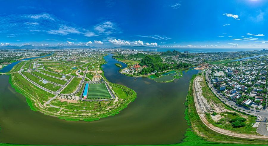
But after only 10 years, Da Nang has "transformed" in the true sense of the word. The city has become 4 times larger than when the province was split (1997). Da Nang stands out on the country's development map, registering with international friends as an attractive destination, a worthwhile investment address in the Central region. And now, Da Nang is expected to be the economic center of the Central region, the development pole of the whole country after the merger of provinces and cities.
I was stunned, because life kept sweeping me away, becoming more and more rushed and busy every day, just like the development of this city itself - so I couldn't have the feeling of a slow-living time. Not just 1 bridge, but Da Nang built more than 10 impressive architectural works across the Han River system. The dream of Ha Than wharf becoming a "rugged street" one day is now a sparkling pearl on Son Tra peninsula. Few people remember the temporary houses by the riverbank in the past.
The Han River is being planned to become a river of light. Not only magnificent with high-class, modern high-rise buildings reflecting into the river, but also a place where attractive cultural and tourism products such as international fireworks will take place annually. The river will tell the ups and downs of history, of the steadfastness, hard work, growing day by day of the heroic land.
The Central region is a narrow strip of land, stretching from North to South. On one side is the majestic Truong Son range, on the other side is the narrow coastal area. The coast is beautiful but also full of storms. There are many rivers but they are all short, steep and cause fierce floods every rainy season, exposing the dry season's bottom. However, Da Nang has a Han River full of water all year round, peaceful without causing floods. That is not only the "favor" of nature, but also the merit of predecessors, digging rivers and dividing water from the "mother river" - Thu Bon.
Hundred-year vision
Connecting from Thu Bon to the Han River is the Vinh Dien River. Originally, it was a tributary of the Thu Bon River, flowing through Dien Ban (former Quang Nam) and flowing into the Han River (Da Nang), but it is winding, narrow and shallow, with many sections blocked.
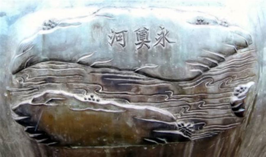
Recognizing the importance of connecting Da Nang port with the upstream area, in Giap Than year (1824), King Minh Mang ordered the river to be renovated. The book Dai Nam Thuc Luc, has detailed the history of digging and embellishing the river. In At Mui year (1835), the image of the Vinh Dien River (Vinh Dien Ha) was honored to be engraved on Du Dinh - one of the Nine Peaks located at The Mieu (in Hue Imperial Citadel), comparable to other famous landmarks of Quang Nam such as Hai Van Pass, Cua Han.
The digging of the Vinh Dien River has extremely important economic significance. At the end of the 18th century, when Cua Dai and Co Co rivers gradually were silted up, Hoi An trading port's role declined, the Vinh Dien River after being cleared became a new "blood vessel". It allowed goods and agricultural and forestry products from upstream Thu Bon, Vu Gia to be transferred directly to Da Nang port and vice versa, while helping to divide floods and quickly drain water for coastal villages along the Vu Gia and Thu Bon rivers.
However, the fate of the river also went through many ups and downs according to historical changes. In 1858, when the French-Spanish coalition attacked Da Nang, fearing that the enemy would follow the Vinh Dien River to ambush Quang Nam province, King Tu Duc was forced to fill the river to block the way.
It was not until around 1887, when the French colonialists promoted colonial exploitation, that the river was reopened. To transport coal from the Nong Son mine and gold from Bong Mieu to Da Nang port, the French ordered dredging and expansion of the Vinh Dien River. This context gave rise to a different version of the folk song "From the time the West came to Cua Han/Digging up the Cau Nhi river to mine gold in Bong Mieu".
Opening the Quang Nam - Da Nang artery
Over nearly 200 years, the Vinh Dien River today still retains its vital value. This is the main inland waterway transporting sand, gravel, and coal from mountainous areas downstream. The river provides domestic water and irrigation for fields from Dien Ban to Da Nang and brings abundant aquatic resources to residents on both banks.
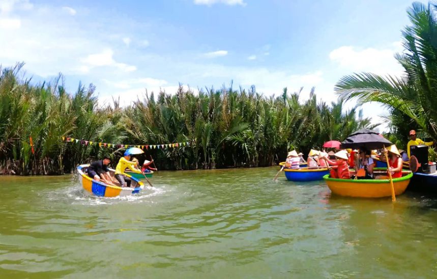
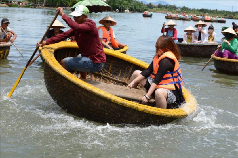
Meanwhile, another river, also connecting Thu Bon with the Han River, but downstream - that is the Co Co River (also known as Lo Canh Giang). This is a "lazy river", located parallel to the coast, connecting the Han estuary with the Dai estuary. It is like a pipeline, connecting 2 large rivers, where the estuary should "flexibly" flow back and forth, dividing water between each flood or tide. It was also King Minh Mang and his dynasty who cleared, renovated, and widened this vital river. Therefore, in the golden age of Tourane (Da Nang City) and Hoi An trading port, the Co Co River was a bustling trade route, where boats were bustling, goods circulated, contributing to prosperity.
However, over time, the river was silted up, falling into a long sleep of more than a century, many sections became low-lying areas, and before they could fully exploit their value, they were forgotten.
In recent years, the two localities of Quang Nam and Da Nang (old) have started to clear the Co Co River. Being implemented unfavorably - now merging the province - the work of reconnecting rivers, clearing traffic arteries, and promoting cultural and historical values will be much more favorable.
In the future, with the potential of river tourism connecting Da Nang - Hoi An - Dien Ban - Nong Son and upstream areas, Vinh Dien River promises to become an attractive eco-tourism route. In particular, returning the original value - dividing fresh water, dividing floods for villages and urban areas along the rivers. Looking back at the turbulent historical flow, later generations are even more admiring the wisdom and century-long vision of King Minh Mang when deciding to unleash this river and the efforts of later generations today.


