On March 5, Lao Dong Newspaper reporters were present at the foot of Hoa Binh bridge (Hoa Binh ward, Phu Tho province), about 3km from Hoa Binh Hydropower Plant.
Real-world records show that the water level of the Da River downstream section has dropped significantly compared to the time when the hydropower plant had to discharge floodwater in September 2025.
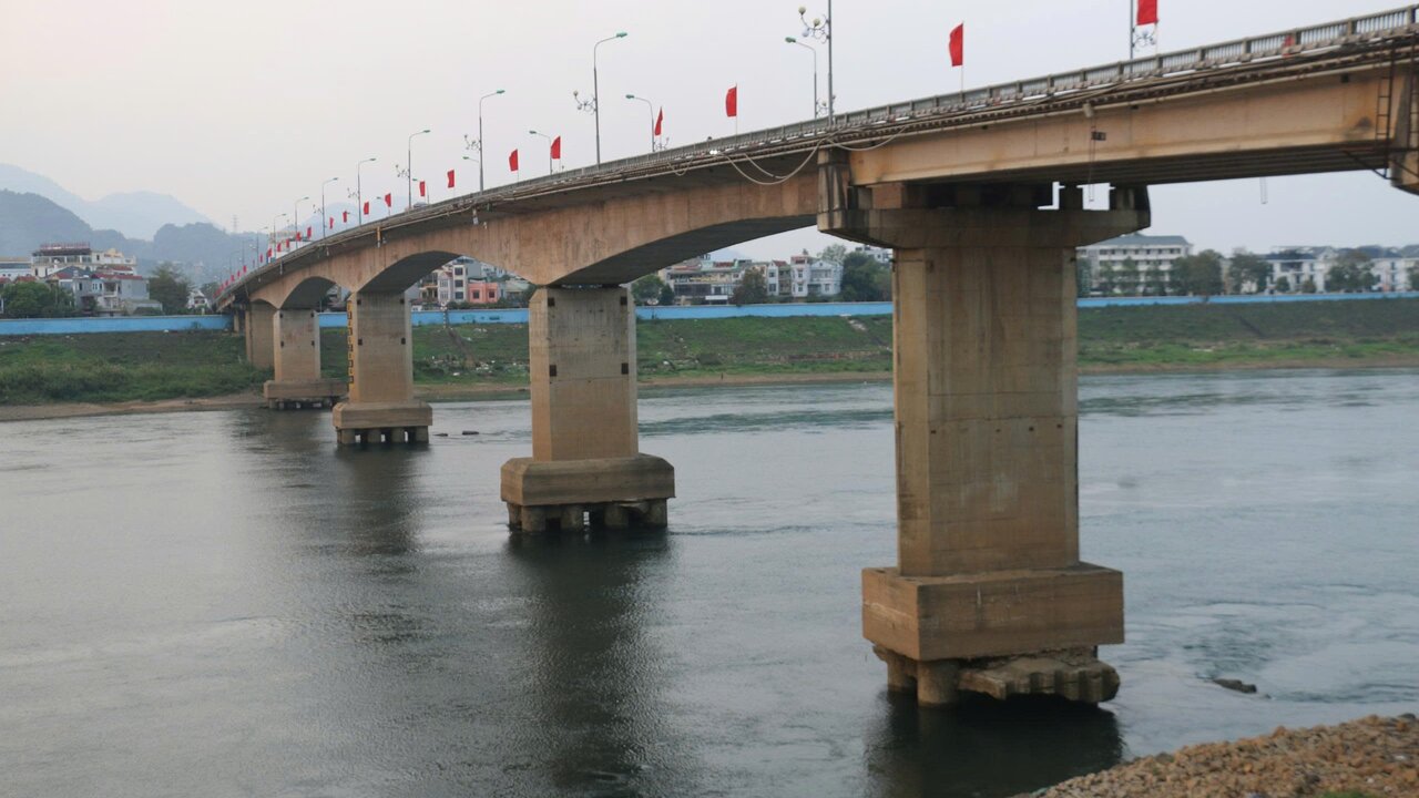
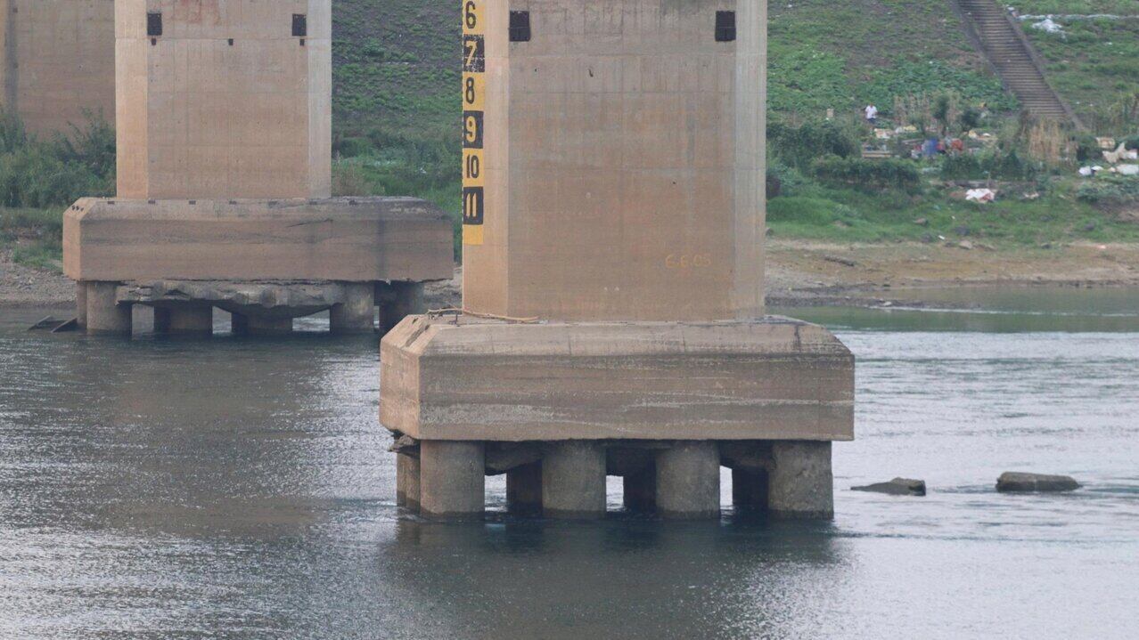
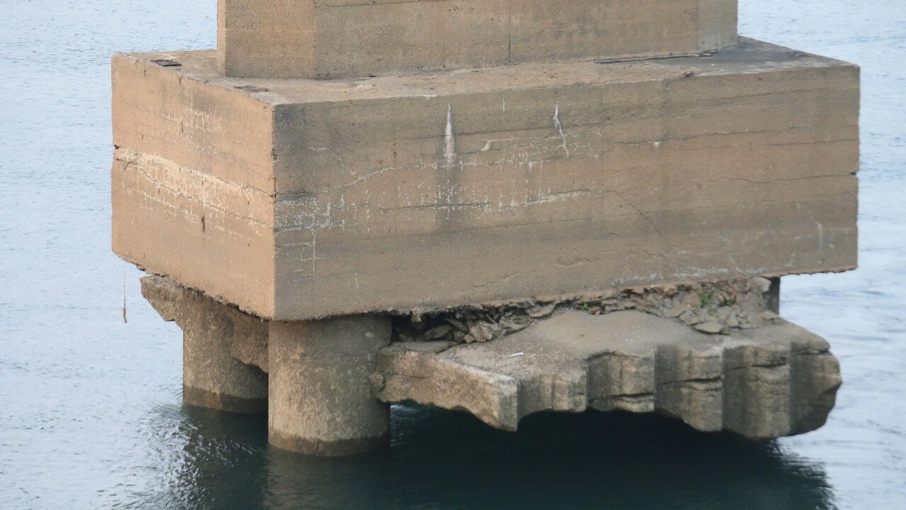
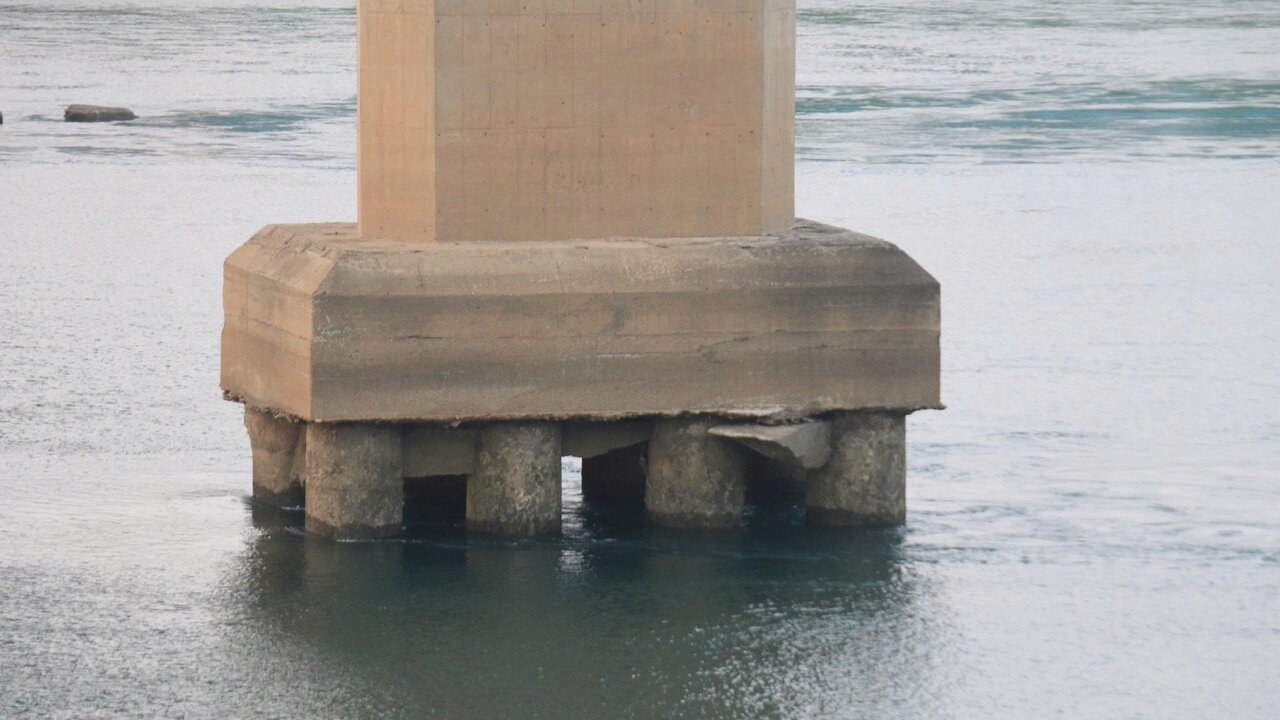
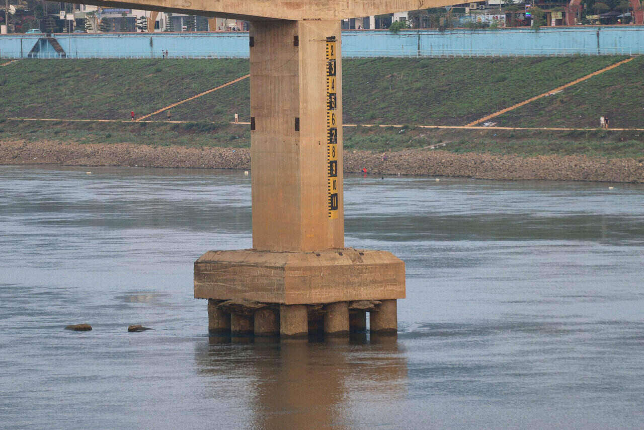
Through observation, the gravel banks on both sides of the bank are clearly visible, which can be observed with the naked eye from the bank. In particular, the low water level of the Da River clearly reveals many pillars of Hoa Binh bridge.
Mr. Nguyen Thanh Trung (30 years old, residing in Tan Hoa ward) said that at this time, the water level of the Da River is very low because Hoa Binh Hydropower Plant does not discharge floodwater. The strong water recede has caused many areas in the middle of the river to reveal rocky beaches, sand dunes, and even in some locations people can wade out to near the middle of the river.
According to Mr. Trung, this image rarely appears, only when the hydropower plant closes its discharge gate, when the water level drops low, does it reveal the bridge abutment and sandbanks that are deep under the riverbed.
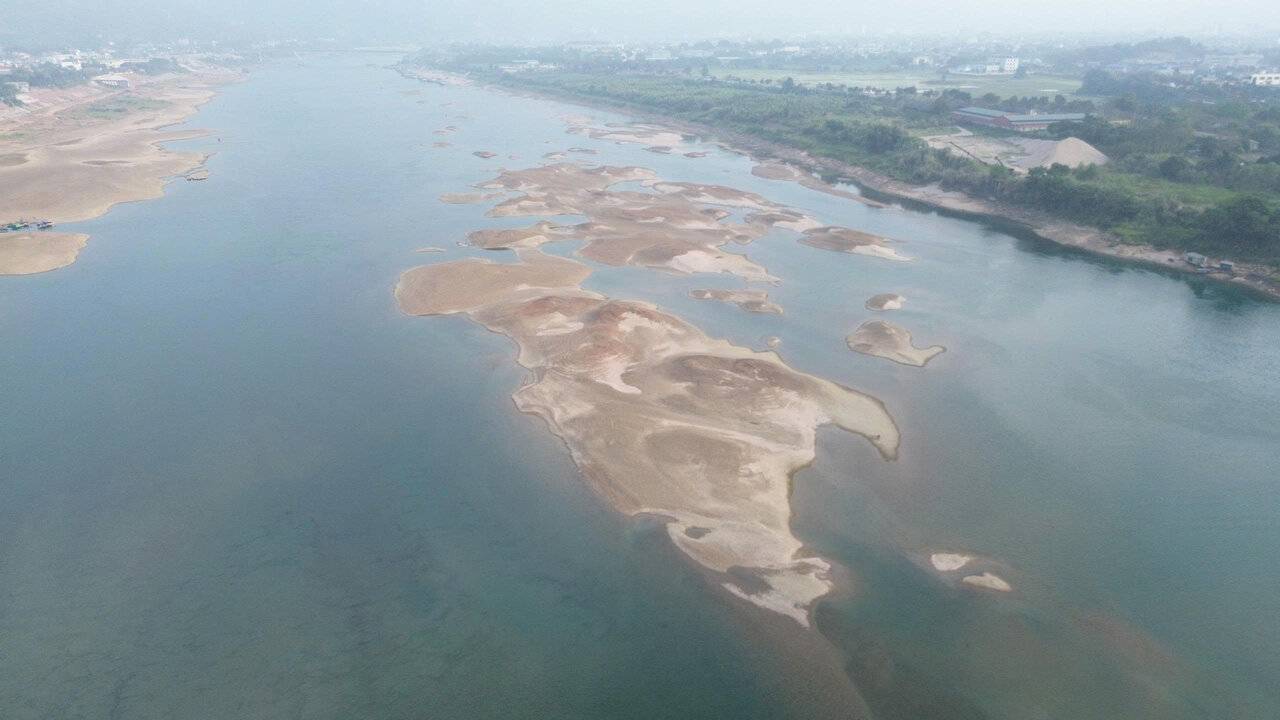
Going downstream about 4 km, in the Da River section passing through Tan Hoa ward, due to low river water, many sand dunes in the middle of the river were clearly revealed.
From above, the riverbed reveals clear contrasting patches of color between water and sand. Some sand dunes stretch tens of meters long, forming a floating strip in the middle of the stream, forcing waterway vehicles to move slowly and choose deeper channels.
Mr. Ngo Van Thong - Head of the fishing village at the foot of Thong Nhat bridge (commonly known as Hoa Binh 3 bridge) - shared: "Compared to September-October 2025, when Hoa Binh Hydropower Plant discharged floodwater, the current river water level is nearly 25-30m lower.
Also according to Mr. Thong, the reduction is quite large, causing many areas of the riverbed that were originally deeply flooded to now become wide sand dunes, clearly visible in the middle of the flow that can be observed with the naked eye.
The low water level currently does not have a major impact on the lives and production of fishermen. People still maintain relatively stable fishing and cage fish farming activities.
Only in cases where the water level drops too deeply, making it difficult for boats to circulate, or when the water rises quickly and suddenly, difficulties arise," Mr. Thong added.

According to operating data from Vietnam Electricity Group at 10:00 am on March 5, Hoa Binh reservoir recorded an upstream water level of 113.33m, lower than the normal water level by 117m; water inflow to the reservoir is 1,480 m3/s, total discharge is 363 m3/s, mainly through the plant.
According to data from Inland Waterway Maintenance Management Joint Stock Company No. 9, the water level in the downstream area of Hoa Binh Hydropower Plant is currently fluctuating at 4.6-4.8 m.


