When the soil is weak, the weather is extreme
The North Central region is the most complex in the country: more than 70% of the area is mountainous, the geological foundation is strongly eroded, many areas have weak soil, large slopes, short rivers, slopes, and seasonal inflow. When extreme rain appears, mountains are likely to "collapse", rivers are likely to "eat", and people are likely to become victims.
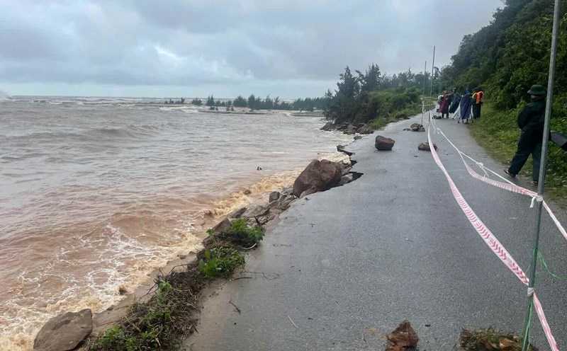
According to data from the General Department of Natural Disaster Prevention, in just 5 years (2020-2025), the North Central region recorded more than 1,000 landslides, of which more than 300 were major landslides in Thanh Hoa, Nghe An, Quang Tri provinces and Hue city. In 2025 alone, heavy rain after storm No. 10 caused nearly 50 serious landslides on national highways 7, 15C, 48, 9, 71, isolating many mountainous areas.
According to Mr. Nguyen Van Tuan - Deputy Director of Thanh Hoa Department of Construction, climate change has caused local rainfall to increase sharply, many rains in just 6-8 hours have reached over 300mm. Previously, there was only one extreme rain in 10 years, now it is every year. Steep land, weak foundation, lost forests, just one rainy night can cause landslides and landslides everywhere".
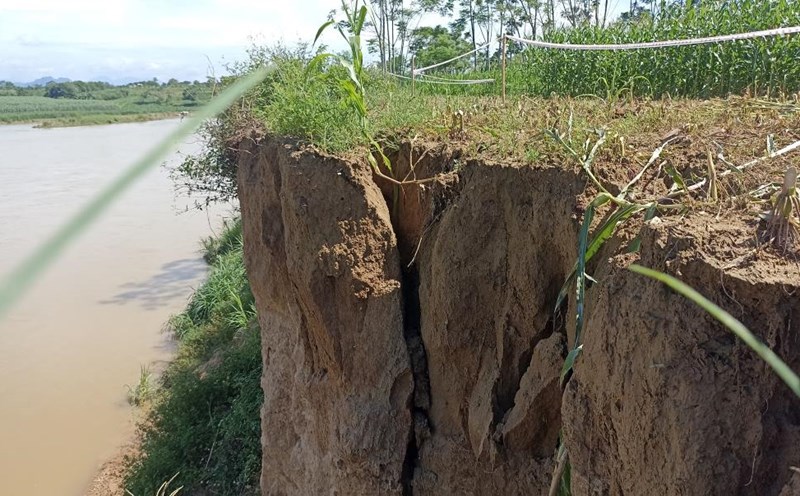
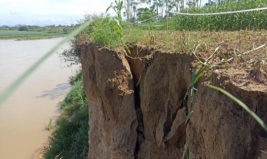
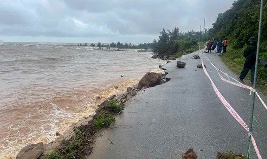
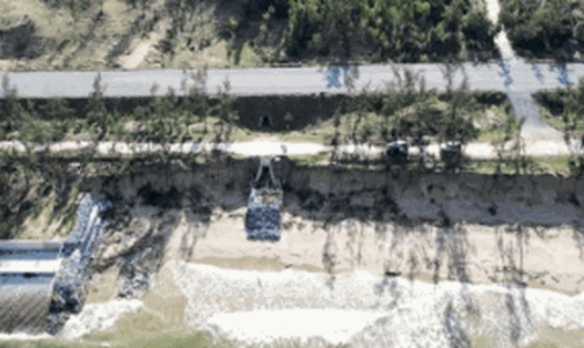
The report of the authorities also pointed out that in 2024 in the Nghe An - Ha Tinh area, the average intensity of soil erosion will increase by 9-12% compared to the period 20102020, while the coverage of natural forests will decrease by nearly 5%. The flow of Lam River, Chu River, Ma River, Thach Han River has changed dramatically after the flood, many sections have been dug 3-5m deeper each year, causing hundreds of hectares of productive land to be washed away.
Obviously, climate change is no longer a distant concept, but has taken shape by collapsed hills and river sections that penetrate deep into the village. But natural disasters, no matter how severe, are not enough to destroy if people do not help.
When people "cut the foot of the mountain to build a house"
If landslides are the "weath" of nature, then humans are making it worse every day. From Thanh Hoa to Hue, nowhere can be seen traces of short-term, temporary interventions - long-term mistakes of people over the years.
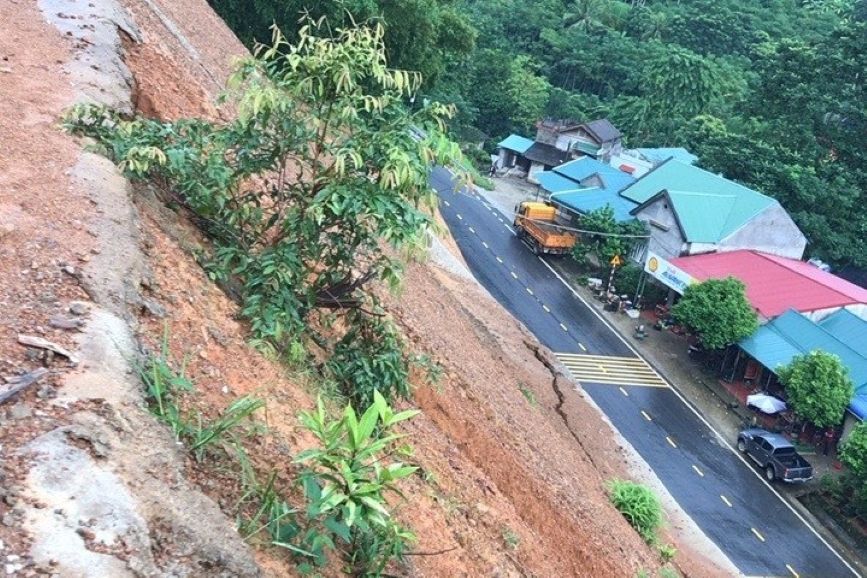
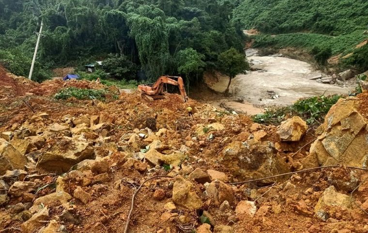
According to the authorities, in the past 10 years, the North Central region has lost more than 20,000 hectares of protective forests due to exploitation and conversion of land use purposes. In the communes of Quan Hoa, Muong Lat district (Thanh Hoa), Ky Son, Que Phong district (Nghe An), a series of steep hills appeared after the forest was "exposed". When there are no more tree roots to keep the soil, just one rain is enough to turn the mountain slopes into a mudflow.
"We have recorded hundreds of thousands of cubic meters of soil and rock, falling down in just a few minutes, burying people's houses with many dead people" - said a representative of the Thanh Hoa Irrigation Department.
At the same time, on major rivers, sand and gravel mining activities took place vigorously. According to statistics from the Nghe An Department of Agriculture and Environment, the Lam River section from Nam Dan to Hung Nguyen currently has more than 40 sand mining sites, of which nearly 1/3 has not been licensed or is exploited beyond the boundary. The riverbed is lowered 1-2m per year, the flow changes direction, the banks are dug up, and the fields and houses collapse.
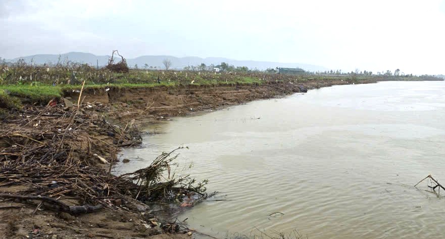
Mr. Nguyen Van Minh - Secretary of the Party Cell of Minh Duc village (Kim Bang commune) - said: "Sand is transported, but people's fields and gardens are lost. forever, the riverbed becomes a ravine, the rushing water eats straight into the foot of the house".
In Thanh Hoa, illegal sand mining caused subsidence and landslides along the banks of the Ma River and Chu River. There have been many dangerous subjects caught in the legal net, but the sand bandits in this province are always painful, the honey fields on both sides of the river are still swept into the water.
A series of recent investigations by Lao Dong also reflected the painful illegal sand mining in Quang Tri and Hue provinces. Obviously, for profit, the thieves are still helping nature destroy it every day.
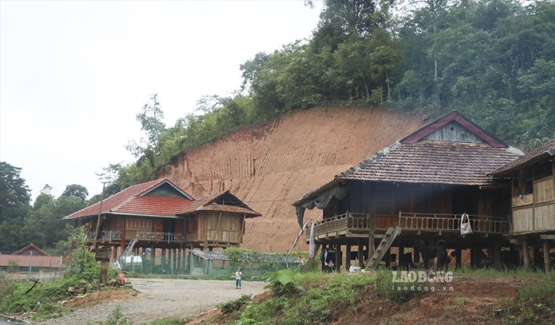
Another reason comes from the cultivation and living habits of the people in the highlands. In many mountainous communes of Thanh Hoa, Nghe An, Ha Tinh, people are still used to building houses at the foot of mountains or hillsides, burning nests to plant, and cutting down trees to level the ground.
Mr. Ngo Hoang Ky - former Chief of Office of Thanh Hoa Provincial People's Committee - said that many years of working in mountainous areas, he saw the scene of people using machinery to cut through the foot of the mountain to get soil to build houses. When it rains for a long time, water seep into the soil, creating a very dangerous landslide of the mountain's crust.
In addition, many resettlement areas after floods are arranged right at the foot of newly eroded hills, lacking embankments, and no drainage. Officials of the Thanh Hoa Department of Agriculture and Environment admitted that sometimes, due to the need for situations, we only evacuate people from dangerous areas immediately, not taking into account long-term safety. Some places have just been resettled, and next year they will have another landslide.
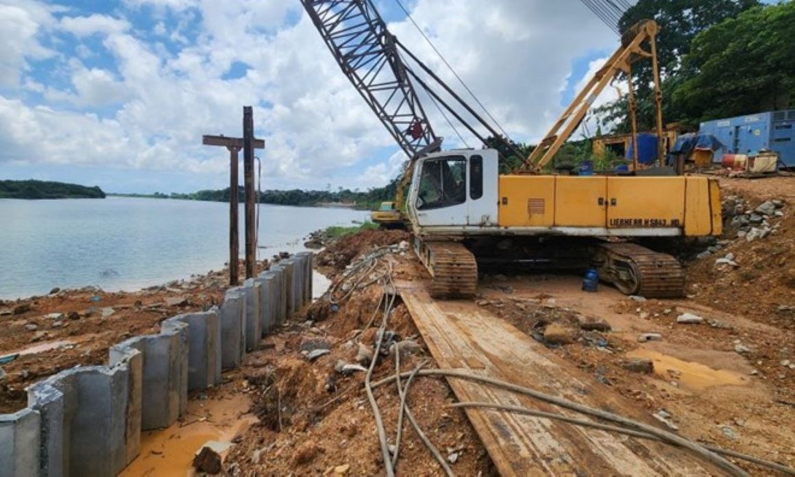
In fact, many projects of embankments, dykes, and river dykes have been invested in unfinished manner due to lack of capital, leading to " one place, one place, one place". According to the Nghe An Steering Committee for Disaster Prevention and Control, Lam River bank erosion repair alone requires more than VND2,000 billion, but the local budget can only meet less than 20%.
Obviously, natural disasters are just the tip of the iceberg. The sinking part - more frightening - is the way people disrupt the natural balance, build - dig - cut - exploit arbitrarily.
Landslides in the North Central region are no longer a single phenomenon, but a combined consequence of climate change and human carelessness. If we continue to think about "fighting the fire", only patching the vi vi sau after each rainy season, the disasters like Rao Trang, Sa Na, Muong Lat, Lam River, Chu River will repeat themselves - with the price getting higher and higher.
To end that vicious cycle, a detailed and scientific map of landslide monitoring is needed; a comprehensive strategy is needed for land management, resources, population planning in risk areas, and restoration of protective forests.