Red River shallow with bare bottom sand
After the last floods from October 2025, in recent months, the water level of the Lo River through Tuyen Quang, Phu Tho and the Thao River (Red River) through Lao Cai, Phu Tho has dropped low.
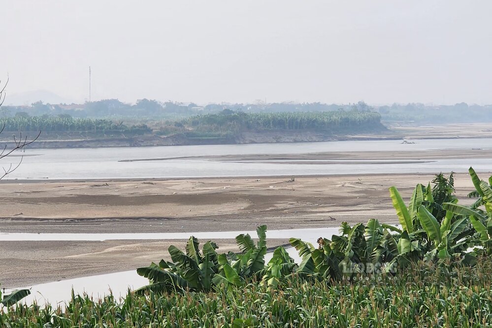
According to reporters' records in Phu Tho province, the locality has both rivers flowing through, the Red River is shallow with only sand at the bottom, and the Lo River is shallow with only underground rocks.
With the Red River in Phu Tho, when in the dry season, the river is narrow, some sections at first glance seem to be walking through, completely different from the image of a vast river in the flood season.
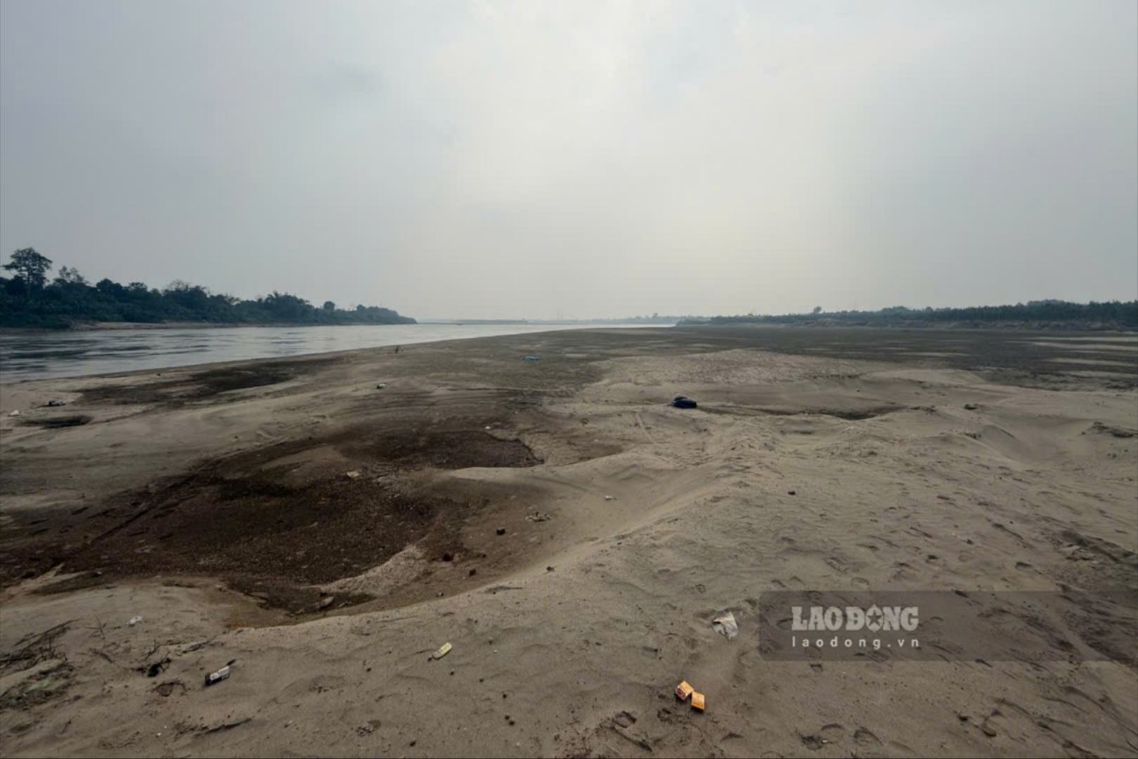
Along with that, there are countless alluvial grounds and sand dunes rising up in the middle of the river, places that were flooded a few months ago are lush with reeds, people also take advantage of the dry season to improve riverside soil and plant short-term crops such as corn, beans, peanuts...
Mr. Tran Van Ton - owner of Tinh Cuong ferry wharf on the Red River (connecting Hung Viet commune with Chi Tien commune) - shared: "Because the river water is shallow, we have to spend more money to build a wharf in another location, when the ferry moves, it also costs more money for gasoline and oil because we have to go around to avoid sand dunes on the river, shallow river water makes ferry business more difficult".
According to the Hydrometeorological Forecast and Warning Bulletin (from February 1st to February 28th) of the National Center for Hydro-Meteorological Forecasting, in February, the water level on the Thao River will change slowly.
According to the table of actual water level data and forecasts, on the Thao River at Yen Bai station (now Lao Cai province), in January, the average water level is 23.44m, highest 23.97m, lowest 23.3,00m. Forecast for February, the average water level is 22.90m, highest 23.85m, lowest 22.50m.
On the Thao River in Phu Tho, in January, the average water level is 11.08m, highest 11.55m, lowest 10.65m. Forecast for February, the average water level is 10.70m, highest 11.25m, lowest 10.20m.
According to the monthly water source forecast bulletin, in February, the flow rate on the Thao River continued to decrease. The total flow rate on the Thao River at Yen Bai station is 76% lower than the multi-year average of the same period.
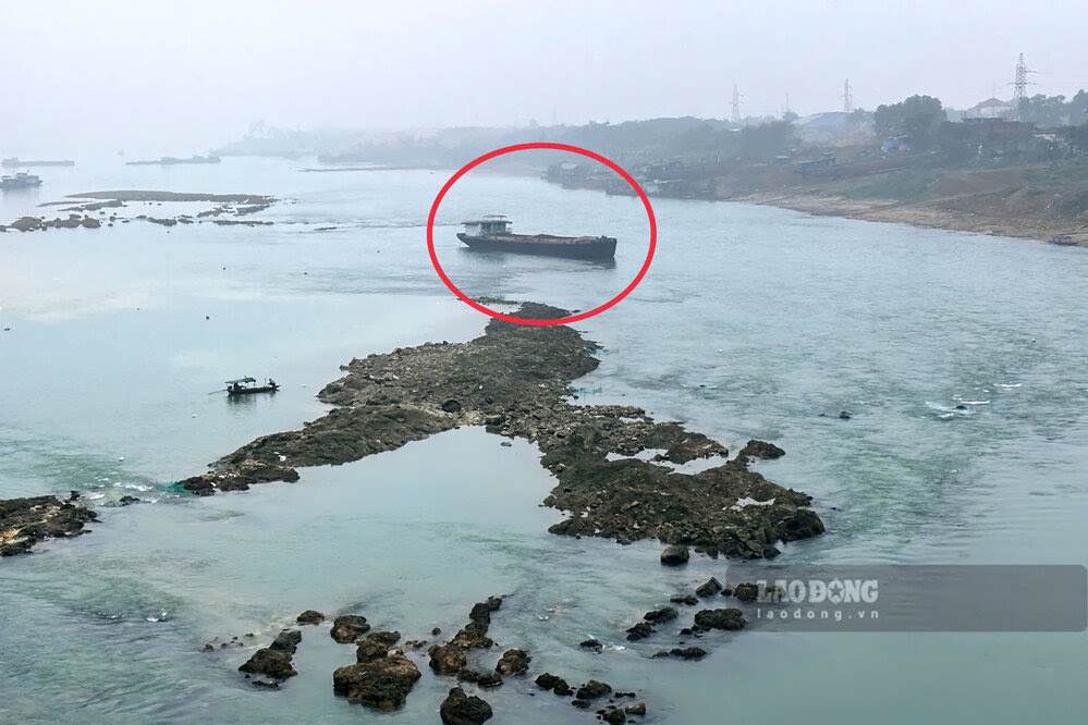
Lo River reveals "matrix" of underground rocks
With the Lo River, according to reporters of Lao Dong Newspaper in the early days of February, the water level has also dropped low, under the jade green water, reefs hundreds of meters long, dense like a "matrix" appear in the middle of the river.
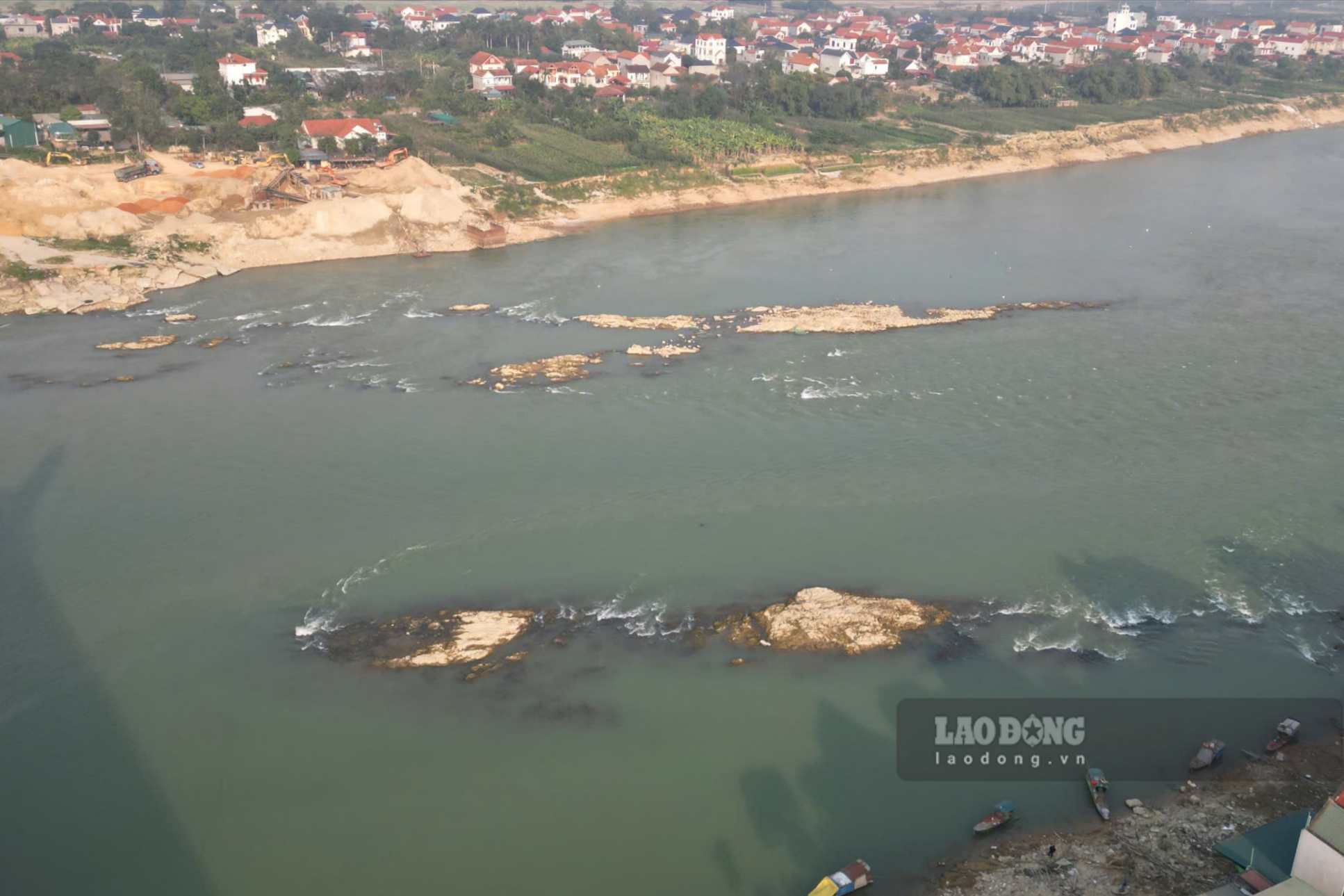
For reefs, waterway vehicles need to be careful when moving. Exactly 1 year ago, also in this area (Vinh Phu bridge area), reporters recorded a cargo ship stranded in the Lo River due to hitting reefs, the ship's propeller broke and could not continue moving.
According to the forecast bulletin, long-term hydrological warning, downstream water levels fluctuate due to the influence of upstream hydropower regulation; in which 2 strong fluctuations appear due to hydropower plants increasing power generation to serve the winter-spring crop of 2025 - 2026.
In January, the water level of the Lo River at Tuyen Quang station is on average 13.10m, highest 14.64m, lowest 11.30m. Forecast for February, the average water level is 12.98m, highest 14.70m, lowest 11.20m.
At Vu Quang station (Phu Tho), the water level of the Lo River in January is on average 522m, highest 656m, lowest 424m. Forecast for February, the average water level is 460m, highest 670m, lowest 420m.
According to the monthly water source forecast bulletin, in February, the flow rate on the Lo River was lower than last month. The total flow rate on the Lo River at Tuyen Quang station is about 46% lower than the multi-year average.


