Urgent storm news (storm number 3)
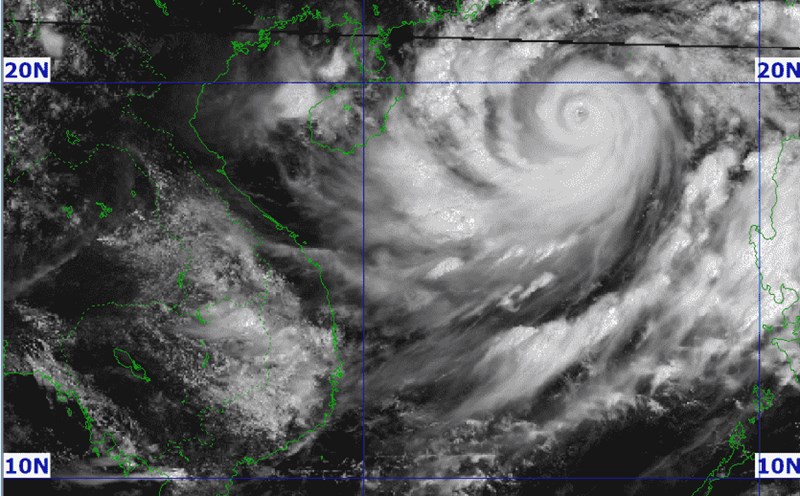
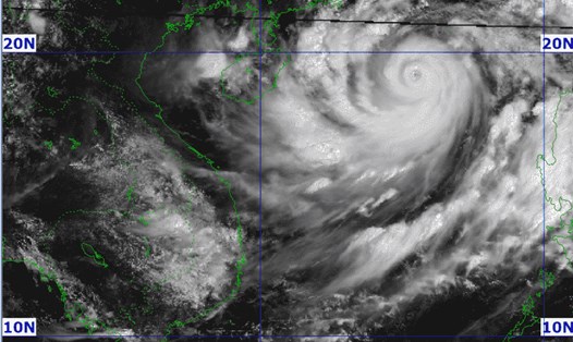
According to the National Steering Committee for Natural Disaster Prevention and Control, at 7:00 a.m. on September 5, the center of the storm was located at approximately 19.0 degrees North latitude; 115.8 degrees East longitude, in the northern sea area of the North East Sea, approximately 520 km east of Hainan Island (China). The strongest wind near the center of the storm was level 15, gusting to level 17, moving westward at a speed of approximately 10 km/h.
Forecast, by 7am on September 6, the location is 19.8 degrees North latitude, 112.6 degrees East longitude; about 190km east of Hainan Island (China); moving West Northwest, about 10 - 15km/h, wind force level 16, gusting above level 17. Dangerous area north of latitude 16.0; longitude 111.5 - 119.5. RRTT level 4: North of the North East Sea area.
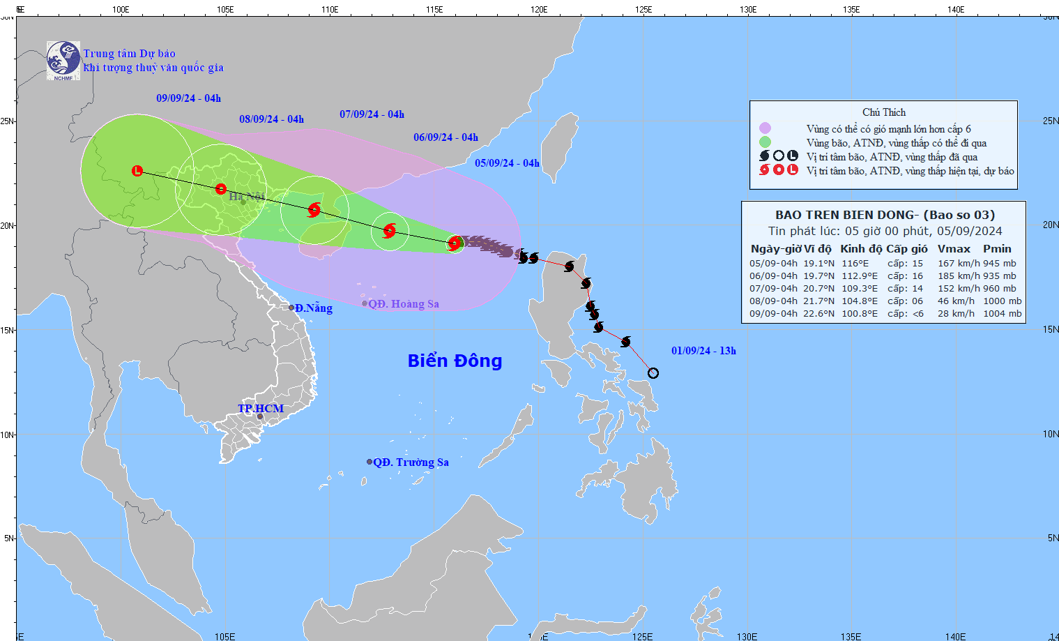
At 7:00 a.m. on September 7, the storm was located at 20.7 degrees North latitude, 109.0 degrees East longitude, in the Northern Gulf of Tonkin, about 190km East Southeast of Quang Ninh; moving West Northwest, about 15 - 20km/h and gradually weakening. Wind force level 13 - 14, gust level 17. Dangerous area north of latitude 15.5; longitude 107.5 - 116.5. Level 4 RRTT: East of the Northern Gulf of Tonkin. Level 3 RRTT: West of the Northern Gulf of Tonkin and South of the Gulf of Tonkin.
Warning of strong winds, high waves and thunderstorms at sea
Due to the impact of storm No. 3, the National Steering Committee for Natural Disaster Prevention and Control warned that on the day and night of September 5, the North East Sea area (including the waters of Hoang Sa archipelago) will have strong winds of level 10 - 13, the area near the storm center will have strong winds of level 14 - 16, gusting to level 17. The sea will be rough; waves will be from 5.0 - 7.0.
The area near the storm center is from 7.0 - 10.0m, from evening and night it can gradually increase to 10.0 - 12.0m. The sea area from Ninh Thuan to Ca Mau, the central and southern East Sea (including the sea area of Truong Sa archipelago) has strong southwest wind level 7, gusting level 8 - 9; waves are from 3.0 - 5.0m high.
On the night of September 5, the sea area from Binh Dinh to Khanh Hoa has strong southwest winds of level 6, gusting to level 7 - 8. Waves are 3.0 - 5.0m high.
In addition, during the day and night of September 5, there will be storms in the North East Sea (including the waters of the Hoang Sa archipelago). The central and southern East Sea (including the waters of the Truong Sa archipelago), the waters from Binh Thuan to Ca Mau, Ca Mau to Kien Giang and the Gulf of Thailand will have showers and thunderstorms. During thunderstorms, there is a possibility of tornadoes and strong gusts of wind of level 8 - 9, with waves of 1.5 - 2.5m high.
Disaster risk level due to strong winds at sea: level 2, eastern sea area of the North East Sea: level 3.
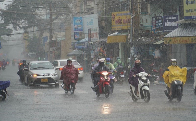
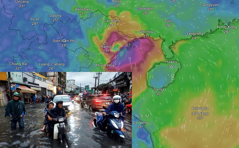
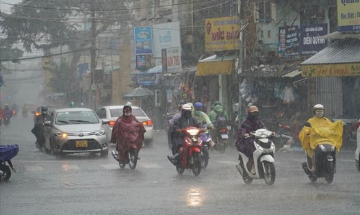
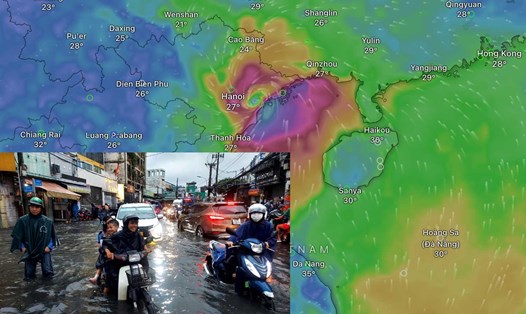
Heavy rain warning in the North and North Central regions; thunderstorm news, warning of local heavy rain, tornadoes, lightning, strong gusts of wind in the area from Da Nang to Binh Thuan, Central Highlands and the South:
From the night of September 6 to the morning of September 9, in the Northern and North Central regions, there is a possibility of heavy rain, locally very heavy rain and thunderstorms with total rainfall ranging from 100 - 300mm, in some places over 500mm.
From the afternoon and night of September 5, the area from Da Nang to Binh Thuan will have scattered showers and thunderstorms, locally heavy rain with rainfall from 10 - 30mm, locally over 50mm. The Central Highlands will have rain, moderate rain and thunderstorms, locally heavy to very heavy rain with rainfall from 20 - 40mm, locally over 80mm. The Southern region will have scattered showers and thunderstorms, locally heavy rain with rainfall from 15 - 30mm, locally over 60mm.
Localized heavy rains can cause flooding in low-lying areas; flash floods in small rivers and streams, and landslides on steep slopes.
Warning level of natural disaster risk due to tornado and lightning: level 1.