The Ho Chi Minh City Department of Construction has just issued an urgent document to relevant departments and branches to collect comments on the outline for building the Project on Anti-Flooding and Wastewater Treatment for the period 2026 - 2060 and the Plan on Anti-Flooding and Wastewater Treatment for the period 2026 - 2036.
Units are required to submit opinions before June 30 to complete dossiers and submit them to the Ho Chi Minh City People's Committee for consideration.
According to the draft outline, the expansion of administrative boundaries after the merger of Binh Duong and Ba Ria - Vung Tau has created a very large urban space.
This poses an urgent requirement to restructure the flood control and wastewater treatment strategy in an inter-regional direction, instead of only limiting it to the administrative scope as before.
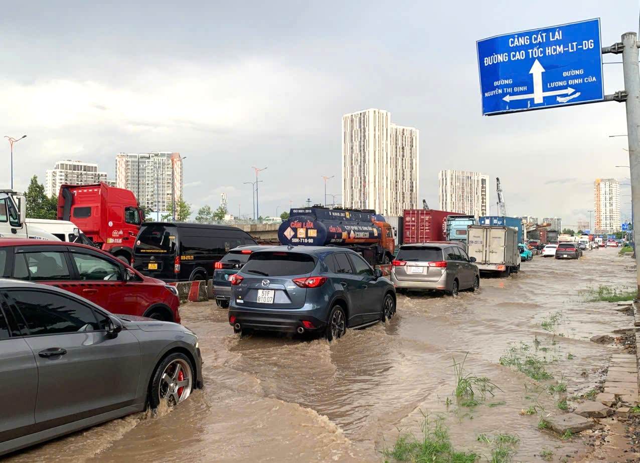
Ho Chi Minh City assesses that the risk of flooding is increasing under the overall impact of climate change, sea level rise, high tides and land subsidence.
In recent years, extreme rains have appeared with a higher frequency, while the tide level at Phu An and Nha Be stations has continuously set new records, exceeding the threshold of 1.8m - higher than the design capacity of many existing flood control works.
Not only facing the flooding problem, the city also bears great pressure on wastewater treatment. Currently, the entire mega-urban area generates about 1.97 million m3 of domestic wastewater per day, but only about 340,000 m3 is treated to meet standards, equivalent to 17%.
Most of the remaining wastewater is still discharged directly into the Saigon - Dong Nai river system and coastal areas, causing significant pressure on the environment.
According to the Ho Chi Minh City Department of Construction, one of the important reasons why flood control effectiveness is still limited is that the current planning system is no longer suitable for the new context.
The overall drainage plan approved in 2001 and the flood control irrigation plan issued in 2008 have both expired and have not updated the climate change scenarios and current urban development speeds.
Meanwhile, the Project on Anti-Flooding and Wastewater Treatment for the period 2020 - 2045 is only built on the old Ho Chi Minh City area with an area of more than 2,000 km2.
According to the direction of building the new project, flood control will be approached in an integrated direction between drainage, wastewater treatment, water resource management, environmental protection and adaptation to climate change. These areas will be considered as a unified whole, linked to land use planning, transport development and the city's socio-economic development strategy.
In addition to investing in infrastructure projects such as tide control culverts, dykes, pumping stations and wastewater treatment plants, Ho Chi Minh City also focuses on non-constructive solutions. These include land use management, protection of drainage corridors, application of smart operating technology, building early warning systems and raising community awareness about flood prevention.
Notably, the project will promote a combination model between "gray" infrastructure and "green-blue" infrastructure, strengthening natural-based solutions such as regulating lakes, water storage spaces, canal and ditch restoration, and flooded ecological zones.
This is considered a sustainable direction to help increase water regulation capacity, reduce pressure on urban drainage systems and improve resilience to extreme weather phenomena.
According to statistics from the Ho Chi Minh City Department of Construction, the whole city currently has 159 points that are frequently flooded. Among them, the area of Ho Chi Minh City before the merger had 76 flooded points, Binh Duong had 52 points and Ba Ria - Vung Tau had 31 points.


