
The National Highway 1A spatial axis project is one of the traffic infrastructure and urban embellishment projects implemented under the public-private partnership PPP method, build-transfer (BT) type contract, starting in May 2026.
The entire route from Ring Road 1 to Cau Gie intersection is about 36.3km long (through 18 communes and wards), after completion it will have a cross-section of 90m. The preliminary land use area is about 337.3ha and is expected to be completed in 2027.
The project section passing through Phu Xuyen commune has a length of nearly 9km. According to initial review, the scope of site clearance (GPMB) in the commune is about 76.5ha, involving more than 2,100 households and hundreds of works, assets and graves that need to be moved.
Mr. Bui Cong Than, Chairman of Phu Xuyen Commune People's Committee, requested specialized departments and agencies after inspection to urgently update the entire current status, make detailed progress reports, and clearly determine the workload to be completed each week.
For agricultural land areas, it is necessary to focus maximum human resources to complete the review, inventory, origin confirmation, formulation and public disclosure of plans, striving to complete all site clearance work before September 30, 2026 according to the commune's plan.
In parallel with agricultural land, specialized agencies continue to carefully review residential land, houses, works, assets and graves within the project scope to develop land clearance plans for each group of subjects, ensuring that the implementation process is continuous and not passive when moving to the next stages.
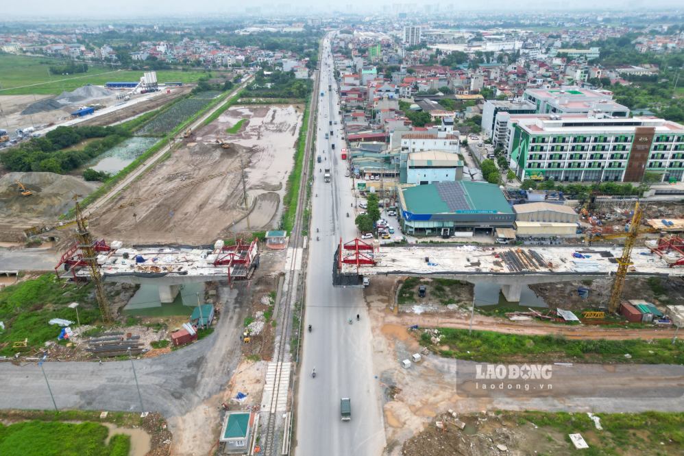
The National Highway 1A spatial axis project associated with urban embellishment and reconstruction through Dai Xuyen commune is 3.8km long, passing through An Hoa, Dong Doai and Co Trai villages.
The total recovered land area is 235,098.9m2, affecting about 585 households and individuals.
To serve land recovery work, the section through Dai Xuyen commune is divided into 15 land clearance map sheets. In which, An Hoa village includes sheets numbered 01 to 06; Dong Doai village from number 07 to 09; Co Trai village from number 10 to 15.
Up to now, Dai Xuyen Commune People's Committee has approved 8/15 map sheets, and 7 sheets are still in the appraisal process.
With a large workload and not much remaining time, completing site clearance in September 2026 requires drastic and synchronous involvement of all levels, sectors, investors, consulting units and local authorities.
Key tasks include: completing 7 map sheets under appraisal; prioritizing the processing of map sheets No. 10, 11, 12 and 13; organizing inventory, verifying the origin of land and developing compensation plans in a rolling manner; accelerating appraisal, approval and payment for eligible plans; and at the same time strengthening information disclosure, dialogue and timely resolution of people's recommendations related to compensation, support and resettlement.
Chuong Duong Commune People's Committee has also organized the implementation of investigation, survey, measurement, and inventory of land and assets attached to land for households and individuals with land areas subject to recovery in Tu Duong village. The inventory process is carried out in a public, objective, accurate, and regulated manner, serving the basis for compensation, support and site clearance. Directly grasping the situation at the grassroots level shows the concern of the commune Party Committee and government for the people; and at the same time contributes to promptly removing difficulties and obstacles in the implementation process, creating consensus among the people.


