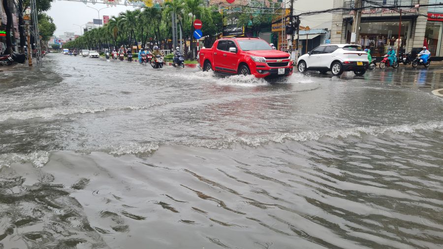
Urbanized roads become rivers
In 2025, the center of Can Tho City and surrounding areas will continuously witness dense flooding, with many record high tides. The rain on May 27 caused nearly 67mm of rain lasting more than 5 hours, causing about 20 roads and residential areas in Ninh Kieu district to be flooded 10 - 30cm deep.
Not only Can Tho, on November 11, high tides in Ca Mau province caused flooding in many places in both urban and rural areas, making it difficult for people's lives and vehicle circulation.
The peak water level at Ca Mau Hydrological Station reached 1.21m, exceeding alert level 3 by 0.36m and exceeding the historical peak of the 2023 tide by 0.05m. In Bac Lieu ward, in October 2025, high tides combined with prolonged heavy rain caused deep flooding in many inner-city roads and low-lying residential areas.
Master Ky Quang Vinh - former Chief of Office of the Department of Climate Change Work in Can Tho City - said that Can Tho is currently suffering the double impact of climate change and subsidence, causing flooding to become deeper and more frequent.
Flooding heats up parliament
What solutions to solve the flooding problem is a pressing issue of particular concern to delegates and voters in Can Tho City, raised at the year-end question-and-answer session of the City People's Council on December 9.
Responding to questions, Mr. Mai Van Tan - Director of the Department of Construction of Can Tho City - said that the rapid urbanization process has increased the density of population, construction works; sand, stone, waste overflowing into manholes and culverts; some previously built sewers have not been connected synchronously, the elevation is not guaranteed, leading to congestion of the drainage system, causing flooding.
Similarly, at the 6th session of the People's Council of Ca Mau province, held on December 8, many delegates and voters also proposed early solutions to prevent urban flooding.
According to Mr. Du Minh Hung - Director of the Department of Construction of Ca Mau province, if the sea level rises 100cm, Ca Mau will lose about 79% of its natural land area, while Bac Lieu (old) will lose about 65%. It is forecasted that by 2030, the sea level in the Mekong Delta may rise by nearly 30cm and by 2100 it will be about 100cm.
Mr. Hung informed that in the past 15 years, Ca Mau has recorded 3 major high tides in 2016, 2020 and 2025. Hydrological data shows that the peak tide in 2025 is about 50cm higher than in 2011. While the scenario by 2030 predicts a 30cm increase in sea level, it has now recorded a 50cm increase, showing that climate change and sea level rise are happening faster.
The Director of the Department of Construction of Ca Mau province also said that the locality is affected by two different tidal regimes: the East Sea is the average daily tide. The West Sea is the tide. Due to this feature, there are times when the water has not yet receded, then rises again, causing prolonged flooding in the city.
Mr. To Hoai Phuong - Director of the Department of Agriculture and Environment of Ca Mau province - said that prolonged flooding is also due to the irrigation system in the area that has not been invested in completely and synchronously for many years. This year alone, the province recorded 17 high tides, with peak concentrations from October to the end of November, many places were flooded 30 - 50cm deep compared to previous years.