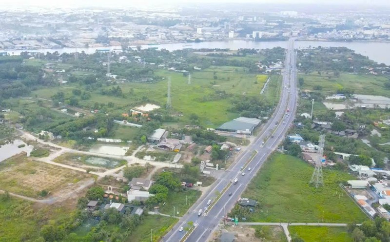
On December 5, the Bien Hoa City Urban Management Department announced the local adjustment dossier of the Bien Hoa City master plan at a scale of 1/10,000 to 2030, with a vision to 2050 - covering Tan Phong ward, Hiep Hoa ward, Long Hung commune, Tam Phuoc ward, publicly to organizations, individuals and the community.
Previously, the People's Committee of Dong Nai province approved the local adjustment of the general planning of Bien Hoa city at a scale of 1/10,000 to 2030, with a vision to 2050 in the area of Tan Phong ward; the area in subdivision A4 of Hiep Hoa ward; the urban area west of Bien Hoa - Vung Tau highway in Long Hung commune and part of Tam Phuoc ward.
Adjust the area of more than 28 hectares (belonging to Tan Phong ward, currently managed and used by Dong Nai Provincial Police) from the function of planning green park land to the function of planning security land.
In Hiep Hoa ward, adjust the area of about 11.66 hectares (adjacent to the east of the intersection between Dang Van Tron street and the central axis road of Bien Hoa city) from the function of low-density newly built residential land (about 8.24 hectares), green park land - water surface (about 2.88 hectares) and traffic land (about 0.54 hectares) to the function of planning land for mixed-use development (commercial center).
Adjust the scope of about 1.68 hectares (including the land of about 0.68 hectares adjacent to the South of the above 11.66 hectares and the land of about 1 hectare adjacent to the Northeast of the intersection between Do Van Thi Street and the central axis road of Bien Hoa City) from the function of low-density newly built residential land to green park land.
Adjust the scope of about 1.5 hectares (located in the area limited by 3 routes Dang Van Tron, Do Van Thi and Bien Hoa city center axis) from the function of renovated residential land to green park land.
In addition, Dong Nai Provincial People's Committee also locally adjusted the 1/10,000 scale planning of Bien Hoa City until 2023, with a vision to 2050, covering part of the urban area west of Bien Hoa - Vung Tau highway.
In which, adjusting the population size from 420,000 people to 434,000 people; Adjusting land use indicators for urban residential land from 45-55 m2/person...
Local adjustment of the master plan to overcome shortcomings in the overall adjustment dossier of the Bien Hoa City master plan approved in 2014, which did not fully update the detailed planning content of 1/500 of projects being implemented within the scope of subdivision C4 (which has been granted land use right certificates).
At the same time, adjust and supplement the planning to suit the new development orientation of Bien Hoa City...


