According to the draft master plan of Ho Chi Minh City for the period 2025 - 2050, 100-year vision, the City orients urban development according to the public transport (TOD) model, gradually forming a 20-60-minute urban area.
Instead of expanding the city depending on roads and personal vehicles, Ho Chi Minh City will take public transport as the nucleus, helping people conveniently access jobs, education, healthcare and essential services in about 20 - 60 minutes, while reducing congestion and moving towards sustainable development.
Metro becomes the "backbone" of TOD urban areas
Vision to 2050, the urban area of Ho Chi Minh City will develop into a "multi-polar - integrated - super-connected" megacity, completely transforming from a spreading development model to an urban structure based on public transport.
The main driving force of this strategy is a network of 28 urban railway lines with a total length of about 1,100km, connecting Ho Chi Minh City with the Binh Duong and Ba Ria - Vung Tau regions before. The metro system will be synchronously connected with the national railway, forming a modern inter-regional transport network.
According to the draft plan, the total investment capital demand for the metro network is estimated at about 72.1 billion USD. Of which, Ho Chi Minh City area is about 40.2 billion USD, Binh Duong 22.6 billion USD and Ba Ria - Vung Tau 9.3 billion USD.
In parallel with that, the City is expected to have about 21,000 hectares of potential land fund for TOD development by 2030.
Three stages of TOD development
To realize the goal, Ho Chi Minh City divides the TOD development roadmap into three phases.
The period 2025 - 2030 will focus on completing mechanisms and policies and piloting from 5-7 key TOD areas along Metro Line 1, Metro Line 2 and Ring Road 3. The city aims to bring the metro network to about 187km, increasing the rate of public transport coverage to 35 - 50% of travel demand. At the same time, the TOD development fund will be put into operation and Ring Road 3 will be completed in 2026.
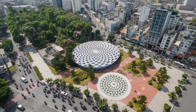
In the period 2030 - 2035, the City will expand from 10 - 15 large-scale TOD zones, increasing the length of the metro to about 275km. Public transport will meet 50-60% of travel demand, while shortening travel time between the central area and satellite cities to less than one hour. Ring Road 4 is also expected to be completed in 2029, creating a regional connection platform.
By the period 2035 - 2045, Ho Chi Minh City aims to complete the TOD urban model with about 700km of interconnected urban railways throughout the region. The goal is that more than 60% of travel needs are met by public transport; 80% of urban residents live within a 10-minute walk to the metro station; reduce more than 30% of personal motor vehicles and move towards the goal of net zero emissions by 2050.
Forming three levels of TOD development
According to the plan, the TOD system of Ho Chi Minh City is organized in three levels.
At the regional level, major traffic hubs will integrate many types of transport such as high-speed railways, national railways, aviation and maritime. Key areas include the TOD complex of Tan Son Nhat airport connecting Long Thanh; Song Than, An Binh, Di An stations; new Mien Dong Bus Station; Hiep Phuoc port; Cat Lai - Phu Huu and Cai Mep - Thi Vai international port complex.
At the city level, TOD intersections will play a role in regulating traffic and forming compressed, multi-polar urban centers. Typical examples are Ben Thanh central station - the intersection of many metro lines; An Suong TOD; Mien Tay TOD; Nga Tu Ga TOD and Thu Thiem TOD.
At the regional level, the TOD network will cover satellite urban areas to connect people with the metro system through buses, waterway buses and transit vehicles. Key areas include the chain of stations along Vo Nguyen Giap axis, Cach Mang Thang Tam - Truong Chinh route, satellite urban areas of Cu Chi, Binh Chanh and the Water-TOD model connecting waterway traffic at Ben Bach Dang, Linh Dong and Thanh Da.