According to the latest weather forecast from the Joint Typhoon Warning Center (JTWC), low pressure Invest 94W currently operating in the Western Pacific region is unlikely to develop into a tropical depression in the next 24 hours.
The maximum sustained wind near the center of the low pressure is currently at 25-35 km/h.
The atmospheric environment around the low pressure is relatively favorable, the sea surface temperature is high, about 29-30 degrees Celsius.
However, in the next 1-2 days, forecast models predict that this low pressure will only strengthen slowly, with common wind intensity of about 35-45 km/h.
It is forecast that low pressure Invest 94W will move mainly in a westerly direction and gradually increase in intensity in the next 2 days.
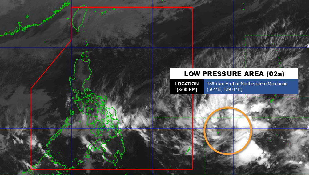
Meanwhile, the Philippine Atmospheric, Geophysical and Astronomical Services Administration (DOST-PAGASA) is also monitoring this low pressure, and named it LPA 02a.
This low pressure area is outside the Philippine Area of Responsibility (PAR), and is assessed to have a moderate possibility of developing into a tropical depression in the next 24 hours.
The low pressure appeared exactly according to PAGASA's weather forecast scenario for the period of February 3-7 and some weather forecast models such as ECMWF, GFS and ICON.
Currently, the diễn biến of the low pressure is still being monitored, and no specific impacts on tourist destinations have been recorded. However, tourists planning to travel by sea, participate in outdoor activities or travel in areas affected by the low pressure need to regularly monitor weather forecasts.
According to the National Center for Hydro-Meteorological Forecasting, in February, there is little chance of storms or tropical depressions appearing in the East Sea.
Cold air is likely to be weaker than the multi-year average, but there are still short-term severe cold spells, especially in the North and Thanh Hoa-Nghe An, which can cause frost in high mountainous areas.
Widespread rain in Ha Tinh - Hue City and the South Central Coast region. The South may have unseasonal rain, tourists should note to bring umbrellas, raincoats and develop contingency plans when planning to travel and sightsee outdoors.


