
Landslides affect travel and production
On September 8, the landslide situation on the road connecting S'Re U residential group (Dong Gia Nghia ward) with residential group 8 (Bac Gia Nghia ward) is still complicated, posing a risk of spreading.
According to local people, the landslide point was initially only about 1m wide. After many rains, especially the heavy rain on the evening of September 5, this area extended about 10m, "deepening" 2/3 of the road surface.
Records show that the road section warned of danger is about 30m long, with a landslide deeper than 9m.
Many coffee trees were pulled down the slope, while new cracks and breaks continued to appear around. If heavy rain continues, the risk of landslides spreading is very high.
Mr. Pham Khac Tai, a resident of S'Re U residential group, said that the landslide occurred on the night of September 1st and early morning of September 2nd. After that, local authorities inspected and placed warning signs.
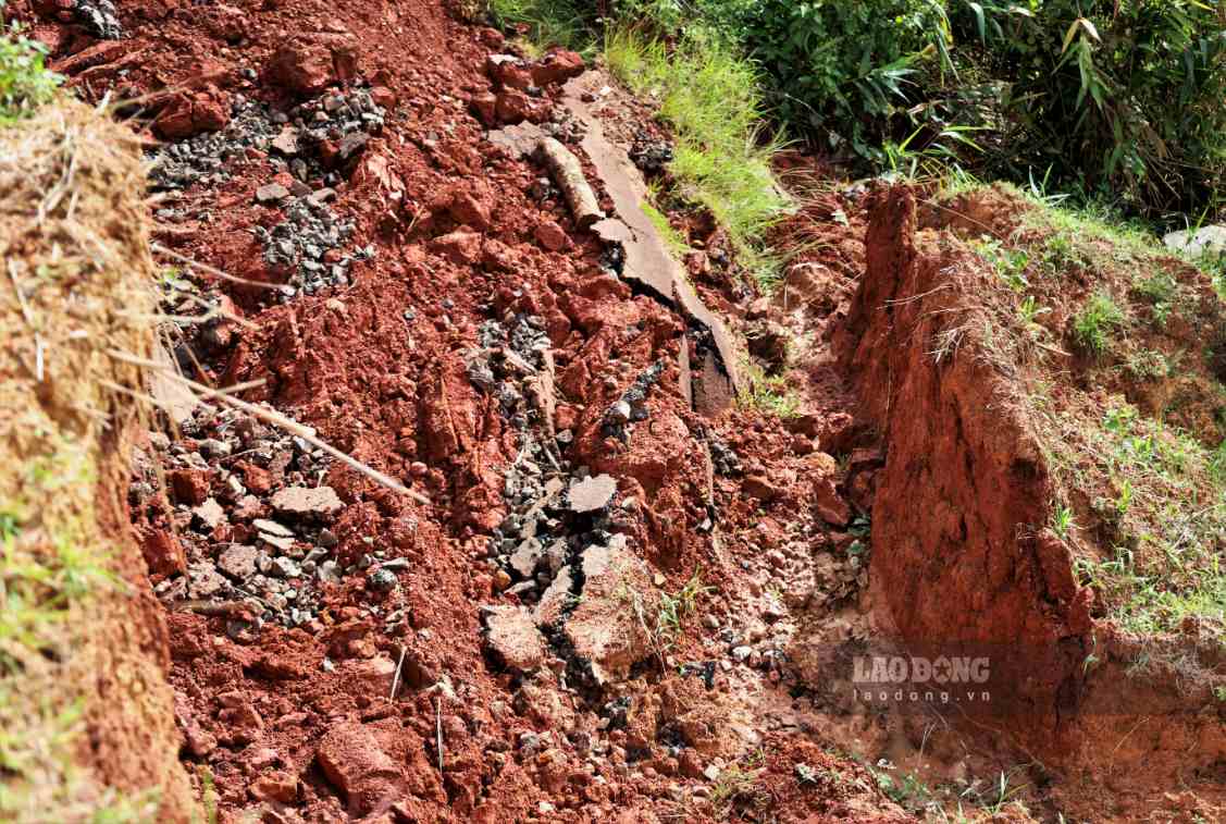
This road serves the travel, labor, production and transportation needs of about 50 households. Many people pass through during the day, but at night people have to choose another way even though the road is further" - Mr. Tai said.
The road not only serves residents of S'Re U residential group but also connects Dong Gia Nghia ward with Bac Gia Nghia ward, Quang Khe commune and production areas.
At this time, people are entering the durian harvest season. Because large trucks cannot pass through the landslide point, many households have to use tractors or motorbikes to transport agricultural products.
Meanwhile, the demand for fertilizer transportation also increased when entering the peak rainy season.
People are worried that if the road is not handled soon, production activities will be affected, and transportation costs will increase due to having to go around.
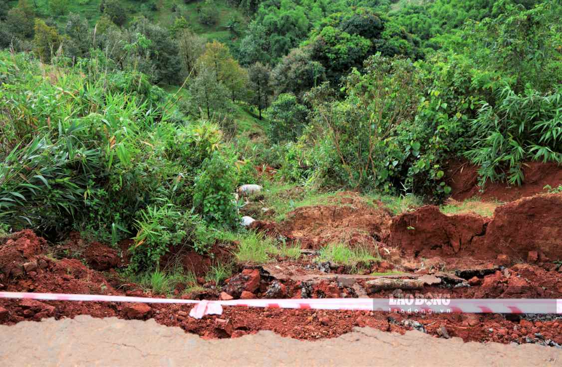
Mr. Hoang Van Duc, a resident of S'Re U residential group, said that this area was previously embankment, and the taluy slopes on both sides had not been reinforced, so landslides occurred.
We hope that the local authorities will soon have measures to handle it, ensure travel safety and prevent the interruption of agricultural product transportation" - Mr. Duc proposed.
Review areas at risk of landslides
Previously, in Cay Xoai residential group (Dong Gia Nghia ward), many cracks also appeared, with a risk of landslides.
Through inspection, the area has an area of about 0.5ha, belonging to land plot No. 70, map sheet No. 59, adjacent to the Dao Nghia - Quang Khe road project.
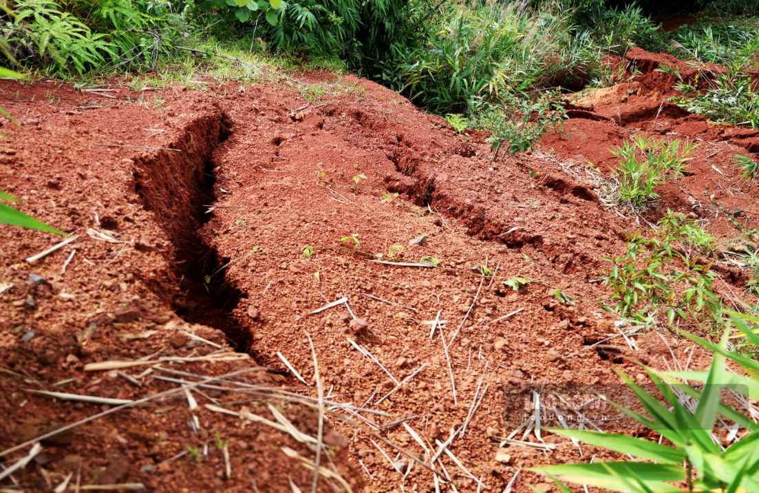
Many locations have cracks 0.1 - 0.7m wide, 0.1 - 8m long. Lands in some adjacent areas also have extended cracks.
Mr. Thach Canh Tinh - Chairman of Dong Gia Nghia Ward People's Committee said that the locality has inspected the scene, hung ropes, planted warning signs and restricted people and vehicles from passing through the dangerous area.
Currently, the locality continues to survey and assess the extent of landslides to have a handling plan" - Mr. Tinh informed.
The western region of Lam Dong is entering the peak rainy season, and the risk of landslides is still present in many places.
Before the forecast of continued heavy rain, the Provincial People's Committee requested localities to closely monitor weather developments, review high-risk areas, proactively develop response plans and be ready to evacuate people when necessary.


