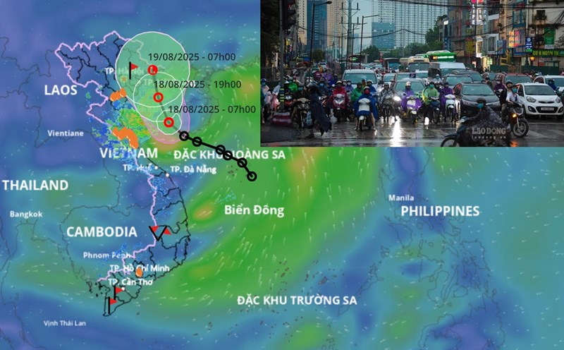
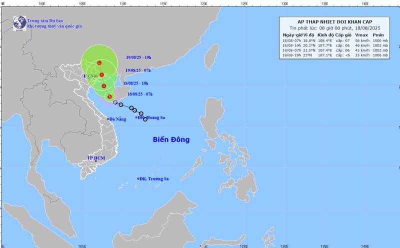
Latest update from the National Center for Hydro-Meteorological Forecasting, at 1:00 p.m. on August 18, the center of the tropical depression was at about 19.4 degrees north latitude; 107.8 degrees east longitude, about 70 km south of Bach Long Vi Special Zone.
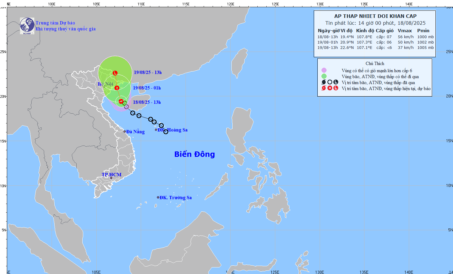
According to Mr. Hoang Phuc Lam - Deputy Director of the National Center for Hydro-Meteorological Forecasting, the strongest wind near the center of the tropical depression is level 6 - 7 (39 - 61 km/h), gusting to level 9; moving north-northeast at a speed of about 15 km/h.

"It is forecasted that in the next 12 hours, the tropical depression will move north-northeast at a speed of 10 - 15 km/h, entering the sea area of Quang Ninh - Hai Phong" - Mr. Lam said.
At 1:00 a.m. on August 19, the center of the tropical depression was at about 20.9 degrees north latitude; 107.3 degrees east longitude. Strong wind level 6, gust level 8. The danger zone is north of latitude 18.5 degrees north; west of longitude 109 degrees east. Level 3 natural disaster risk, affected areas include the Gulf of Tonkin (including Bach Long Vi, Cat Hai, Co To and Van Don special zones).
"It is forecasted that in the next 24 hours, the tropical depression will continue to move north-northeast at a speed of 10 - 15 km/h and gradually weaken into a low pressure area" - Mr. Lam provided information on the path of the tropical depression.
At 1:00 p.m. on August 19, the center was at about 22.6 degrees north latitude; 107.1 degrees east longitude, in the Guangxi area (China), with winds below level 6. The danger zone is north of latitude 20 degrees north; west of longitude 108.5 degrees east. Level 3 natural disaster risk, affected areas include the northern Gulf of Tonkin (including Bach Long Vi, Cat Hai, Co To and Van Don special zones).
Regarding the impact of the tropical depression at sea, the Gulf of Tonkin (including the special areas of Bach Long Vi, Cat Hai, Co To and Van Don) will have thunderstorms, strong winds of level 6 - 7, gusts of level 9, waves 2 - 3.5 m high, rough seas.
Ship operating in the above-mentioned dangerous areas are likely to be affected by thunderstorms, whirlwinds, strong winds and large waves.
According to Mr. Lam, on the mainland from the afternoon of August 18, coastal areas from Quang Ninh and Hai Phong will have strong winds of level 6, gusting to level 8.
From the afternoon of August 18 to the night of August 19, the northeast and Thanh Hoa will have moderate rain, heavy rain and thunderstorms, with common rainfall of 50 - 150 mm, locally very heavy rain over 300 mm.
On the afternoon and night of August 18, Nghe An and Ha Tinh will have moderate rain, heavy rain and thunderstorms, with common rainfall of 20 - 50 mm, locally very heavy rain over 100 mm.
Regarding the weather situation from now until the end of August, according to Mr. Nguyen Van Huong - Head of Weather Forecast Department, National Center for Hydro-Meteorological Forecasting, the forecast products show that from now until the end of August 2025, there is a possibility of 1-2 storms/tropical depressions appearing in the East Sea.
"On the mainland of the Northern region, the Central and Southern highlands, thunderstorms and localized heavy rain will still appear frequently in the evening and at night" - Mr. Huong said.