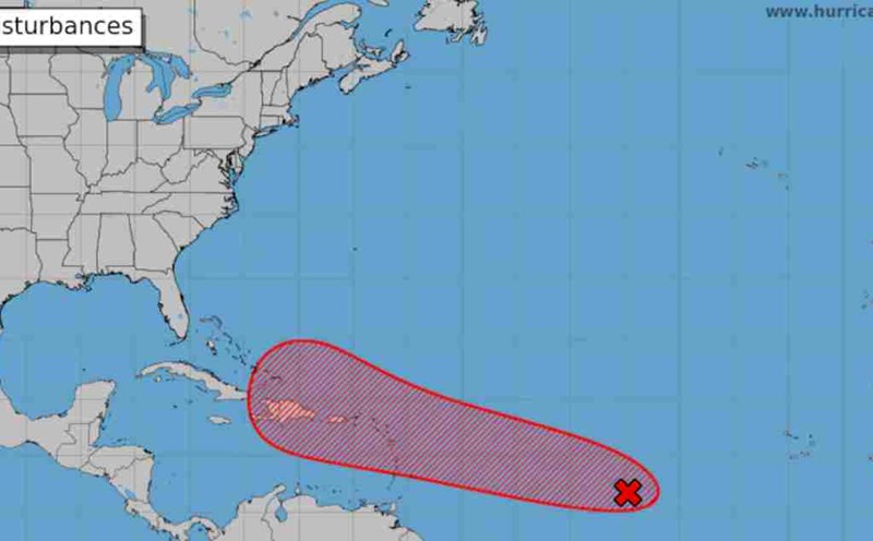
According to data from the National Center for Hydro-Meteorological Forecasting, currently, the tropical convergence zone has an axis at about 14 - 17 degrees north latitude connecting with the tropical depression (at 7:00 a.m. on September 15, it was located at about 16.5 - 17.5 degrees north latitude, 125.5 - 126.5 degrees east longitude) combined with strong southwest monsoon activity.
These dangerous conditions are combined to cause showers and thunderstorms in the central and southern East Sea (including the waters of the Truong Sa archipelago), the waters from Quang Tri to Ca Mau, Ca Mau to Kien Giang and the Gulf of Thailand.
Forecast in the next 24 hours, the sea area from Ninh Thuan to Ca Mau; the south of the central East Sea area, the South East Sea area (including the sea area of Truong Sa archipelago) will have strong winds of level 6, sometimes level 7, gusting to level 8 - 9; rough seas. Waves are 2 - 4m high.
The sea area from Ca Mau to Kien Giang and the Gulf of Thailand has strong winds of level 5, sometimes level 6, gusting to level 7 - 8. Rough seas; waves from 1 - 2.5m high.
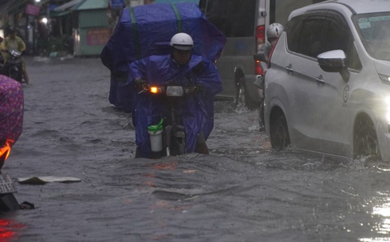
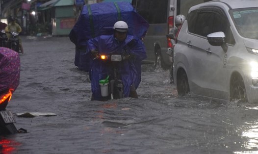
During the day and night of September 15, the sea area from Quang Tri to Ca Mau, Ca Mau to Kien Giang, the Gulf of Thailand, the southern sea area of the North East Sea (including the sea area of Hoang Sa archipelago), the central and southern East Sea area (including the sea area of Truong Sa archipelago) will have showers and thunderstorms.
During thunderstorms, there is a possibility of tornadoes and strong gusts of wind of level 7-8. Currently, the tide level in the western coastal area of the South is high, so it is necessary to be on guard against abnormal water levels causing sea dike erosion.
During the day and night of September 16, the sea area from Ninh Thuan to Ca Mau, the sea area south of the area between the East Sea and the South East Sea area (including the sea area of Truong Sa archipelago) will have strong southwest winds of level 6, especially in the South East Sea area (including the sea area of Truong Sa archipelago) at times level 7, gusting to level 8 - 9; rough seas; waves 2 - 4m high.
The area from Ca Mau to Kien Giang and the Gulf of Thailand has southwest winds of level 5, sometimes level 6, gusting to level 7 - 8; rough seas; waves from 1 - 2.5m high.
All vessels operating in the above areas are at high risk of being affected by cyclones, strong winds and large waves.