Storm Krathon connects low pressure trough, strongly affecting the East Sea

AN AN |

Storm Krathon causes thunderstorms, strong winds, and rough seas in the North East Sea.

According to the National Center for Hydro-Meteorological Forecasting, the low pressure trough is currently located at about 19 - 22 degrees north latitude, connecting with storm Krathon. At 7:00 a.m. on September 30, the storm was located at about 20.2 degrees north latitude and 122.1 degrees east longitude.

Vietnam's meteorological agency forecasts that storm Krathon will move slowly in a west-northwest direction towards the south of Taiwan (China).

Anh may ve tinh hoi 8h30 ngay 30.9. Anh: Trung tam Mang luoi Khi tuong Thuy van Quoc gia
Satellite cloud image at 8:30 a.m. on September 30. Photo: National Hydrometeorological Network Center

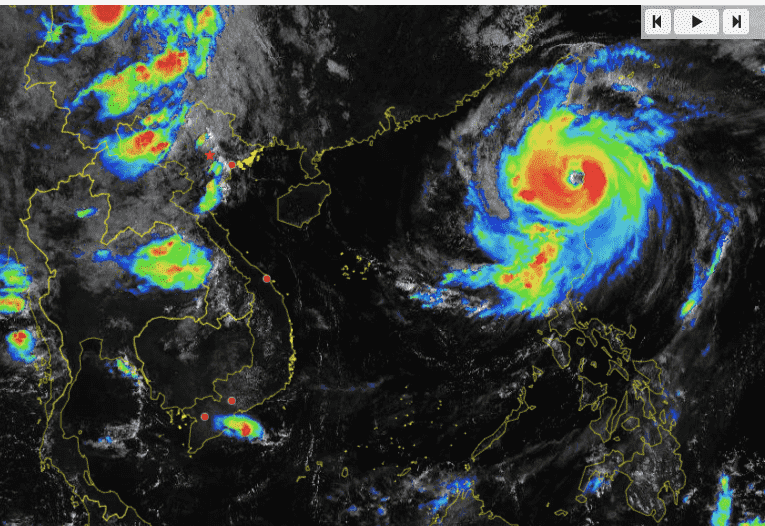
During the day and night of September 30, the eastern part of the North East Sea (from 116 - 120 degrees east longitude) will have winds gradually increasing to level 6 - 7, gusting to level 9. This area will also have showers and strong thunderstorms. There is a possibility of tornadoes during thunderstorms.

Particularly in the east of meridian 118.5, in the evening and at night, there will be strong winds of level 8 - 10, near the center of storm Krathon, strong winds of level 12 - 14, gusting to level 17. The sea will be rough, with waves 4 - 6m high.

During the day and night of October 1, the eastern area of ​​the North East Sea (from longitude 116 - 120 degrees east) will have strong winds of level 6 - 7, gusting to level 9; especially the eastern area of ​​longitude 118.5 will have strong winds of level 8 - 10, the area near the center of storm Krathon will have strong winds of level 12 - 14, gusting to level 17. The sea will be very rough. Waves will be 4 - 6m high.

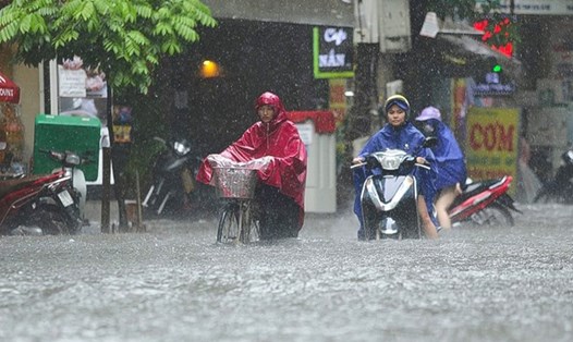
From noon on October 1, the northeast wind in the Gulf of Tonkin gradually increased to level 6, gusting to level 7-8; rough seas. Waves were 1.5-2.5m high.

The meteorological agency warned that the level of disaster risk due to strong winds at sea is level 2.

All vessels operating in the above areas are at high risk of being affected by cyclones, strong winds and large waves.

AN AN
RELATED NEWS

Forecast of the possibility of storms, low pressures and widespread rain in May

|

It is forecasted that in May, there is little chance of storms/tropical depressions appearing in the East Sea; there is a risk of widespread rains, concentrated in the North.

Working with the seller of 1 ice cream for 100,000 VND after a tourist's complaint

|

Khanh Hoa - Police and functional agencies have invited street ice cream vendors to work on complaints from tourists.

trekking is not a stroll to live virtually

|

Trekking is becoming a trend loved by many young people, but many people still underestimate safety, lack skills and necessary preparation.

House fire in Ho Chi Minh City, rescuing trapped people safely

|

Ho Chi Minh City - Functional forces are investigating the cause of the fire at a house on Ngo Tat To street.

Ho Chi Minh City will build 6 bridges connecting Binh Quoi - Thanh Da Urban Area

|

Ho Chi Minh City plans to build 6 bridges connecting Binh Quoi - Thanh Da Urban Area with surrounding areas, breaking the "unique path" situation.

Forecast for the North, some places will have very heavy rain exceeding 150mm

AN AN |

The meteorological agency said that today and tonight, September 30, the North is forecast to have some places with very heavy rain with rainfall of over 150mm.

Weather today September 30: Cold air is coming, heavy rain in the North

NHÓM PV |

Weather today September 30, the Northern region and Thanh Hoa have moderate rain, heavy rain and scattered thunderstorms, locally very heavy rain.

Typhoon Krathon combines with low pressure trough to cause dangerous weather

AN AN |

Vietnam's meteorological agency said a low-pressure trough connected to storm Krathon will cause strong winds and thunderstorms in the northern East Sea.