Risk of widespread flooding from Ha Tinh to Quang Ngai

Mr. Mai Van Khiem - Director of the National Center for Hydro-Meteorological Forecasting, Department of Hydro-Meteorology said that due to the influence of storm No. 12 combined with strong cold air, from the afternoon of October 22, the coastal mainland of the provinces from Quang Tri to Da Nang city will have winds gradually increasing to level 6, sometimes level 7, gusting to level 8-9.
The representative of the meteorological agency especially emphasized that due to the influence of storm circulation and cold air combined with easterly wind disturbances and terrain effects, the Central region will face a very heavy rain.
From noon on October 22 to October 27, the area from Ha Tinh to Quang Ngai will have widespread heavy rain. The total rainfall is generally in the area from Ha Tinh to northern Quang Tri and Quang Ngai, about 200-400 mm, locally over 500 mm.
"Heavy rain will be concentrated from the afternoon of October 22 to the end of October 23. In the south of Quang Tri, Hue, Da Nang, it is generally 500-700 mm, in some places over 900 mm. The Central region is likely to experience a large-scale flood, especially the river basin from the south of Quang Tri to Quang Ngai with flood levels that may exceed alert level 3 - equivalent to or even higher than the major flood in November 2017. The flood level may not be as good as in 2020, but the complexity needs to continue to be monitored and updated until the end of October and early November" - Mr. Khiem analyzed.
The Director of the meteorological agency has further warned about the possibility of heavy rain with rainfall of 200 - 300 mm/3 hours, related to the risk of flash floods and landslides in mountainous areas, flooding in low-lying areas and urban areas.
" Heavy rain in the Central region is not only 1 - 2 days but is likely to last until the end of October 2025, so the risk of widespread flooding and inundation needs to be paid close attention"
The National Center for Hydro-Meteorological Forecasting recommends that we should be on guard against the risk of thunderstorms, whirlwinds, and strong gusts of wind in the area affected by the storm's circulation, both before and during the storm's landfall.
Storm weakens into tropical depression before making landfall
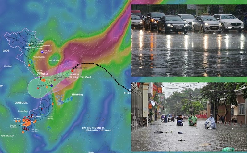
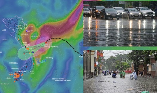
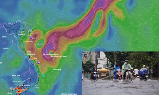
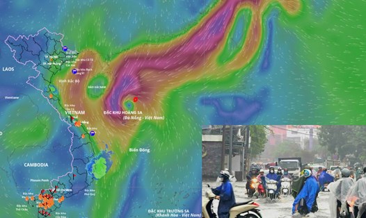
Updated from the National Center for Hydro-Meteorological Forecasting, at 4:00 a.m. on October 22, the center of storm No. 12 was at about 17.2 degrees north latitude - 110.9 degrees east longitude, in the northwest sea of Hoang Sa special zone, about 310 km east-northeast of Da Nang city. The strongest wind near the storm center is level 10, gusting to level 12.
According to Mr. Khiem, it is forecasted that in the next 24 hours, the storm will move west-southwest at a speed of 10-15 km/h and gradually weaken into a tropical depression. At 4:00 a.m. on October 23, the center of the tropical depression was at about 15.9 degrees north latitude - 108.6 degrees east longitude, in the coastal area from Hue city to Quang Ngai. Strong wind level 7, gust level 9.
It is forecasted that in the next 36 hours, the tropical depression will weaken into a low pressure area in the southern Laos. The strongest wind is below level 6.
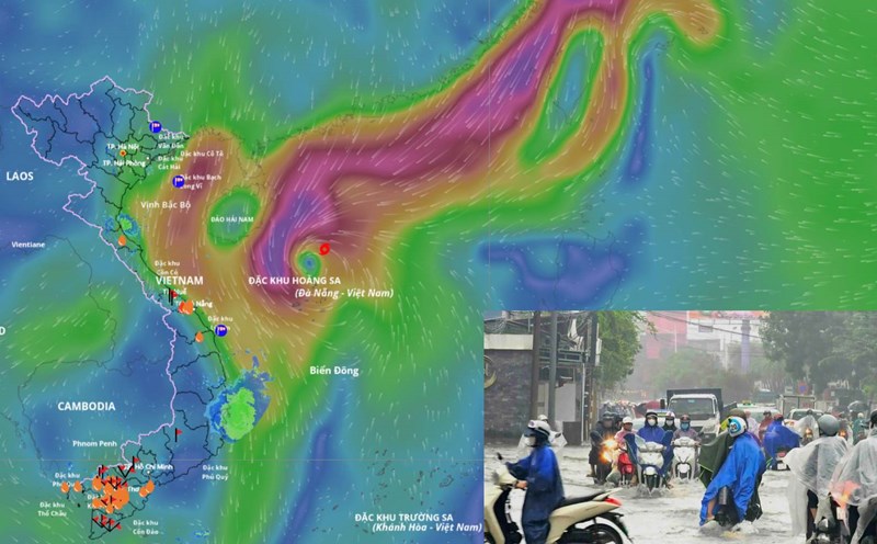
Regarding the impact of the storm at sea, according to the representative of the meteorological agency, the sea area west of the northern East Sea (including Hoang Sa special zone) will have strong winds of level 7-8, the area near the storm's eye will have strong winds of level 9-10, gusts of level 12, waves 3-5 m high, the area near the storm's eye will be 5-7 m high, the sea will be very rough.
The sea area from Quang Tri to Quang Ngai (including Con Co special area, Cu Lao Cham island and Ly Son special area) will have strong winds of level 6-7, the area near the storm's eye will have level 8, gusts of level 10, waves 3-5 m high, rough seas. The coastal areas of the provinces from Quang Tri to Da Nang city will have storm surge of 0.4-0.8 m high.
Warning that all ships operating in the above dangerous areas are likely to be affected by thunderstorms, whirlwinds, strong winds and large waves. Coastal areas and river mouths from Quang Tri to Da Nang city need to be on guard against large waves combined with high tides and rising water due to wind causing flooding in low-lying areas, coastal roads, and coastal erosion.