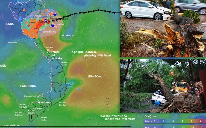
Storm on land Ninh Binh - Thanh Hoa, maintains intensity compared to 2 hours ago
At 1:00 p.m. on July 22, the center of the storm was at about 20.1 degrees north latitude; 106 degrees east longitude, on the mainland of Ninh Binh - Thanh Hoa provinces. The strongest wind near the storm center is level 8 (62-74 km/h), gusting to level 10. The storm is moving west at a speed of 10-15 km/h.
It is forecasted that in the next 24 hours, the storm will continue to move west-southwest at a speed of 10-15 km/h and weaken into a tropical depression, then continue to weaken into a low pressure area.
At 1:00 p.m. on July 23, the center of the low pressure area was at about 19.5 degrees north latitude; 103.0 degrees east longitude, in the Upper Laos area. Wind speed decreases below level 6.
The danger zone is north of 18.5 degrees north latitude, west of 108 degrees east longitude. The risk level of natural disasters due to storms is level 3 for affected areas, including the western sea area of the Gulf of Tonkin, coastal waters and mainland provinces from Quang Ninh to Nghe An.
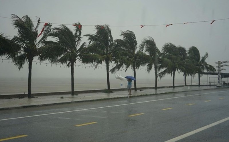
At sea on the afternoon of July 22, the Gulf of Tonkin area including the special areas of Bach Long Vi, Co To, Van Don, Cat Hai, Hon Dau and Hon Ngu islands had strong winds of level 6-7, near the storm center level 8, gusting to level 10. Waves are 2 - 4 m high; rough seas.
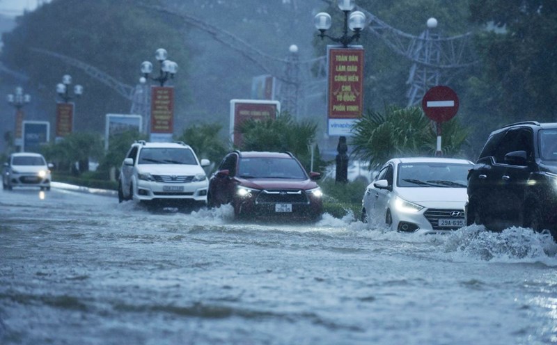
Coastal areas from Ninh Binh to Quang Ninh have rising water due to storm circulation from 0.4-0.8 m high. Coastal water levels this afternoon continue to rise due to tides combined with storm rising water. At Ba Lat (Hung Yen), it is 2.8-3.1 m high, Hon Dau (Hai Phong) is 3.9-4.2 m high and at Cua Ong (Quang Ninh) it is 4.4-4.8 m high. There is a high risk of flooding in coastal areas and river mouths.
Warning, the weather at sea and in coastal areas during the storm is extremely dangerous, unsafe for any vehicles or works operating in dangerous areas such as tourist boats, passenger ships, transport ships, cages, aquaculture areas, dykes, embankments, coastal roads. Vehicles are likely to overturn, be destroyed, or be flooded due to strong winds, thunderstorms, whirlwinds, large waves, and rising sea levels.
On land, coastal areas from Quang Ninh to Nghe An will have strong winds of level 6-7, near the storm center level 8, gusting to level 10. Deep inland areas of Hai Phong, Hung Yen, Bac Ninh, Hanoi, Ninh Binh and Thanh Hoa provinces and cities have gusts of level 6-8. Level 8 winds can break tree branches, blow off roofs, and cause damage to houses.
Regarding heavy rain, from the afternoon of July 22 to the morning of July 23, Thanh Hoa, Nghe An, southern Phu Tho and Son La will have heavy to very heavy rain and thunderstorms with common rainfall of 60-120 mm, locally over 200 mm.
Other places in the Northern region and Ha Tinh will have rain, moderate rain, locally heavy rain and thunderstorms with rainfall of 20-40 mm, locally over 100 mm.
Warning of the risk of heavy rain over 150 mm in 3 hours. Heavy rainfall in a short period of time can cause flash floods, landslides in mountainous areas, and flooding in low-lying areas.
Updated to 2:00 p.m. on July 22: Due to the influence of storm No. 3, in Bach Long Vi special area, there were strong winds of level 10, gusting to level 12; Co To special area had strong winds of level 9, gusting to level 11. Cat Ba (special to Cat Hai area) had strong winds of level 6, gusting to level 8; Cua Ong had strong winds of level 10, gusting to level 12; Bai Chay has strong winds of level 8, gusting to level 10; Quang Ha has strong winds of level 11. Tien Yen has strong winds of level 10, gusting to level 14. Thai Binh station has strong winds of level 7, gusting to level 8; Ba Lat (Hung Yen) has strong winds of level 8, gusting to level 9; Mong Cai has strong winds of level 7, gusting to level 9; Phu Lien has strong winds of level 6, gusting to level 8; Hon Dau (Hai Phong) has strong winds of level 9.
In Thanh Hoa and Nghe An, there will be heavy to very heavy rain with common rainfall of 100-200 mm, some places over 300 mm. The storm surge in Hon Dau (Hai Phong) was 0.6 m high and in Ba Lat (Hung Yen) was 0.8 m high.