Storm No. 8 Toraji causes bad weather in the East Sea

AN AN |

The Meteorological Agency forecasts that the northern sea area of ​​the North East Sea will continue to maintain bad weather conditions due to the impact of storm No. 8 Toraji.

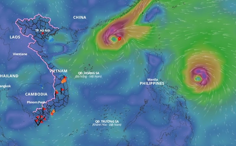
Latest update from the National Center for Hydro-Meteorological Forecasting, at 10:00 a.m. on November 13, the center of storm No. 8 was located at about 20.4 degrees north latitude; 116.0 degrees east longitude, in the northeastern sea of ​​the North East Sea. The strongest wind near the center of the storm is level 8 - 9 (62 - 88 km/h), gusting to level 11. The storm is moving west-northwest at a speed of 10 - 15 km/h.

In the next 24 hours, the storm is forecast to move west-northwest at a speed of 10 - 15 km/h, gradually weakening. At 10:00 a.m. on November 14, the center of the storm was located at about 20.8 degrees north latitude - 113.8 degrees east longitude; in the northern sea area of ​​the North East Sea. The strongest wind near the center of the storm is level 8, gusting to level 10.

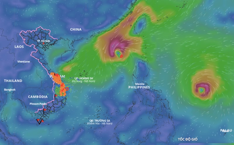
It is forecasted that in the next 48 hours, the storm will move west-southwest at a speed of 10km/h, weakening into a tropical depression. At 10:00 a.m. on November 15, the center of the tropical depression will be at about 19.8 degrees north latitude - 112 degrees east longitude; in the northwest sea of ​​the North East Sea. The strongest wind near the center of the tropical depression will be at level 6 - 7, gusting to level 9.

It is forecasted that in the next 72 hours, the tropical depression will move south-southwest at a speed of 5-10km/h, weakening into a low pressure area. At 10:00 a.m. on November 16, the center of the low pressure area will be at about 18.5 degrees north latitude - 111.5 degrees east longitude.

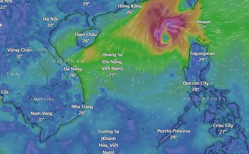
Regarding the impact of the storm, the northern sea area of ​​the North East Sea has strong winds of level 6 - 7, near the eye of the storm level 8 - 9, gusts of level 11, waves 3 - 5m high, near the eye of the storm 5 - 7m; very rough seas.
Ships operating in the above-mentioned dangerous areas are likely to be affected by storms, whirlwinds, strong winds, and large waves.

AN AN
RELATED NEWS

Latest forecast of the path and danger areas of storm number 8

|

The meteorological agency forecasts that storm No. 8 Toraji will have gusts of level 11 and will gradually weaken.

Time when storm No. 8 Toraji weakens in the East Sea

|

The Meteorological Agency forecasts that storm No. 8 Toraji will tend to weaken in the next 48 hours.

Weakened tropical depression from storm No. 7 Yinxing causes very heavy rain

|

The meteorological agency forecasts that the tropical depression (weakened from storm No. 7 Yinxing) will continue to weaken into a low pressure area in the next 24 hours.

Hai Phong police inform about the tourist boat collision in Lan Ha Bay that killed 1 person

|

Hai Phong - On the evening of June 14, the City Police informed about the waterway accident in Lan Ha Bay.

People excitedly record the aura around the sun in Ninh Binh

|

Ninh Binh - At noon on June 14, many people in the Vu Ban commune area expressed interest when they saw extremely clear sun halos.

People rescue goods to help drivers reduce damage after collision

|

Lam Dong - Many people in Lien Huong commune have joined hands to collect and buy goods to help drivers reduce damage after collisions.

Latest forecast of the path and danger areas of storm number 8

AN AN |

The meteorological agency forecasts that storm No. 8 Toraji will have gusts of level 11 and will gradually weaken.

Time when storm No. 8 Toraji weakens in the East Sea

AN AN |

The Meteorological Agency forecasts that storm No. 8 Toraji will tend to weaken in the next 48 hours.

Weakened tropical depression from storm No. 7 Yinxing causes very heavy rain

AN AN |

The meteorological agency forecasts that the tropical depression (weakened from storm No. 7 Yinxing) will continue to weaken into a low pressure area in the next 24 hours.