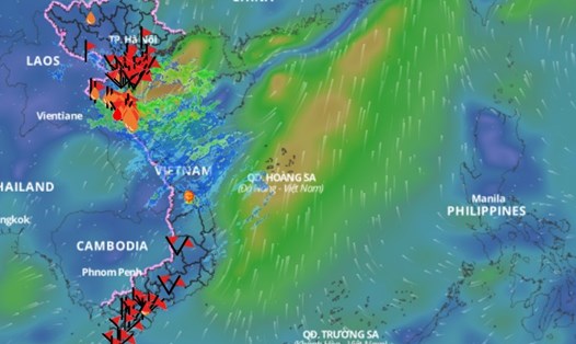
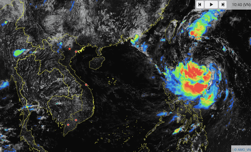
Immediately after Storm No. 4 Soulik, many tropical cyclones continuously approached the Northwest Pacific Ocean. This raised concerns related to the risk of more storms and tropical depressions appearing in the East Sea.
According to Mr. Mai Van Khiem - Director of the National Center for Hydro-Meteorological Forecasting, Directorate of Hydro-Meteorological Forecasting, currently, in the Northwest Pacific region, there are 2 storms and 2 tropical depressions active.

"It is forecasted that these four storms and tropical depressions will all move north of the North Pacific Ocean, and will likely not move into our country's East Sea," said Mr. Khiem.
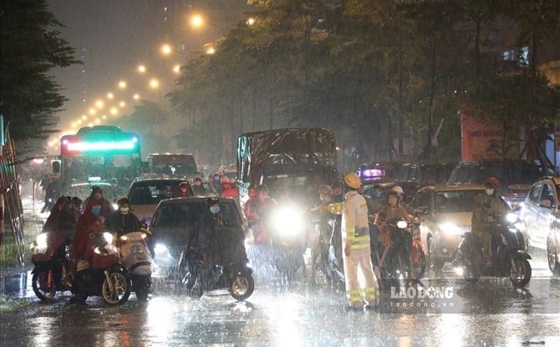
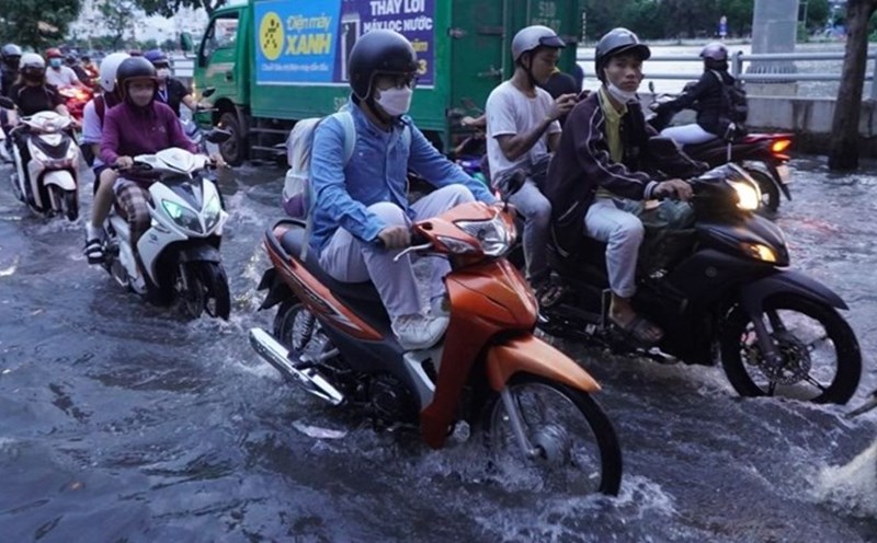
Regarding the weather on land, the Director of the National Center for Hydro-Meteorological Forecasting said that from the night of September 28 to September 30, the North will experience a period of thunderstorms of 30-60mm, with some places experiencing heavy rain of over 100mm, and be on guard against the risk of landslides re-occurring.
From October 1 to 3, the Central region from Thanh Hoa to Thua Thien Hue will have moderate to heavy rain.
Commenting on further weather trends, Mr. Mai Van Khiem said that from October to December 2024, there will be about 4-5 storms/tropical depressions in the East Sea.
Provinces in the Central region need to review plans to be ready to respond to extreme floods in October - November 2024.
The flood peak in 2024 in rivers from Quang Binh to Khanh Hoa is at alert level 2 - alert level 3 and above alert level 3, rivers in Phu Yen, Ninh Thuan, Binh Thuan are above alert level 2.
Floods in 2024 at the headwaters of the Mekong River fluctuate above alert level 1; flood peaks at downstream stations of the Mekong River are at alert levels 2 - 3 and above alert level 3.
"With such a predicted flood peak, it is likely to be the highest in the last 4 years and lower than 2018," said Mr. Khiem.