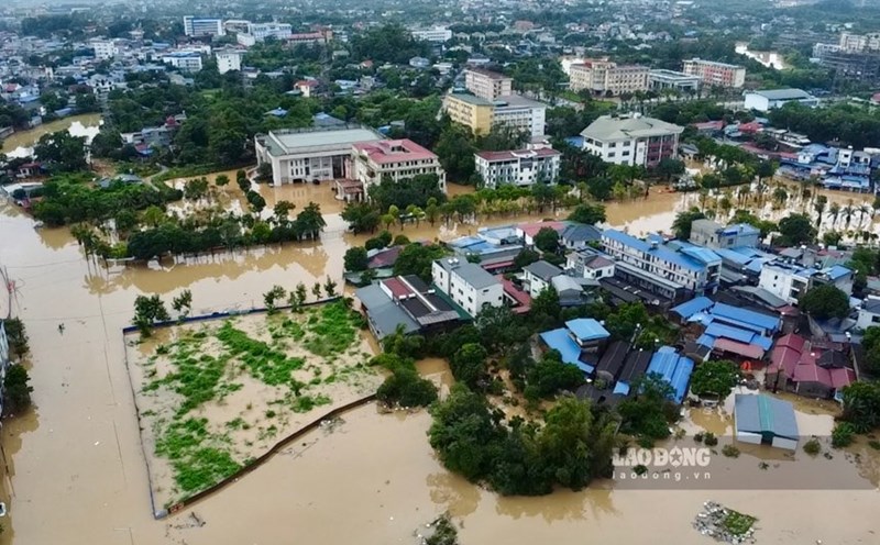
Latest update on October 10 from the National Center for Hydro-Meteorological Forecasting, floods on the Cau River, Thuong River (Bac Ninh) and the Trung River (Lang Son) are receding.
The water level at 3:00 a.m. on October 11 on the rivers is as follows:
On the Cau River at Dap Cau station 7.1m, above alert level 3 by 0.8m.
On Thuong River at Cau Son station 15.99m, at alert level 3; at Phu Lang Thuong station 7.32m, above alert level 3 by 1.02m, 0.21m lower than the historic flood in 1986 (7.53m).
On the Trung River at Huu Lung station, 19.62m (at 01:00 on October 11), above alert level 3, it was 0.62m.
In the next 12 hours, floods on the Cau River at Dap Cau Station and on the Thuong River at Phu Lang Thuong Station will continue to decrease and remain above alert level 3; floods on the Trung River at Huu Lung Station will continue to decrease and remain below alert level 3.
In the next 12 - 24 hours, the flood on the Cau River at Dap Cau station will continue to decrease and remain below alert level 3; the flood on the Thuong River at Phu Lang Thuong station will continue to decrease but remain above alert level 3; the flood on the Trung River at Huu Lung station will continue to decrease and remain below alert level 2.
In the next 24 hours, floods on Luc Nam River (Bac Ninh) at Luc Nam Station and floods on Thai Binh River (Hai Phong) at Pha Lai Station will decrease and remain below alert level 1.
Flooding in Thai Nguyen, Bac Ninh, Lang Son provinces is likely to last for the next 1 - 3 days; there is a risk of riverbank, river dike and landslides on steep slopes in the above areas.
Real-time warning information for areas at risk of flash floods and landslides is provided online on the website of the Department of Hydrometeorology at: https://luquetsatlo.nchmf.gov.vn and in a separate bulletin warning of flash floods and landslides.
The warning level of natural disaster risk due to floods is level 3. Floods on rivers cause flooding in low-lying areas along rivers, affecting activities such as waterway transportation, aquaculture, agricultural production, people's lives and socio-economic activities.
The meteorological agency noted that forecast and warning information is calculated at the expected regulation level of discharge from upstream reservoirs. The Hydrometeorological Agency will update bulletins when there are changes in the discharge flow of reservoirs.
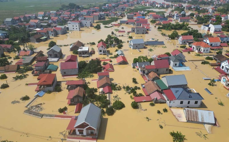
Regarding the flood situation in Hanoi, the Northern Hydrometeorological Station said that the water level of Cau and Ca Lo rivers is currently decreasing.
At 3:00 a.m. on October 11, the water level on the Cau River at Luong Phuc station was 9.51 m (above alert level 3: 1.51 m); on the Ca Lo River at Manh Tan station was 9.28 m (above alert level 3: 1.28 m).
In the next 12-24 hours, the water level of Cau and Ca Lo rivers will continue to decrease.
The water level on the Cau River and Ca Lo River is at a high level, causing flooding in low-lying areas, floating beaches in the middle of the river, and riverside areas with a flooding depth of 0.2 - 1m, in some places more than 2m. The flooding period can last 2 - 4 days, in some places the flooding lasts longer.
The warning level of natural disaster risk due to floods is level 2. River water levels are at a high level to prevent landslides and erosion along the river, dangerous in flooded areas and low-lying areas, riverbanks; safety affecting weak dykes, culverts, spillways, bridges, culverts, and traffic routes in some communes along the Cau River and Ca Lo River.
Floods, inundation, and landslides have affected people, some industrial parks, aquaculture areas, agriculture, daily life and transportation of people.
Currently, the risk level due to floods on the Cau Cau River at Phuc Loc Phuong station is level 3.