According to data from the National Center for Hydro-Meteorological Forecasting, last night and this morning (September 11), the Central Central, Central Highlands and Southern regions had showers and thunderstorms, with some places having heavy to very heavy rain.
Rainfall from 7pm on June 10 to 8am on June 11 was over 100mm in some places such as: Hue 208.8mm, Nhon Hoa (Gia Lai) 197,6mm, Hai Lam (Quang Tri) 127.2mm,...

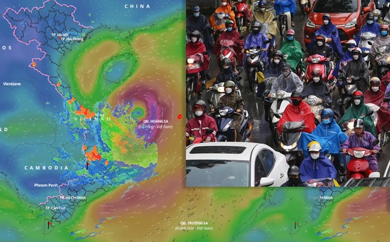
According to Dr. Hoang Phuc Lam - Deputy Director of the National Center for Hydro-Meteorological Forecasting, with the current scenario of the movement of storm No. 1 Wutip, the storm could cause heavy rain in the Central provinces.
In the afternoon and night of June 11, the South Central, Southern Central Highlands and Southern regions will have moderate rain, heavy rain and thunderstorms, locally very heavy rain with common rainfall of 30 - 70mm, some places over 150mm.
On June 11, the area from Hue to Phu Yen will have showers and thunderstorms, locally heavy rain with common rainfall of 20 - 40mm, some places over 70mm.
Mr. Hoang Phuc Lam especially warned that from the afternoon and night of June 11 to June 13, the Central Central region will have heavy to very heavy rain with common rainfall from 100 - 300mm, some places over 450mm.
The Northern Central Highlands region will have moderate rain, heavy rain and thunderstorms, locally very heavy rain with common rainfall from 70 - 150mm, some places over 200mm.
"There is a possibility of tornadoes, lightning, hail and strong gusts of wind during thunderstorms. We also warn of the risk of local heavy rain (rainfall greater than 200mm within 6 hours). The development of rain is still very complicated, depending on the direction of movement and the impact of storm No. 1, it is necessary to continue to monitor and update" - Dr. Hoang Phuc Lam analyzed.
In addition, the southwest monsoon will increase its activity, so it is forecasted that on the day and night of June 11, the Central Highlands and the South will also have moderate rain, heavy rain, locally very heavy rain with common rainfall of 30 - 80mm, some places over 150mm.
Heavy rain is likely to cause flooding in low-lying areas, urban and industrial areas; flash floods on small rivers and streams, landslides on steep slopes.
Real-time warning information for areas at risk of flash floods and landslides is provided online on the website of the Department of Hydrometeorology at: https://luquetsatlo.nchmf.gov.vn and in a separate bulletin warning of flash floods and landslides.
The National Center for Hydro-Meteorological Forecasting predicts that from June 14, heavy rain in the above areas will decrease.
At 7:00 a.m. on June 11, the center of storm No. 1 Wutip was at about 16.1 degrees north latitude; 113.7 degrees east longitude in the sea east of Hoang Sa archipelago. The strongest wind near the storm center is level 8 (62 - 74km/h), gusting to level 10.
It is forecasted that in the next 24 hours, the tropical depression will move west-northwest at a speed of about 10 km/h and is likely to strengthen.
At 7:00 a.m. on June 12, the center of the storm was at about 16.7 degrees north latitude - 111.5 degrees east longitude; in the Hoang Sa archipelago. The strongest wind near the storm center is level 9, gusting to level 11.