Storm Tra Mi moves at a steady speed, about to reach its peak
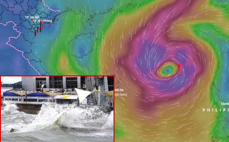
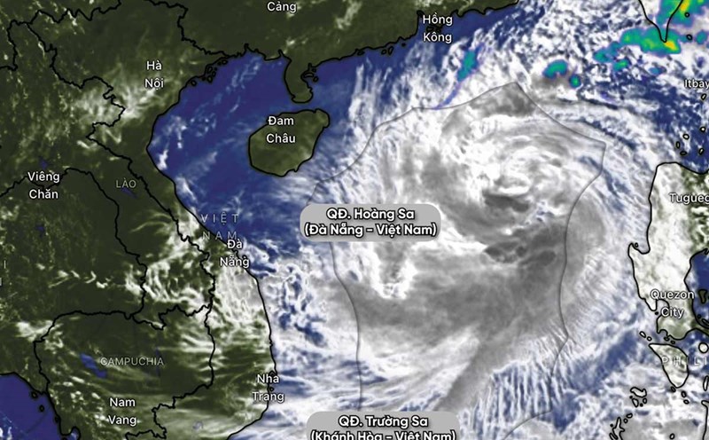
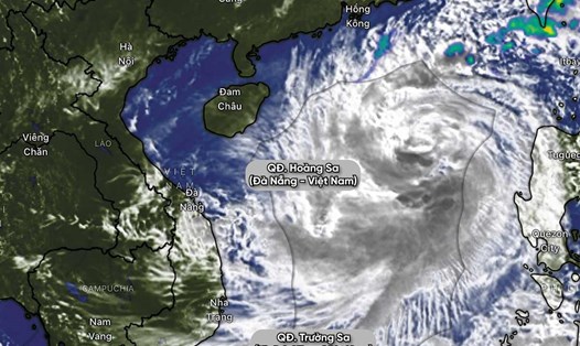
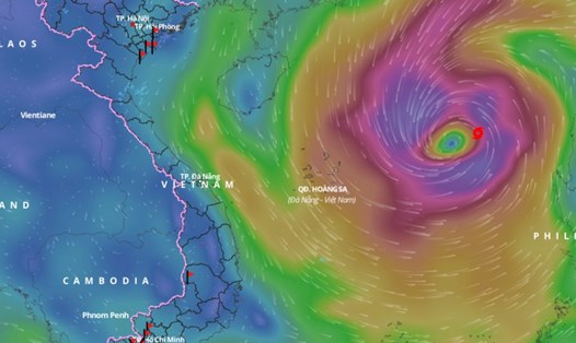
Latest update from the National Center for Hydro-Meteorological Forecasting, at 4:00 p.m. on October 25, the center of the storm was located at about 17.6 degrees north latitude; 116.6 degrees east longitude, in the eastern sea of the North East Sea, about 450km east-northeast of the Hoang Sa archipelago.
The strongest wind near the storm center is level 10 (89-102km/h), gusting to level 12. The storm moves west at a speed of about 20km/h.
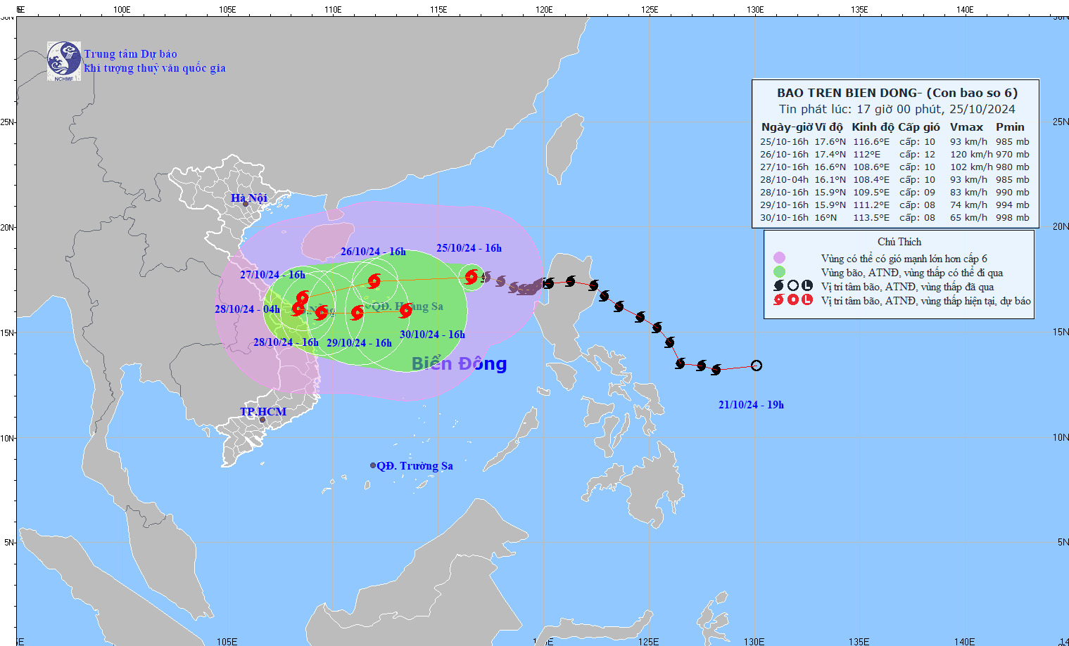
It is forecasted that in the next 24 hours, the storm will move westward at a speed of about 20km/h. At 4:00 p.m. on October 26, the center of the storm will be at about 17.4 degrees north latitude - 112 degrees east longitude; in the waters of the Hoang Sa archipelago.
The strongest wind near the storm center is level 11 - 12, gusting to level 15.
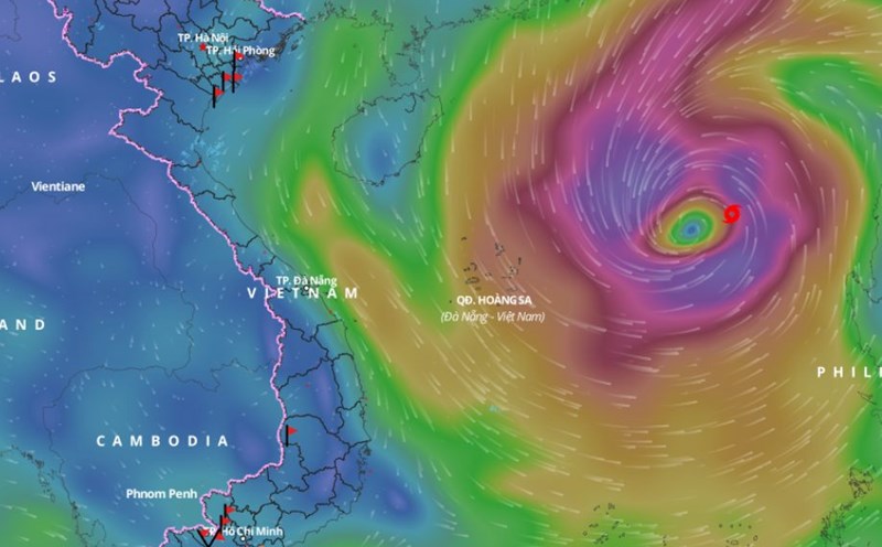
It is forecasted that in the next 48 hours, the storm will move west-southwest at a speed of about 15km/h. At 4:00 p.m. on October 27, the center of the storm will be at about 16.6 degrees north latitude - 108.6 degrees east longitude; in the coastal waters of the Central Central provinces.
The strongest wind near the storm center is level 10, gusting to level 12.
Forecast in the next 72 hours, the storm will move southwest then east southeast at a speed of about 5 - 10 km/h. At 4:00 p.m. on October 28, the center of the storm will be at about 15.9 degrees north latitude - 109.5 degrees east longitude; in the Central Central Coast.
The strongest wind near the storm center is level 9, gusting to level 11.
From the next 72 to 120 hours, the storm will move mainly eastward at 5-10km per hour, and its intensity will continue to weaken.
Heavy rain in Quang Tri to Quang Ngai area
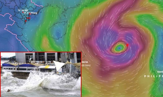
Regarding the impact of the storm at sea, the North East Sea area has strong winds of level 8-9, the area near the storm's eye has winds of level 10-12 (89-133km/h), gusts of level 15, waves 5-7m high, the area near the storm's eye has waves of 7-9m; the sea is very rough.
From early morning on October 27, the sea areas from Quang Binh to Quang Ngai provinces (including Con Co Island, Cu Lao Cham, Ly Son) will have winds gradually increasing to level 6-7, then increasing to level 8-9, near the storm's eye level 10-11, gusting to level 14, waves 3-5m high, near the storm's eye 5-7m; the sea will be very rough.
From the morning of October 27, coastal areas from Quang Tri to Quang Nam provinces are likely to experience storm surges of 0.4 - 0.6 meters high.
Ships/boats operating in the above-mentioned dangerous areas (especially in the Hoang Sa island district), coastal areas from Quang Binh to Quang Ngai are likely to be affected by storms, whirlwinds, strong winds, and big waves.
High risk of landslides of sea dikes and embankments along the coast of provinces from Quang Tri to Quang Nam due to the impact of big waves and storm surges.
On land, from the morning of October 27, coastal mainland from Quang Binh to Quang Ngai will have winds gradually increasing to level 6-7, near the storm center level 8-9, gusting to level 11.
From the evening and night of October 26 to October 28, the area from Quang Tri to Quang Ngai will have heavy to very heavy rain with total rainfall ranging from 300-500mm, locally over 700mm. Warning of the risk of local heavy rain (greater than 100mm/3 hours). The area from Ha Tinh - Quang Binh, Binh Dinh and the Northern Central Highlands will have heavy rain, locally very heavy rain with total rainfall ranging from 100 - 200mm, some places over 300mm.
The meteorological agency warns that the development of storm No. 6 is still very complicated and may change. Please pay attention to updates in the next storm bulletins.