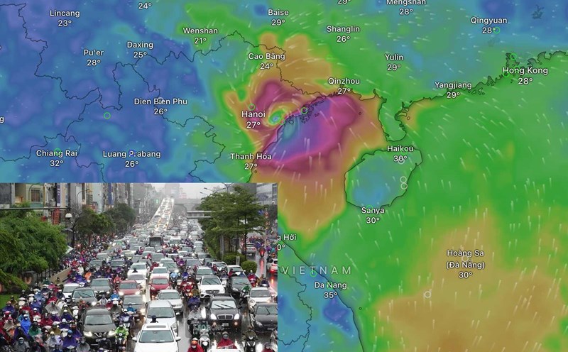
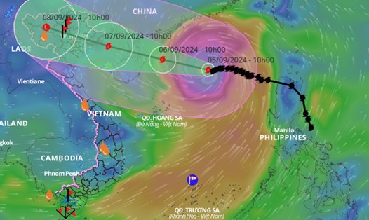
Storm No. 3 Yagi is in the north of the North East Sea; storm intensity is level 16 (super storm level), gusting over level 17. This is the strongest storm since the beginning of the 2024 storm season.
Mr. Mai Van Khiem - Director of the National Center for Hydro-Meteorological Forecasting, General Department of Hydro-Meteorology provided information on the next developments of storm No. 3.
Storm No. 3 is level 9-12 when it impacts land.
Sir, when is storm number 3 forecast to affect the weather on land and when it enters the North, what is the storm's intensity level?
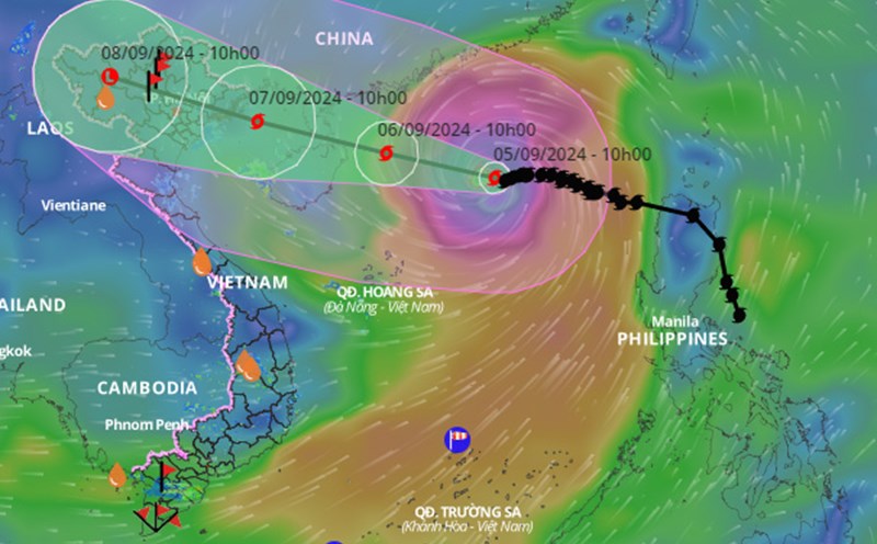
- Storm No. 3 is forecast to maintain level 16, gusting above level 17 until it moves into the eastern sea of Hainan Island. It is forecasted that around the night of September 6, the storm will pass the northern area of Hainan Island and move into the Gulf of Tonkin, then directly affect all coastal provinces from Quang Ninh to Thanh Hoa.

When entering the Gulf of Tonkin, the storm will still be at level 13-14, gusting to level 16, and when affecting land, the intensity will likely be at level 9-12, gusting to level 13-14.
Around the afternoon to night of September 7, storm No. 3 moved inland to the northern provinces, then moved to the northwest, weakened into a low pressure area and gradually dissipated.
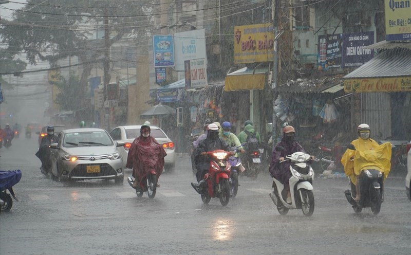
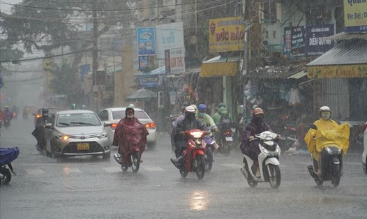
Forecast from the night of September 6, the North will have rain due to storm number 3
What is the rainfall forecast in areas affected by storm number 3, sir?
- From early morning on September 7, coastal areas from Quang Ninh to Thanh Hoa provinces will have winds gradually increasing to level 6-7, then increasing to level 8-9, areas near the storm center (Quang Ninh, Hai Phong City, Thai Binh, North Nam Dinh) will have winds of level 10-12, gusting to level 14; areas deep inland in the Northeast will have strong winds of level 6-8, gusting to level 9-11.
From the night of September 6 to the morning of September 9, the provinces of Quang Ninh, Hai Phong, Lang Son, Ha Giang, Phu Tho, Hoa Binh, the Northern Delta region (including the capital Hanoi) and Thanh Hoa will have heavy to very heavy rain with common rainfall of 150 - 350mm, locally over 500mm.
Other places in the Northeast and North Central regions have average rainfall of 100 - 150mm. From the afternoon of September 7 to the end of September 8, in the Northwest region, there will be heavy rain, some places will have very heavy rain with average rainfall of 100 - 200mm. Particularly in Lao Cai, Yen Bai, Son La provinces, it will be 150 - 250mm, locally over 350mm.
With such heavy rain, what are the warnings about the risk of natural disasters such as flash floods and landslides, sir?
- It is forecasted that the Northern and North Central provinces may experience a flood, widespread flooding. From September 7 to 10, a flood will appear on rivers and streams in the Northern region and Thanh Hoa. Warning of the risk of widespread flooding in mountainous provinces, the Northern midland plains, urban areas, especially the provinces of Quang Ninh, Hai Phong, Lang Son, Cao Bang, Ha Giang, Yen Bai, Bac Can, Thai Nguyen.
Heavy rain concentrated in a short period of time is a special danger of flash floods and landslides, concentrated in mountainous and midland areas of the North, Thanh Hoa and Nghe An.
Thank you very much!