Heavy rain forecast to fall on Hanoi due to storm No. 5 Kajiki, some places exceed 200mm

AN AN |

According to the Northern Meteorological Agency, it is forecasted that due to the impact of storm No. 5 Kajiki, from tomorrow morning, August 25, Hanoi will have moderate rain, heavy rain, some places with very heavy rain and thunderstorms.

According to the Northern Hydrometeorological Station, in the past 24 hours, Hanoi has had scattered rain, showers and thunderstorms. Rainfall from 7pm on August 23 to 7pm on August 24 was generally from 5 - 15mm, some places were larger such as Bat Bat 43.2mm; Huong Son 36mm; Ung Hoa 25.6mm; Soc Son 25.4mm, Phuong Duc 24.8mm; Co Do 24.4mm; Quang Oai 23mm.

Due to the influence of the northern edge of the tropical convergence zone with an axis through the North Central region connecting with storm No. 5, the axis will gradually increase to the north, then be affected by the circulation of storm No. 5, Hanoi city will have scattered rain, showers and thunderstorms tonight.

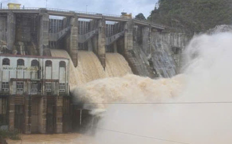
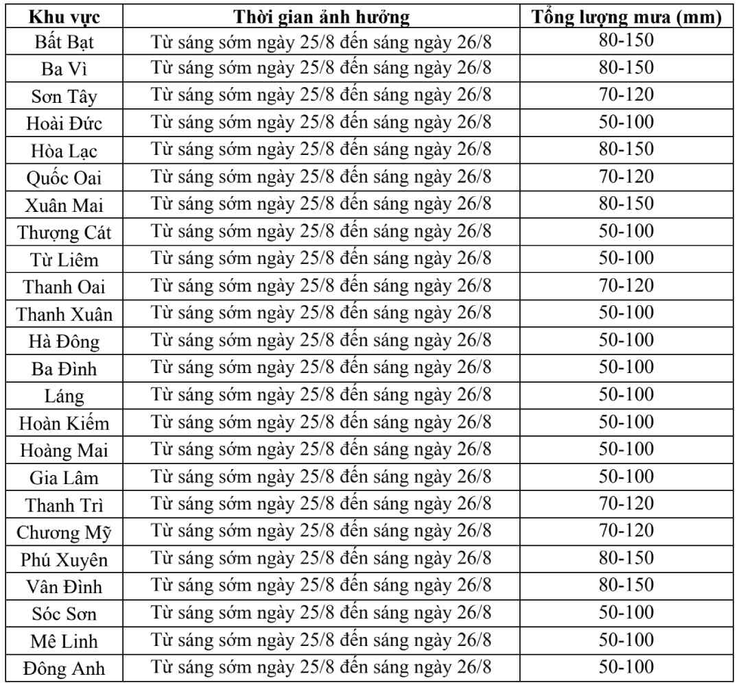
From early tomorrow morning (August 25-) to the morning of August 26, Hanoi will have moderate rain, heavy rain, some places will have very heavy rain and thunderstorms. Rainfall is generally from 50 - 150mm, in some places over 200mm.

In the afternoon and night of August 26, Hanoi will have rain, moderate rain, some places will have heavy rain and thunderstorms.

On the day and night of August 27, Hanoi will have rain, showers and thunderstorms, with common rainfall of 10 - 20mm, some places will have more.

Du bao chi tiet luong mua o cac khu vuc thuoc thanh pho Ha Noi. Nguon: Dai Khi tuong Thuy van Bac Bo
Detailed forecast of rainfall in areas of Hanoi city. Source: Northern Hydrometeorological Station

The meteorological agency warns that there is a possibility of tornadoes, lightning and strong gusts of wind during thunderstorms. The warning level of natural disaster risk due to heavy rain is level 1.

Regarding the impact of heavy rain, thunderstorms can be accompanied by tornadoes, lightning and strong gusts of wind that break trees, damage houses, traffic works and infrastructure.

Heavy rain overloaded the urban drainage system, causing flooding in residential areas, urban areas and low-lying areas, traffic congestion due to flooding and reduced visibility when driving, causing slippery traffic and accidents.

High-intensity rain in a short period of time can cause landslides in mountainous areas, where the terrain is steep.

AN AN
RELATED NEWS

On the evening of August 24, storm No. 5 Kajiki rapidly strengthened, gusting to level 17 and may increase in intensity

|

According to the meteorological agency, at 7:00 p.m. on August 24, storm No. 5 Kajiki was at level 14, gusting to level 17.

Forecast of 3 provinces with the heaviest rain due to storm No. 5 Kajiki, warning of dangerous weather

|

According to the representative of the meteorological agency, the three provinces forecast to focus on heavy rain due to storm No. 5 Kajiki are Nghe An, Ha Tinh and northern Quang Tri (old Quang Binh).

Storm No. 5 increased to level 7 after 2 days, gusting to level 16, forecast time of landfall

|

According to the meteorological agency, storm No. 5 is currently at level 13 - 14, gusting to level 16 and is likely to strengthen.

On the occasion of National Day, September 2, the largest number of people have been granted amnesty ever

|

According to the records reviewed and approved, the second amnesty on the occasion of National Day is expected to have the largest number of amnesty recipients ever.

The gap between domestic and world gold prices has increased sharply, the Ministry of Finance has a new proposal

|

Gold prices fluctuate strongly, the domestic and world gap increases, the Ministry of Finance makes a noteworthy proposal.

Ho Ho Hydropower Plant begins regulating the overflow from 8:00 p.m. on August 25 to respond to storm No. 5

|

Ha Tinh - To proactively respond to storm No. 5, Ho Ho Hydropower Plant plans to regulate water through overflow depending on the actual situation.

The old central artery road of Hoa Binh City is deeply flooded after heavy rain

|

Phu Tho - On August 25, the impact of storm No. 5 caused prolonged heavy rain, causing flooding in some locations on An Duong Street, Thong Nhat Ward.

Forecast of heavy to very heavy rain areas due to storm No. 5 Kajiki, warning of dangerous weather

|

The National Center for Hydro-Meteorological Forecasting has issued a warning about areas with heavy rain, causing widespread flooding due to storm No. 5.

On the evening of August 24, storm No. 5 Kajiki rapidly strengthened, gusting to level 17 and may increase in intensity

AN AN |

According to the meteorological agency, at 7:00 p.m. on August 24, storm No. 5 Kajiki was at level 14, gusting to level 17.

Forecast of 3 provinces with the heaviest rain due to storm No. 5 Kajiki, warning of dangerous weather

AN AN |

According to the representative of the meteorological agency, the three provinces forecast to focus on heavy rain due to storm No. 5 Kajiki are Nghe An, Ha Tinh and northern Quang Tri (old Quang Binh).

Storm No. 5 increased to level 7 after 2 days, gusting to level 16, forecast time of landfall

AN AN |

According to the meteorological agency, storm No. 5 is currently at level 13 - 14, gusting to level 16 and is likely to strengthen.