According to the National Center for Hydro-Meteorological Forecasting, due to the impact of cold air, the Gulf of Tonkin has strong northeast winds of level 6, gusting to level 7.
From March 29 to March 30, the Gulf of Tonkin will have strong winds of level 6, gusting to level 7 - 8. The sea is rough, with waves 2 - 3m high.
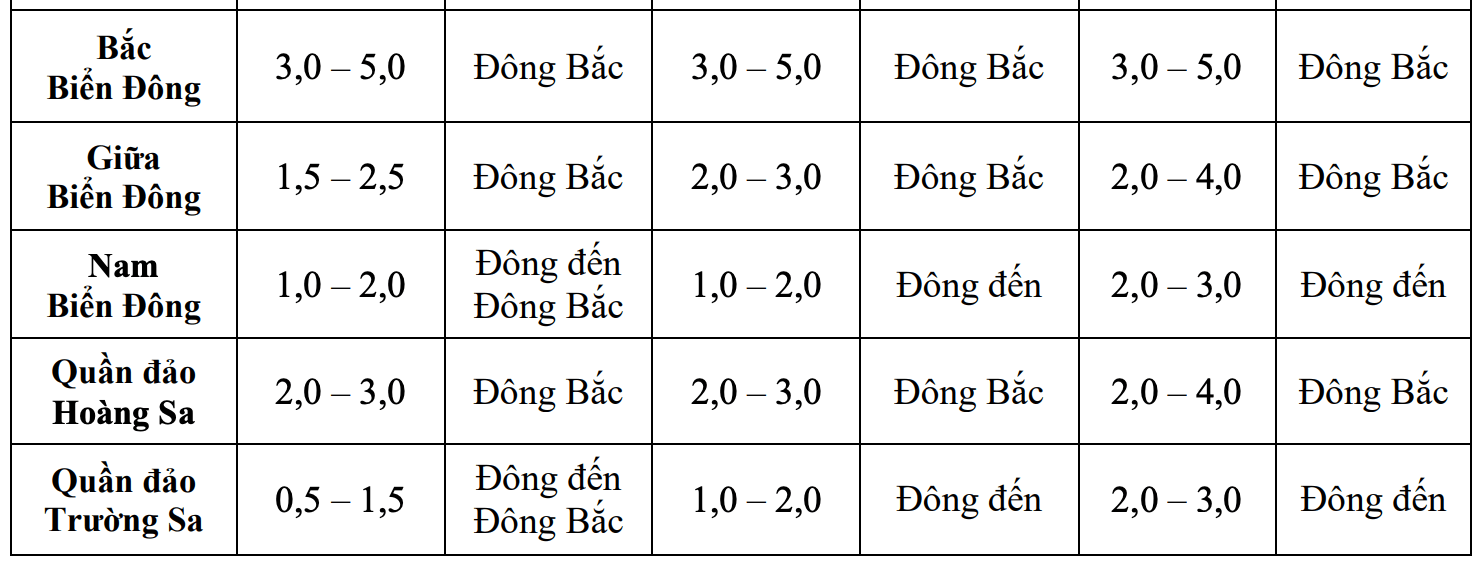
The northern sea area of the North East Sea will have strong winds of level 6, sometimes level 7, gusting to level 8. The sea is rough, with waves 3 - 5m high.
The meteorological agency warns, the risk level of natural disasters due to strong winds at sea: level 2. All ships operating in the above areas are at high risk of being affected by tornadoes, strong winds and big waves.
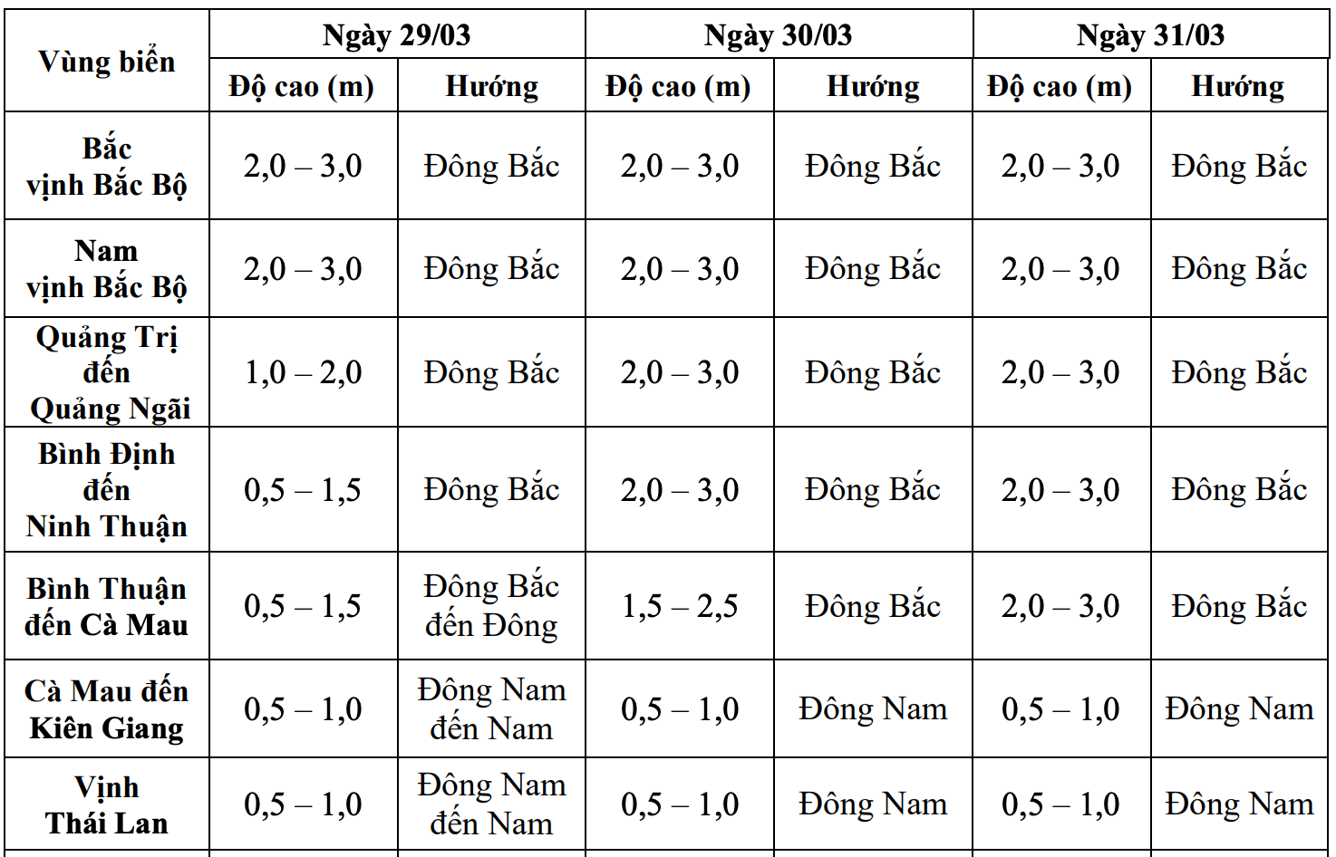
Regarding the weather in other sea areas, the sea area of Quang Tri - Quang Ngai on March 29, waves 1 - 2m high, from March 30 the waves will increase to 2 - 3m.
Binh Dinh - Ninh Thuan sea area on March 29, waves are 0.5 - 1.5m high, from March 30, waves will increase to 2 - 3m
The sea area of Binh Thuan - Ca Mau on March 29 will have waves of 0.5 - 1.5m, from March 30 the waves will increase to 1.5 - 3m.
The sea area of Ca Mau - Kien Giang and the Gulf of Thailand will have waves 0.5 - 1m low.
Hoang Sa archipelago and Truong Sa archipelago from 29.30-1.3, waves 2 - 4m high.
From April 1 to April 7, the Gulf of Tonkin is forecast to have waves 1.5 - 2.5m high.
The sea area of Quang Tri - Quang Ngai, Binh Dinh - Ca Mau is forecast to have waves of 2 - 3m.
The sea area of Ca Mau - Kien Giang, Gulf of Thailand is forecast to have waves 0.5 - 1.5m high.
The North East Sea area has waves of 2 - 4m strong.
The central and southern East Sea (including Hoang Sa archipelago and Truong Sa archipelago) is forecast to have waves of 1.5 - 3m.