Storm No. 1 is approaching the mainland of Quang Ninh - Hai Phong. One of the notable impacts of the storm is that the Northeast and Thanh Hoa need to be wary of heavy rain, thunderstorms, tornadoes, flash floods and landslides.
According to the National Center for Hydro-Meteorological Forecasting, from the morning of July 4 to the end of July 5, there will be heavy to very heavy rain, common rainfall of 100-200mm; especially Northeast of the North 200-300mm, locally over 500mm. Rain concentrated in Lang Son, Quang Ninh, Hai Phong and Bac Ninh.
Prolonged heavy rain combined with strong thunderstorms increases the risk of flooding in urban areas and low-lying areas; floods on small rivers and streams; flash floods and landslides in mountainous areas, affecting traffic, production and people's lives.
Regarding the impact of the storm on Hanoi city, the Northern Hydrometeorological Station said that from this afternoon (July 4) to the afternoon of July 5, there will be moderate rain, heavy rain, very heavy rain in some places and scattered thunderstorms, during thunderstorms there is a possibility of tornadoes and strong gusts of wind.
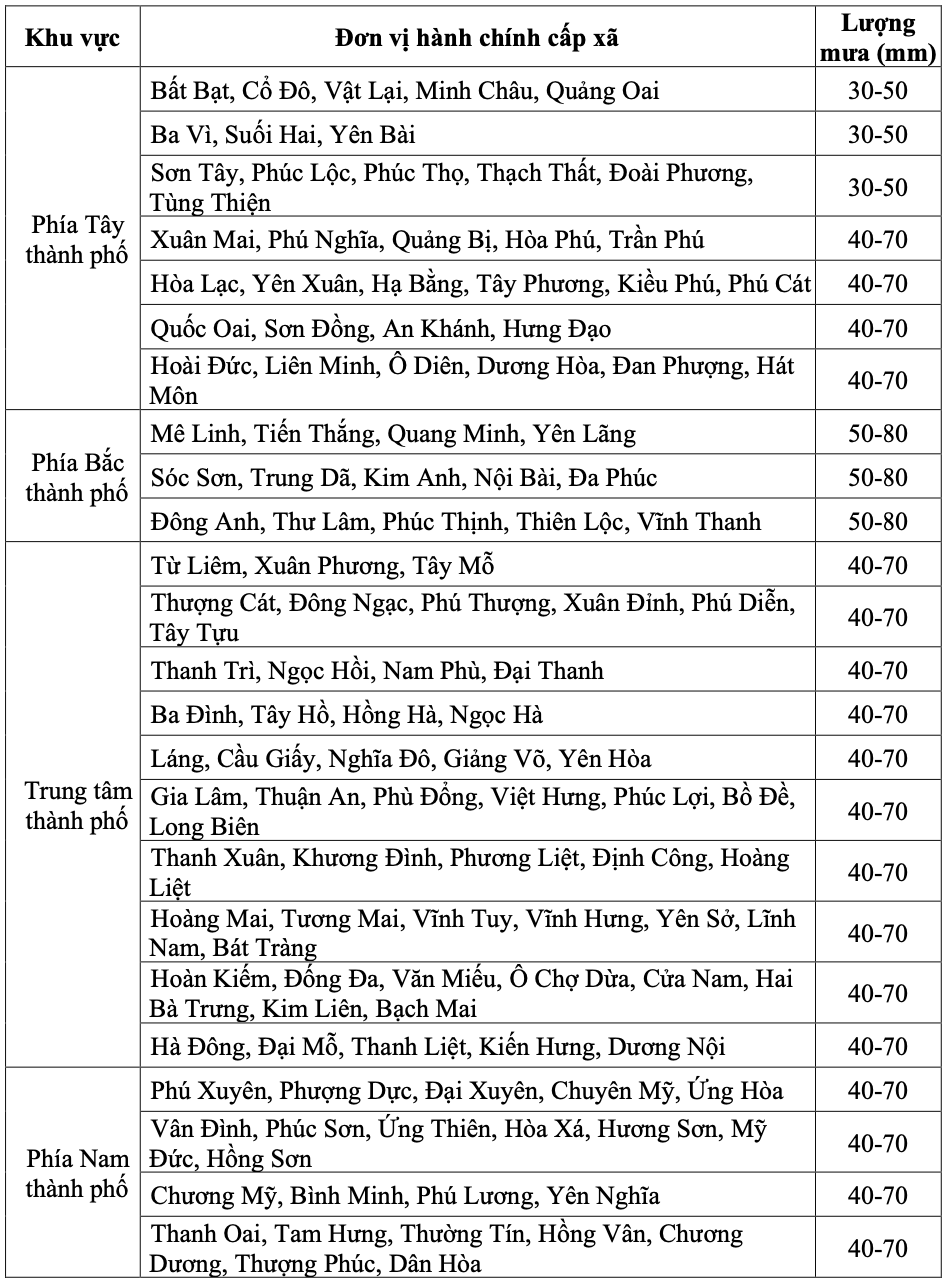
Common rainfall in the northern area of Hanoi city is commonly 50 - 80mm, in some places over 100mm.
In the city center, the western and southern areas of Hanoi city, the common rainfall is 40 - 70mm, with some places over 100mm.
The meteorological agency warns that heavy rain may overload the urban drainage system, causing flooding in residential areas, traffic jams due to road flooding and reduced visibility when driving, causing slipperiness and traffic accidents.
In thunderstorms, there may be tornadoes, lightning and strong gusts of wind that break down trees, damage houses, traffic works and infrastructure. Heavy rain in a short time can cause landslides in mountainous areas, flooding urban areas and low-lying areas.


