The National Center for Hydro-Meteorological Forecasting has updated the weather forecast for tonight and tomorrow (September 29) in areas across the country.
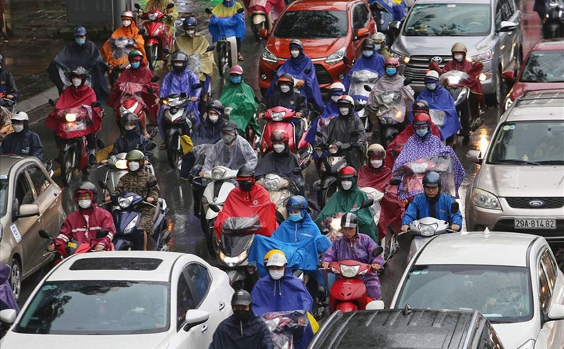
Due to the impact of storm No. 10 Bualoi, the North will have moderate rain, heavy rain and scattered thunderstorms, locally very heavy rain; the plains will have heavy to very heavy rain.
The area from Thanh Hoa to Hue will have heavy to very heavy rain and thunderstorms, from tomorrow in the south of this area, the rain will gradually decrease.
The Southern region will have scattered showers and thunderstorms, with some places having heavy rain.
Weather forecast for tonight and tomorrow, September 29 for the regions:
Hanoi City
Lowest temperature: 23-25 degrees Celsius.
Highest temperature: 30-32 degrees Celsius.
Cloudy, moderate rain, heavy rain and thunderstorms, locally very heavy rain. Northeast wind level 3. During thunderstorms, there is a possibility of tornadoes, lightning and strong gusts of wind.
Northwest
Lowest temperature: 21-24 degrees Celsius, some places below 20 degrees Celsius.
Highest temperature: 25-28 degrees Celsius.
Cloudy, moderate rain, heavy rain and scattered thunderstorms, locally very heavy rain. Light wind. During thunderstorms, there is a possibility of tornadoes, lightning and strong gusts of wind.
Northeast
Lowest temperature: 22-25 degrees Celsius, mountainous areas below 21 degrees Celsius.
Highest temperature: 25-28 degrees Celsius.
Cloudy, moderate rain, heavy rain and scattered thunderstorms, locally very heavy rain; the plains have heavy to very heavy rain. Northeast wind level 3, especially along the coast from Quang Ninh to Ninh Binh, strong wind level 6-7, gust level 8-9. During thunderstorms, there is a possibility of tornadoes, lightning and strong gusts of wind.
Thanh Hoa to Hue
Lowest temperature: 22-25 degrees Celsius.
Highest temperature: 26-29 degrees Celsius, some places above 29 degrees Celsius.
Cloudy, with heavy to very heavy rain and thunderstorms, from tomorrow the rain will gradually decrease in the South. The area from Thanh Hoa to North Quang Tri will have strong winds of level 6-7, then increase to level 8-9, the area near the storm's eye will have winds of level 10-12, gusting to level 14; from South Quang Tri to Hue City. The wind will be strong at level 6-7, gusting to level 8-9; tomorrow the wind will gradually decrease. During thunderstorms, there is a possibility of tornadoes, lightning and strong gusts of wind.
South Central Coast
Lowest temperature: 23-26 degrees Celsius.
Highest temperature: 29-32 degrees Celsius, some places above 32 degrees Celsius.
Cloudy, the North has scattered showers and thunderstorms, some places have heavy rain; Da Nang has moderate rain, heavy rain at night, some places have very heavy rain; the South has showers and thunderstorms in some places. Southwest to southwest wind level 3-4. During thunderstorms, there is a possibility of tornadoes, lightning, hail and strong gusts of wind.
Central Highlands
Lowest temperature: 19-22 degrees Celsius.
Highest temperature: 26-29 degrees Celsius.
Cloudy, scattered showers and thunderstorms, locally heavy rain. Southwest wind level 2-3. During thunderstorms, there is a possibility of tornadoes, lightning, hail and strong gusts of wind.
Southern region
Lowest temperature: 23-26 degrees Celsius.
Highest temperature: 29-32 degrees Celsius.
Cloudy, scattered showers and thunderstorms, locally heavy rain. Southwest wind level 2-3. During thunderstorms, there is a possibility of tornadoes, lightning, hail and strong gusts of wind.
Ho Chi Minh City
Lowest temperature: 24-26 degrees Celsius.
Highest temperature: 30-32 degrees Celsius.
Cloudy, scattered showers and thunderstorms, locally heavy rain. Southwest wind level 2-3. During thunderstorms, there is a possibility of tornadoes, lightning, hail and strong gusts of wind.