Updated forecast until the end of the afternoon of October 3, according to Mr. Hoang Phuc Lam - Deputy Director of the National Center for Hydro-Meteorological Forecasting, Department of Hydro-Meteorology, the next developments in the storm's trajectory and intensity will depend on terrain friction with the Lusian Peninsula and Hainan Island (China) and the activity of the subtropical high pressure.
There are currently 2 different scenarios for storm trajectory and intensity, but the common landfall point is Quang Ninh province. The expected time is from the night of October 5 to the early morning of October 6.

From tomorrow, October 4, the forecast of the development and impact of the storm will be more reliable.
However, Mr. Lam noted that people should not pay too much attention to the center of the storm and the time of landfall, but should be vigilant about the time and area affected by strong winds and heavy rain.
"The time the storm will impact will be earlier than the time the storm makes landfall. Heavy rain and strong winds are expected due to the storm, starting from the evening of October 5" - Mr. Lam said.
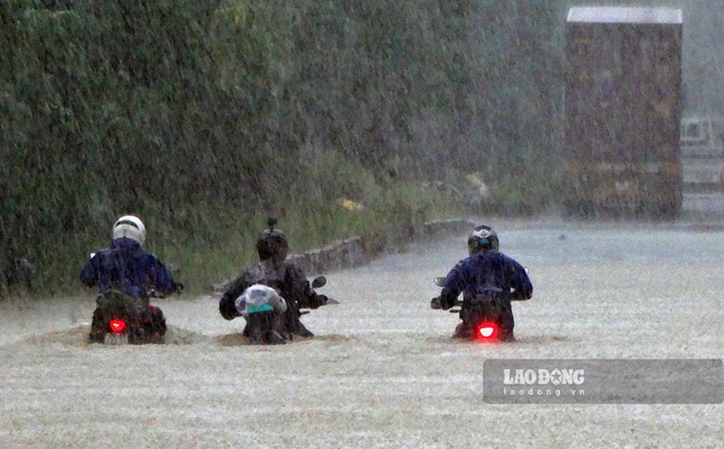
Due to the impact of storm No. 10 Bualoi, Hanoi experienced continuous heavy rains on September 30, causing many roads and streets to be deeply flooded. Therefore, the information forecasting the impact of storm No. 11 is of even greater interest to the people of the capital.
Mr. Hoang Phuc Lam also said that Hanoi is in the area affected by heavy rain in storm No. 11, strong winds of about level 4 - 5. The main rainfall is forecast to be concentrated from early morning to the evening of October 6.
"The forecast for rainfall in Hanoi during storm No. 11 is generally from 100 - 200 mm, which is likely to cause flooding on some streets" - Mr. Lam advised.
The National Center for Hydro-Meteorological Forecasting has also issued a warning bulletin of heavy rain in the North, Thanh Hoa, Nghe An lasting from the night of October 5 to the end of the night of October 7.
The Northern region and Thanh Hoa will have heavy to very heavy rain with common rainfall of 100 - 200mm, locally over 300mm. The focus of rain in the mountainous and midland areas of the North will have rainfall ranging from 150-250mm, locally over 400mm.
With such a rain situation, warn from October 6 to 9, in the North, Thanh Hoa, Nghe An, there will be 1 flood, the flood peak on the rivers will be from above alert level 2 to above alert level 3.
According to the scenario, there is a high probability of heavy rain in the mountainous and midland areas of the North.
"It is very worrying that the focus is on the provinces in the midland and mountainous areas of the Northern region including Tuyen Quang (including the old Tuyen Quang and Ha Giang), Lao Cai (including the old Lao Cai and Yen Bai). The rainfall from storm No. 11 may be slightly lower than storm No. 10, but in the context of very heavy and prolonged rain in the same area of the North, concentrated in the mountainous and midland areas, the risk of flash floods, landslides, and flash floods is very high" - Mr. Lam warned.