Storm Matmo follows storm No. 10 Bualoi into the East Sea this afternoon, October 3. Speaking to Lao Dong Newspaper reporter late this afternoon, Mr. Hoang Phuc Lam - Deputy Director of the National Center for Hydro-Meteorological Forecasting, Department of Hydro-Meteorology provided the latest comments on this storm.
Both storm scenarios hit Quang Ninh
Mr. Hoang Phuc Lam, it is forecasted that after entering the East Sea, storm No. 11 Matmo is likely to strengthen rapidly. So what is the cause of the storm's intensification, sir?
- Along with storm No. 10 Bualoi, storm No. 11 is assessed as a storm moving at a fairly fast speed, about 25km/h. It is forecasted that after moving into the East Sea, the sea surface will have relatively favorable water temperature conditions of about 29 degrees Celsius, the dynamic conditions of wind shear in the northern area of the East Sea - (where the center of storm Matmo moves in) will be small, favorable for the development of the storm.
Meanwhile, the subtropical high pressure, which determines the speed of movement in the direction of Matmo, will move strongly westward, causing Matmo to strengthen and move rapidly.
Tonight, October 3 and especially tomorrow, October 4, the storm will strengthen quite quickly. The maximum intensity of the storm could reach level 12-13, gusting to level 14 - 15 when it is east of the Lusi Peninsula (China) - around the evening of October 4.

Will the storm schedule change after entering the East Sea and which scenario has the highest probability, sir?
- The next development in the storm's trajectory and intensity will depend on terrain collisions with the Lusian Peninsula and Hainan Island (China) and the activity of the subtropical high pressure.
Scenario 1 is very likely, corresponding to the trend of subtropical high pressure tongue weakening rapidly and retreating to the east, storm No. 11 will move more north, moving more on land quite similar to the path of storm No. 9.
When it reaches the northern area of Quang Ninh province, it will decrease by 2-4 degrees compared to the time of the strongest storm.
With this scenario in the Gulf of Tonkin, strong winds of level 9-10, mainland Quang Ninh-Hai Phong strong winds of level 8-9, and heavy rain in the North.
It is very worrying that the focus is on the provinces in the midland and mountainous areas of the North including Tuyen Quang (including the old Tuyen Quang and Ha Giang), Lao Cai (including the old Lao Cai and Yen Bai).
Scenario 2 is worse but the lower probability is that when the subtropical high pressure weakens slightly, causing the storm to move mainly at sea, it will weaken less than scenario 1.
Therefore, the storm intensity when entering the Quang Ninh area will be stronger than scenario 1, possibly causing strong winds of level 9-10 (level 12-14), the impact will expand to the south (Quang Ninh - Ninh Binh provinces).
The rain will also be heavier, and the strong winds will also be deeper inland. With this scenario, rain will be more concentrated in the Northern Delta and Thanh Hoa than in the midlands and mountainous areas of the North.
From tomorrow, October 4, the forecast of the development and impact of the storm will be more reliable.
The focus of heavy rain is the midlands of the Northern mountainous region
What is the specific forecast for the rainfall of the regions and when will the heavy rain start, sir?
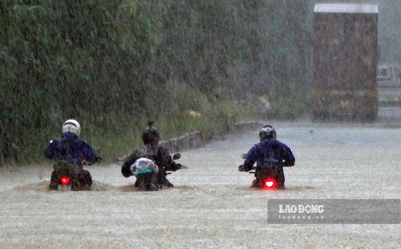
- We have issued a warning bulletin of heavy rain in the North, Thanh Hoa, Nghe An lasting from the night of October 5 to the end of the night of October 7. The time of rain will start around 7:00 p.m. on October 5. The Northern region and Thanh Hoa will have heavy to very heavy rain with common rainfall of 100 - 200mm, locally over 300mm. The focus of rain in the mountainous and midland areas of the North will have rainfall ranging from 150-250mm, locally over 400mm.
With such rain, warn from October 6 to 9, in the North, Thanh Hoa, Nghe An, there will be a flood, the flood peak on the rivers will be from above alert level 2 to above alert level 3.
The North has had heavy rain after storm No. 10 Bualoi, if it continues to rain due to storm No. 11, what is the potential risk of causing dangerous phenomena, sir?
- The rainfall from storm No. 11 may be slightly lower than storm No. 10. In the context of very heavy and prolonged rain in the same area of the North, concentrated in the mountainous and midland areas, the risk of flash floods, landslides, and flash floods is very high.
Sincerely thank you!