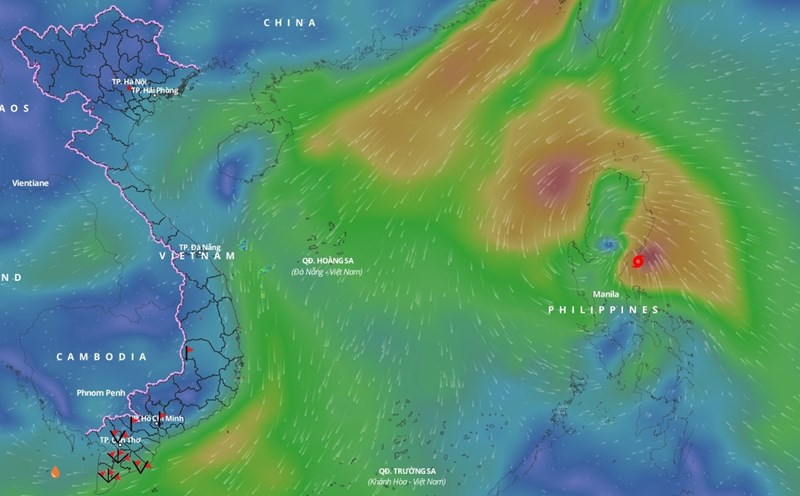
According to the National Center for Hydro-Meteorological Forecasting, Typhoon Man-yi is moving northwestward toward the East Sea. In addition, a cold air mass is moving from the north to the south.
On the night of November 17 and November 18, the North East Sea area (including the Hoang Sa archipelago) will have strong winds of level 6 - 7, gusting to level 8 - 9; the eastern sea area will later increase to level 8 - 9, the area near the storm's eye will have levels 10 - 13, gusting to level 15. The sea will be rough, with waves 2 - 4m high, and 5 - 7m high near the storm's eye. The eastern sea area of the North East Sea will have stormy rain.
Gulf of Tonkin on November 18, wind gradually increased to level 6, gusting to level 7 - 8. Rough sea, waves 1.5 - 2.5m high.
On the night of November 18 and the day of November 19, the North East Sea (including Hoang Sa archipelago) has strong winds of level 6 - 7, near the storm's eye level 8 - 9, gusts of level 12; waves 4 - 6m high, near the storm's eye 7 - 9m; very rough seas. Gulf of Tonkin has strong northeast winds of level 6, gusts of level 7 - 8; waves 2 - 3.5m high; rough seas.
The meteorological agency warns that the risk level of natural disasters due to strong winds at sea is level 2; the eastern sea area of the North East Sea is level 3.
All vessels operating in the above areas are at high risk of being affected by cyclones, strong winds and large waves.


