The National Center for Hydrometeorological Forecasting said that this afternoon and afternoon (August 5), the Central Highlands and Southern regions will have moderate to locally heavy rain. Rainfall from 10:00 to 15:00 on August 5 in some places was over 40mm such as: Dak Ha (Kon Tum) 51.2mm, Thuan Ha (Dak Nong) 51.6mm, Vinh Chau (Soc Trang) 48mm, Khanh Hung (Ca Mau) 60mm …
In the Northwest region, the provinces of Tuyen Quang, Cao Bang, Bac Kan, Thai Nguyen, Ha Giang, Lang Son of the North in the evening and night of August 5, there were scattered showers and thunderstorms, with some places having heavy to very heavy rain. with rainfall from 15 - 30mm, locally over 90mm.
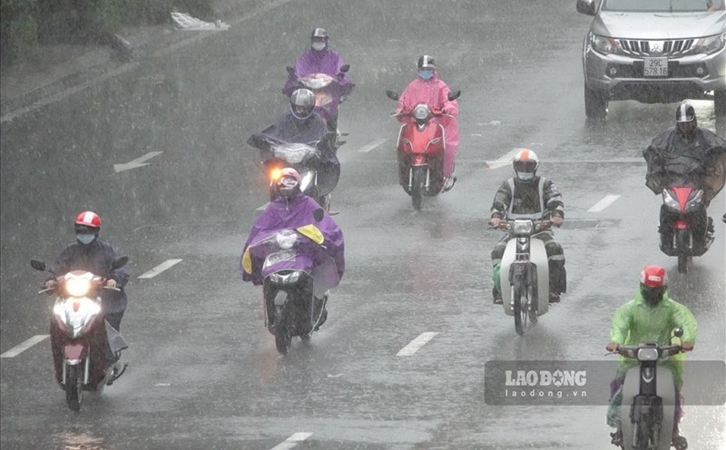
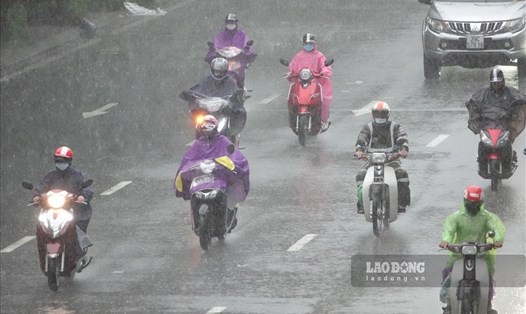
In the afternoon and evening of August 5 , the Central Highlands and Southern regions had scattered showers and thunderstorms, locally there were heavy rains with rainfall from 10 - 30mm, locally over 70mm.
The meteorological agency warns that during thunderstorms there is a possibility of tornadoes, lightning and strong winds. The level of natural disaster risk due to tornadoes and lightning is level 1. Local heavy rain can cause flash floods on small rivers and streams, landslides on slopes and flooding in low-lying areas. Beware of heavy rain in a short period of time causing flooding in urban areas.
The Northern Delta, Southern Son La and Hoa Binh areas on August 6 - 7 are forecast to have hot weather with the highest temperature commonly ranging from 35 - 36 degrees Celsius, in some places above 36 degrees Celsius. Relative humidity is lowest. common 55 - 60%.
The area from Thanh Hoa to Phu Yen has hot weather, some places are extremely hot with the highest temperature commonly ranging from 35 - 37 degrees Celsius, some places are over 37 degrees Celsius. The lowest relative humidity is commonly 50 - 55 %.
Regarding marine weather , currently the middle and southern areas of the East Sea (including the waters of the Truong Sa archipelago), the sea area from Ca Mau to Kien Giang and the Gulf of Thailand have showers and thunderstorms.
It is forecasted that on the night of August 5 and August 6, the middle and southern areas of the East Sea (including the waters of the Truong Sa archipelago), the waters from Binh Thuan to Ca Mau, Ca Mau to Kien Giang and the Gulf of Thailand will have showers and thunderstorms. . During thunderstorms, there is a possibility of tornadoes and strong winds of level 7 - 8.
In addition, on the night of August 5 and August 6, in the sea area from Khanh Hoa to Binh Thuan, the southwest wind was strong at level 5, sometimes level 6, gusting to level 7; Sea waves are 2 - 3m high; rough sea.
The National Center for Hydrometeorological Forecasting warns that all boats operating in the above areas are at high risk of being affected by tornadoes, strong winds and large waves.