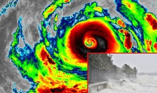
Typhoon No. 3 Yagi has many unusual features.
Storm No. 3 Yagi has made landfall in Vietnam and caused huge consequences. Assessing this storm, Mr. Mai Van Khiem - Director of the National Center for Hydro-Meteorological Forecasting, Directorate of Hydro-Meteorological Forecasting pointed out many unusual points.
"Storm No. 3 is the strongest storm in the past 30 years in the East Sea. This is also a storm that increases in intensity very quickly (in 24 hours, the storm's intensity increases by 8 levels) and maintains the super storm level for a long time. When it makes landfall in the East of Hainan Island (China), it still maintains the super storm level," said Mr. Khiem.
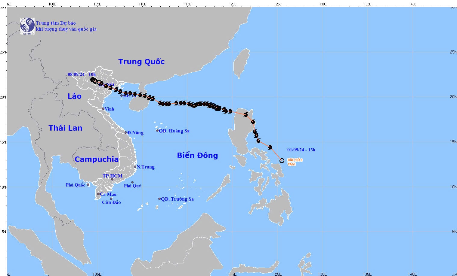
In addition, the level of degradation along the way does not follow the usual rule. Normally, when passing Hainan Island (China) into the Gulf of Tonkin, storms often weaken quickly, but with storm No. 3, the intensity did not decrease quickly. When approaching the coast of Quang Ninh - Hai Phong, the storm still maintained its intensity at level 12 - 13.

Another unusual point according to Mr. Khiem is that the storm's stay on land lasted 12 hours.
The development of rain caused by storm No. 3 also showed unusual characteristics. Storm No. 3 moved deep inland and weakened into a tropical depression in the Northwest region. However, the heaviest rain caused by storm No. 3's circulation was mainly in the east of Hoang Lien Son mountain range, although it was not in the storm's path and was not directly affected by the storm's winds. Most storms with similar trajectories in the past often caused heavy rain in the west of Hoang Lien Son mountain range.
Very heavy rain over a large area (including many provinces) in the basins of Thao River, Chay River, Lo River, Gam River with high intensity (over 200 mm/day), lasting for many days after the storm dissipates.
Thao River flood in Lao Cai and Yen Bai exceeds 53-year historical flood peak
According to Mr. Khiem, due to heavy rain, since September 8, water levels on many rivers and streams in the North have risen rapidly. In particular, water levels on Thao River, Lo River, Thuong River, Gam River, Thai Binh River, the lower reaches of Red River, Luc Nam River, Hoang Long River... have all exceeded alert level 3.
In particular, the flood on Thao River in Lao Cai and Yen Bai has exceeded the historical flood peak that existed for 53 years. The flood peak in Yen Bai reached 35.73m (4pm on September 10), 3.73m above the alarm level 3 and 1.31m above the historical flood level in 1968.
Along with that, the flood on Thac Ba Hydroelectric Reservoir also reached historic levels, threatening the safety of the dam.
In Hanoi, the water level of the Red River also recorded its highest level in 20 years. Rivers in the Red River and Thai Binh River basins - the largest river system in the North - also experienced floods. Flooding on a large scale with many levels exceeding the threshold is also rare. According to statistics, 20/25 provinces and cities in the North experienced serious flooding.
Due to heavy rains, landslides, flash floods and flash floods have occurred in many localities, causing very serious damage to people and property of the people and the state. Some areas have experienced serious flash floods and landslides, such as in the provinces of Cao Bang, Hoa Binh, Lao Cai, Yen Bai, Quang Ninh... Especially in Lang Nu village, Phuc Khanh commune, Bao Yen district, Lao Cai province, causing particularly serious damage to people.
"The main reason is that the northern mountainous region has had a lot of rain in the past 3 months, 40-60% higher than the average of many years. In Lao Cai in August, there were 23/31 rainy days and in Yen Bai, 21/31 rainy days, which is also rare," said Mr. Khiem.